Brought to you by Calvert Title Company
Yesterday was quite the active weather day with a confirmed tornado touching down in Bowie after we saw the heat and humid ramp up. Well, the heat and humidity will not be going anywhere today. We will again have afternoon storm chances, but today’s storms should not be as severe.
We are off to a muggy start this morning, with temperatures in the 70s and dewpoints in the upper 60s. Temperatures will take off fast this morning, with many of us getting into the 90s just after lunchtime. The humidity will make it feel several degrees warmer as well. This will set the stage for hit-and-miss storms this afternoon and evening.
Things are quiet on the radar this morning, But, our Chesapeake’s Bounty Futurecast shows that we should begin to see scattered showers and storms fire up as we approach 3pm. These scattered showers and storms will continue throughout the afternoon and likely increase in coverage as we approach the evening hours.
These storms are not likely to be widespread, at least, not initially. Until sunset, we are likely to just see hit-and-miss storms that fire up rather randomly. This means that not everyone will see a storm this afternoon. We should see the rain start to become more widespread later this evening, increasing everyone’s chances of seeing rain.
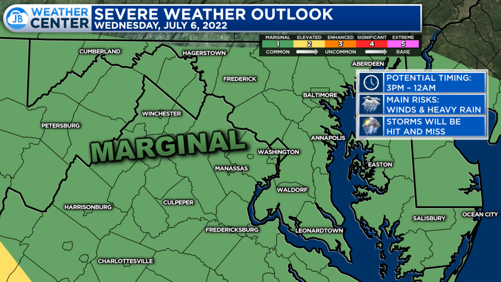
The Storm Prediction Center has placed much of the region under a Level 1 “Marginial Risk” of severe weather for today. This threat means that the atmosphere may be supportive of a few strong storms, but that most storms will have a hard time reaching severe limits. This risk is lower than it was yesterday!
Anytime after 2 or 3pm will be fair game to see rounds of rain begin to move through. Some spots may see several rounds of different storms while other spots may see very little today. That is just the nature of summertime thunderstorms.
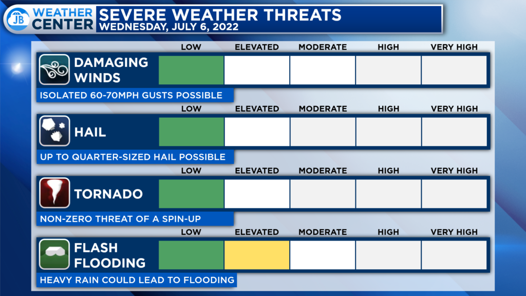
Our severe weather threats today are rather low. The primary concern if any storms do turn severe would be from damaging winds up to 60-65mph. The tornado threat is rather low today. I am much more concerned about the elevated flooding threat some areas could have if storms continue to roll over the same places throughout the afternoon and evening.
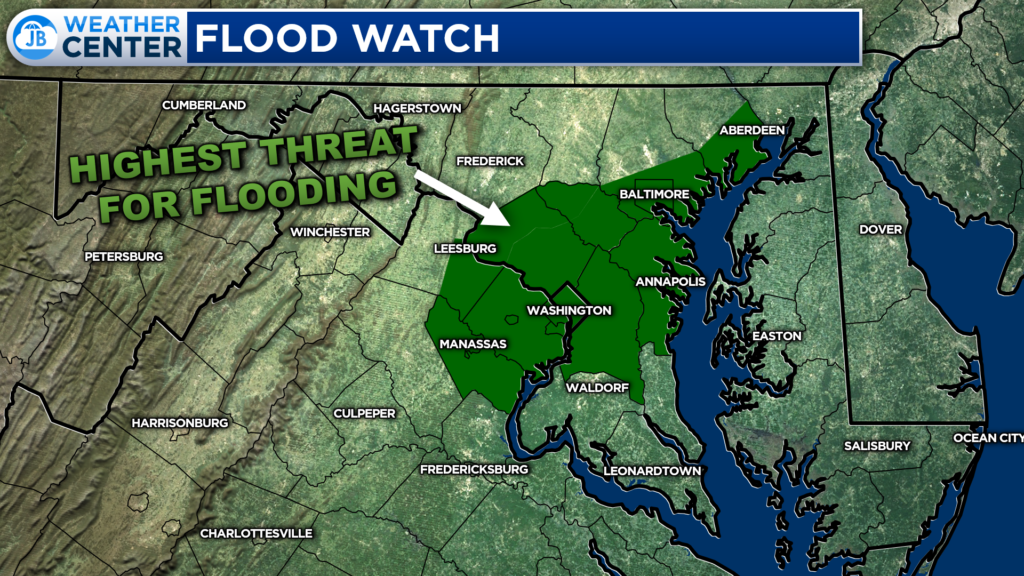
The National Weather Service has already placed the urbanized areas along I-95 under a Flood Watch from 3-11pm. These are the areas that are the most prone to flooding today, but I think everyone will have an elevated flooding risk.
Again, these storms will be hit-and-miss and quite random. This means that everyone will need to stay weather aware and be ready to act quickly if storms move overhead.
I will be out of the weather office all day today, so I will not be able to provide live coverage. With that said, you can track any storms here on the website, at jbweather.net/radar. And, any weather watches or warnings will also be auto-posted to my social media feeds.
Stay with JB Weather for the latest information on Southern Maryland weather. You can always access my forecasts and updates here on the website, on Facebook, on Twitter, on Instagram, and on YouTube.
-JB

Calvert Title Company is guiding you HOME one closing at a time! Check out https://calverttitle.com/ today!
