Brought to you by Berkshire Hathaway HomeServices PenFed Realty
Yesterday turned out to be quite and humid with heat indices making it above 105° for many communities. The storm activity was pretty limited as well. However, that will look to change today. We will still keep the hot and humid conditions this afternoon, but widespread storms are likely.
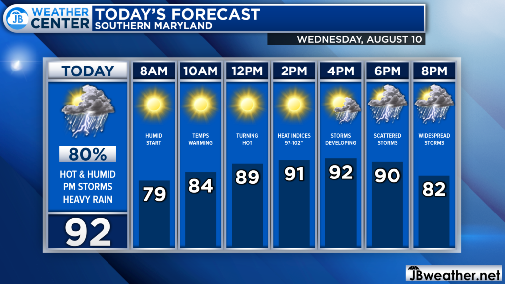
Many communities are waking up to yet another warm and humid start with dewpoints in the 70s. Mostly clear skies and light southerly winds this morning and afternoon will allow temps to warm into the 90s. Heat indices will look to get back over 100° as well. This will set the stage for the PM storm risk.
Our latest run of Futurecast suggests that we will begin to see popcorn-style storms begin to develop after lunchtime. As an incoming weather boundary works eastward, we will likely see the storms increase in coverage by the evening hours. Some storms could be strong. Futurecast also suggests that the storms may continue throughout the night, as well.
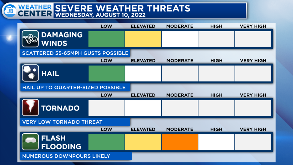
The Storm Prediction Center only has our region at a Level 1 “Marginial Risk” of severe weather for this afternoon. While storms are likely, this is because most of the severe parameters look to be low today. The primary severe risk is that some storms may continue gusts up to 50-60mph and frequent lightning. The far greater risk today will come from flash flooding.
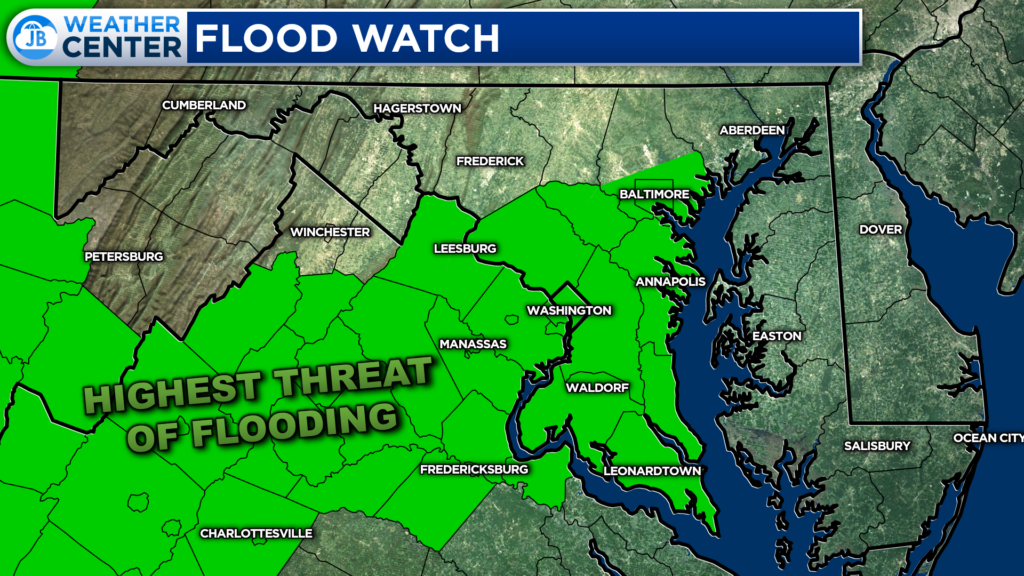
Almost our entire region has been placed under a Flood Watch from 2-11PM. Showers and numerous thunderstorms are expected later this afternoon through this evening, especially south of DC. Rainfall amounts will vary but should average around 1-1.5″ across the area. But locally higher amounts of 2-4″ are likely, and much of that may fall in a one to two hour timeframe. Heavy rain in short periods of time may cause creeks and streams to rapidly rise out of their banks along with potential flash flooding in urban areas.

PRECAUTIONARY/PREPAREDNESS ACTIONS: You should monitor later forecasts and be prepared to take action should Flash Flood Warnings be issued.
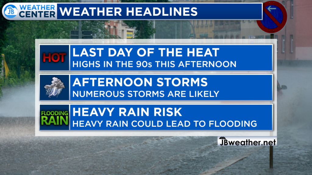
Today is likely to be another high-impact weather day. Many spots will see highs in the 90s this afternoon with heat indices getting back over 100°. An incoming front will allow for storms to begin to develop after lunchtime and continue into the evening and overnight hours. Some rain could be heavy, which could lead to flash flooding. It will be important to stay weather aware today and heed all warnings. Our region is under a Flood Watch from 2-11PM.
If you have outdoor plans this afternoon and evening, I would cancel them and move them indoors. High impacts from the heat and, especially, the rain will make getting outdoor events done rather difficult. The weather impacts will ramp up later into the day we head.
Stay with JB Weather for the latest information on Southern Maryland weather. You can always access my forecasts and updates here on the website, on Facebook, on Twitter, on Instagram, and on YouTube.
-JB

Real Estate now! Not sure where to start? View our Southern Maryland inventory of homes, land, farms and commercial properties on penfedrealty.com. Engage with our planning tools to determine your next real estate lifestyle decision, choose your realtor as a trusted advisor. Experience the difference with service and support from real estate’s forever brand!
