Brought to you by Sonder Studios
After just about a week of tracking, today will be the day that we will see most of the effects of our latest winter storm. However, instead of widespread heavy snow, we will be looking at periods of light snow throughout the day with minor impacts.
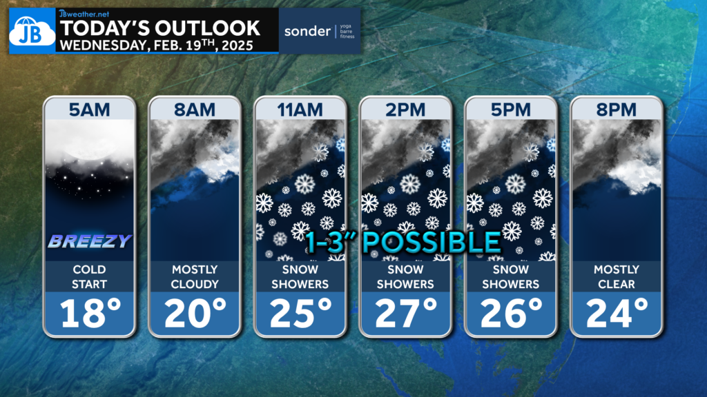
We are off to a cold start, with many waking up to temps in the teens this morning. We will stay chilly throughout much of the day, with temps only maxing out into the 20s this afternoon. Snow chances appear to be the highest this afternoon into the early evening.
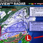
Our Cedar Point Federal Credit Union Futureview model tells the story well. Southern MD continues to set right on the edge of impacts. Many of our computer models agree that anytime after 10am is fair game for potential impacts. While additional snow showers are possible Thursday morning, the bulk of today’s snow chances are from 10am-9pm.
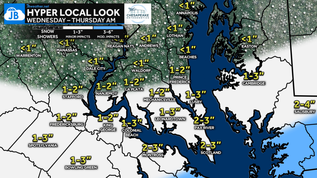
I continue to believe that this is only a 1-3″ across parts of southern Maryland. There will likely be more the further south you head, especially south of the Benedict Bridge. Areas south of Lexington Park will have the best chance of picking up a couple of inches. The Northern Neck will see more with 3-6″ possible there.
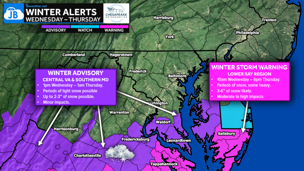
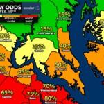
Winter Weather Advisories are up for Southern Maryland, Central Virginia, and the mid-Delmarva peninsula from 10am Wednesday through 1am Thursday for the threat of 1-3″ of snow. Minor impacts are possible there this afternoon, with some snow-covered roads slowing travel. Winter Storm warnigns are issued across the lower Delmarva and Tidewater Virginia for higher snowfall accumulations bringing significant impacts after 10am.
School impacts are possible across our southern zones. Several schools in central Virginia, including Fredericksburg City, King George, Spotsylvania, and Westmoreland Counties, have already closed for the day. You can stay up to date on the latest closings at the link below.
Stay with JB Weather for the latest information on impacts here in Southern Maryland and across the Mid-Atlantic. You can always access my forecasts and updates here on the website, on Facebook, on Twitter, on Instagram, and on YouTube. JB Weather is the Mid-Atlantic’s Weather Leader, and I am working around the clock to keep you ahead of any storm!

SONDER℠ Yoga studio. Barre studio. Fitness Studio. Classes, events & education for being well. Sonder is a mindful community, and you are invited. 5+ years in Calvert County, MD. We are grateful for your trust. Check out sonderstudios.us!
John Bordash
View More PostsJB Weather forecaster John Bordash is working around the clock to provide Southern Maryland, and neighboring communities, with accurate and reliable weather information.