Brought to you by Calvert Title Company
We have the potential to have an active weather day across the Mid-Atlantic today. First up, we will have warm temps and humid conditions around this afternoon, thanks to southerly winds. The warmest temperatures are likely to be found the further inland you head. This will then lead to the chance of showers and storms this evening.
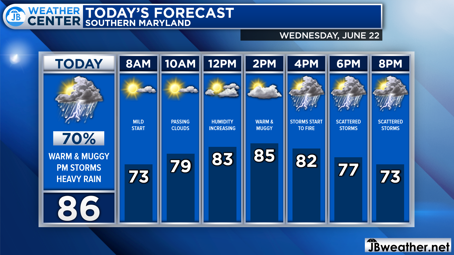
We are off to a mild start this morning with temperatures in the 60s and 70s. We should reach the 80s by lunchtime with humidity levels beginning to rise as well. Clouds will begin to move in after lunchtime with scattered showers and storms beginning to fire by mid-to-late afternoon. The chance of rain will stick with us through the overnight hours.
Our Chesapeake’s Bounty Futurecast depicts this threat of showers and storms quite well. Our model shows that rain chances begin to increase by 4pm. Showers and storms will likely develop to our north, first, before moving southward. The initial round of storms may be severe as they work through between 4-10pm.
Futurecast then shows additional areas of rain, with locally heavy downpours, working through the region throughout the night. We may see these areas of rain linger into tomorrow morning, as well.
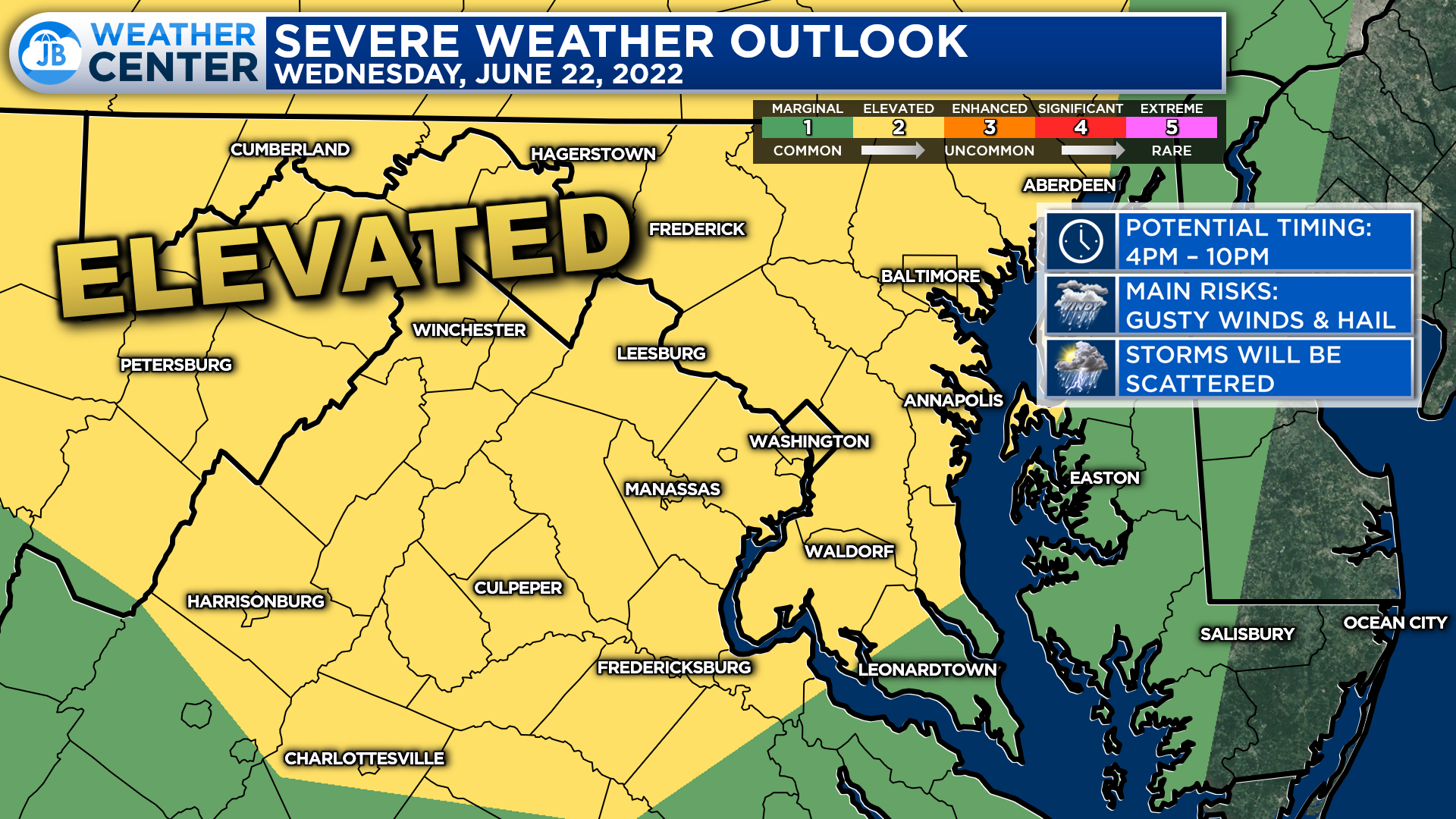
The Storm Prediction Center has placed much of our region under a Level 2 “Elevated Risk” of seeing severe weather this afternoon and evening with the initial round of storms that push through. The greatest severe weather chances will be focused to our northwest, but most everyone will have the threat to see 1 or 2 severe thunderstorms.
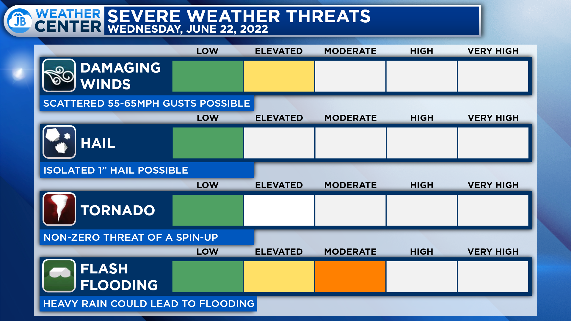
On the severe weather front, the threat of damaging winds will be the highest. Afternoon and evening storms will have the potential to produce 55-65mph wind gusts. Thunderstorms may also produce hail up to 1″ in diameter, and there is a non-zero tornado risk. Granted, the tornado risk will not be the primary concern today. In addition to damaging winds, flash flooding will also be a big threat.
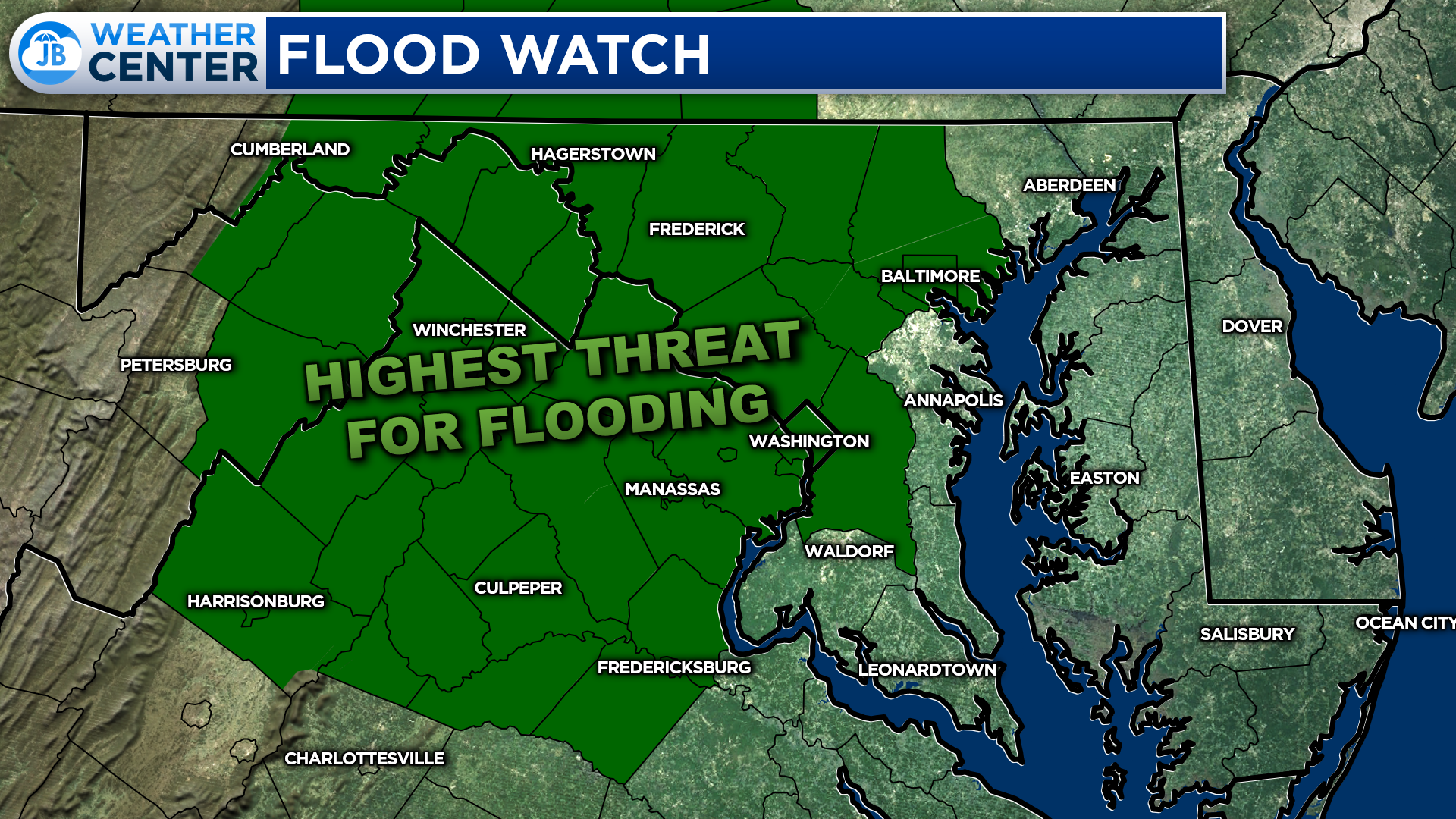
The National Weather Service has already issued a Flood Watch for areas along and west of I-95, including the Blue Ridge Mountains, from 3-11pm Wedensday. This is where the heaviest rains are the most likely to be with a widespread threat of 1-3″ of rain falling there. This is where several rounds of storms are likely to move through this afternoon and evening.
While Southern Maryland is not formally under the Flood Watch, I do have some concerns for flooding here as well. As Futurecast showed, we are also going to have the potential for a couple of rounds of storms to move through here. While widespread 1-3″ rain amounts are not likely here, localized amounts of 1-2″ will be possible in the areas that do see the heaviest rains. This could quickly lead to flooding.

It will be important to stay weather aware this afternoon and evening as heavy rain looks to move through the region. While the highest flooding concerns will be out west, we will have an elevated threat of flooding here in Southern Maryland as well. Rain chances will begin to increase by 4pm, and rain is likely to linger into the overnight hours.
Stay with JB Weather for the latest information on Southern Maryland weather. You can always access my forecasts and updates here on the website, on Facebook, on Twitter, on Instagram, and on YouTube.
-JB
Calvert Title Company is guiding you HOME one closing at a time! Check out https://calverttitle.com/ today!
John Bordash
View More PostsJB Weather forecaster John Bordash is working around the clock to provide Southern Maryland, and neighboring communities, with accurate and reliable weather information.