Brought to you by Calvert Title Company
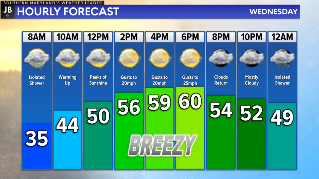
This week has gotten off to quite the cold start with highs on Monday and Tuesday both staying in the 40s with morning lows below freezing. While we are starting this morning off a tad chilly, we will see warmer air take hold by this afternoon! Many spots today should get into the lower 60s, which is around our seasonal average for this time of year.

This morning, we do have a few raindrops out there as a weak warm front lifts northward. Any rain early this morning should clear by mid-morning as the front continues to move northward. Behind the front, we will see southerly winds move in, which will help to drive up the warmer air. We may see winds gust as high as 20mph at times this afternoon as we see temps surge in the lower 60s. Temperatures will not be quick to fall off overnight, and we may see an additional spotty shower by midnight.
The warm air will stick around through tomorrow, which will help to set the stage for potential storms on Thursday. Check out my report from yesterday for more details on tomorrow’s storm threat, and a detailed look at what impacts we may see. Additional updates are possible throughout today, so stay tuned!
Stay with JB Weather for the latest information on Southern Maryland weather. You can always access my forecasts and updates here on the website, on Facebook, on Twitter, on Instagram, and on YouTube.
-JB

Brought to you by Calvert Title Company. Calvert Title Company is guiding you HOME one closing at a time! Check out https://www.facebook.com/calverttitle today!

