Brought to you by Berkshire Hathaway HomeServices PenFed Realty
Our string of nice weather will come to an end today as a system to our west will bring up a slug moisture, and lead to rainy Wednesday across the Mid-Atlantic. While it will not rain all day, we will see frequent rounds of rain push through the region.
Our Chesapeake’s Bounty Futurecast shows that rain showers will begin to move into the region this morning. Initially, the rain is not likely to be overly heavy and we will just be talking about rain showers. We may gradually build up to a more steady by lunchtime.
There are current indications that we may see a brief break in the activity by mid-to-late afternoon. However, we will see another push of moisture lead to another round of rain moving through this evening. This evening round could have some embedded thunderstorms within it.
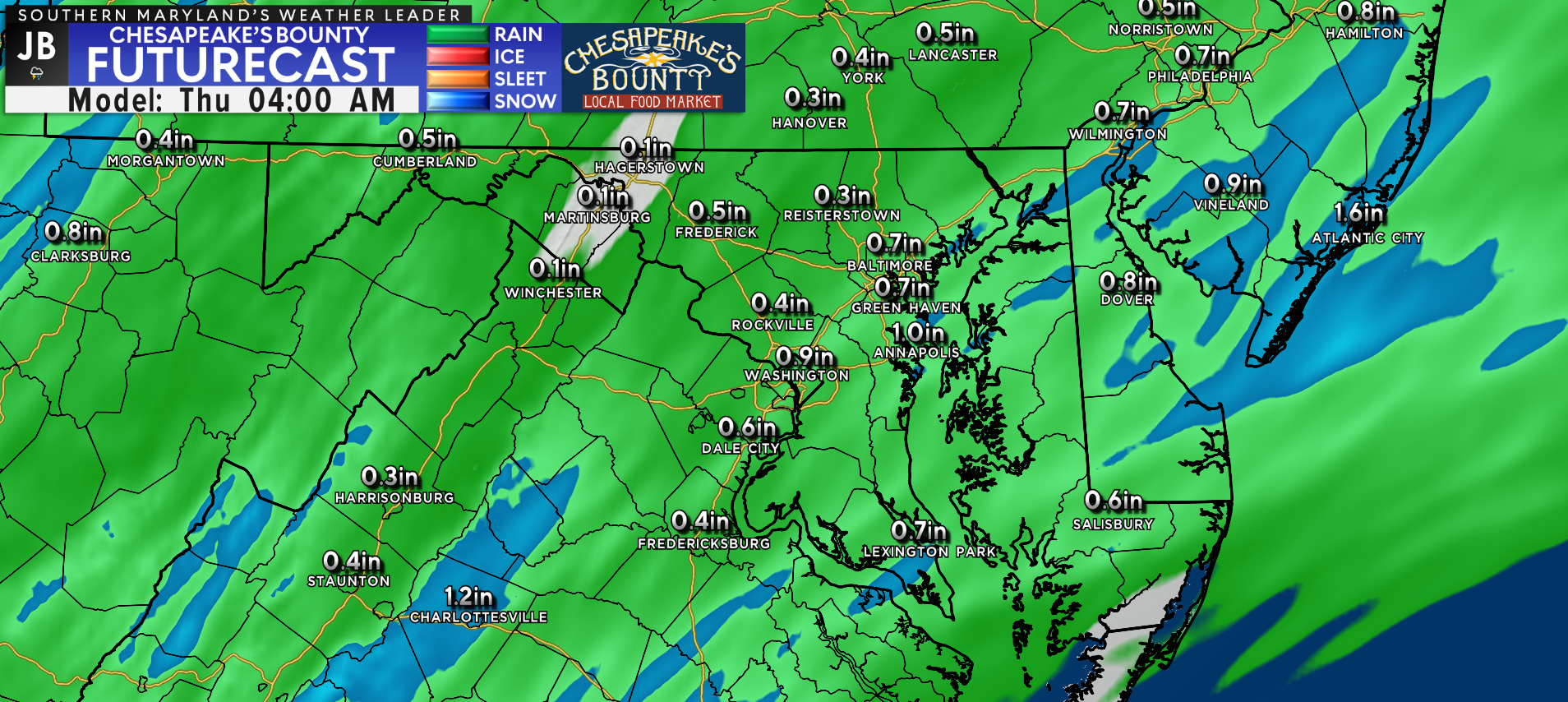
Futurecast suggests that we may see as much as a half-inch to an inch of rain throughout today. We will see locally higher totals fall in the region that are able to get under some of those embedded thunderstorms. The highest rain totals overall are likely to be found southeast of DC, and come this afternoon and evening.
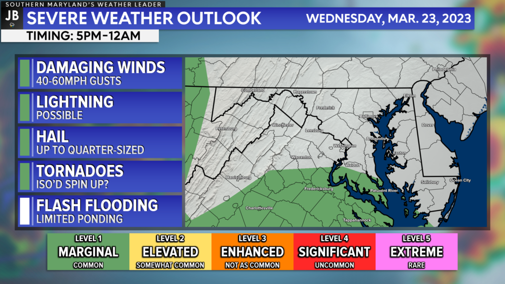
While the severe weather threat today is not overly high, it is not either. We have a Level 1 “Marginial Risk” threat across southern Maryland and the Northern Neck for today and tonight. We will not have much atmospheric storm energy to support the development of storms. However, there will be a lot of wind energy in the middle to upper levels of the atmosphere. This means that if any storm is able to get going, there would be a decent amount of wind energy for it to tap into. However, it may be hard for thunderstorms to develop much.
If 1 or 2 storms are able to develop in the batch of rain that moves through late tonight, they would have the ability to produce 40-60mph gusts, locally heavy rain, and some small hail. There is also an outside chance, around 1%, that any storm may try to rotate some, and produce a spin-up tornado. While this threat is not high or overly concerning to me, this is something to watch as the threat is non-zero.
I do not expect a repeat of what has happened down south over the last few days. We lack the atmospheric support for a widespread severe weather outbreak. The main threat today is rain, not severe weather.
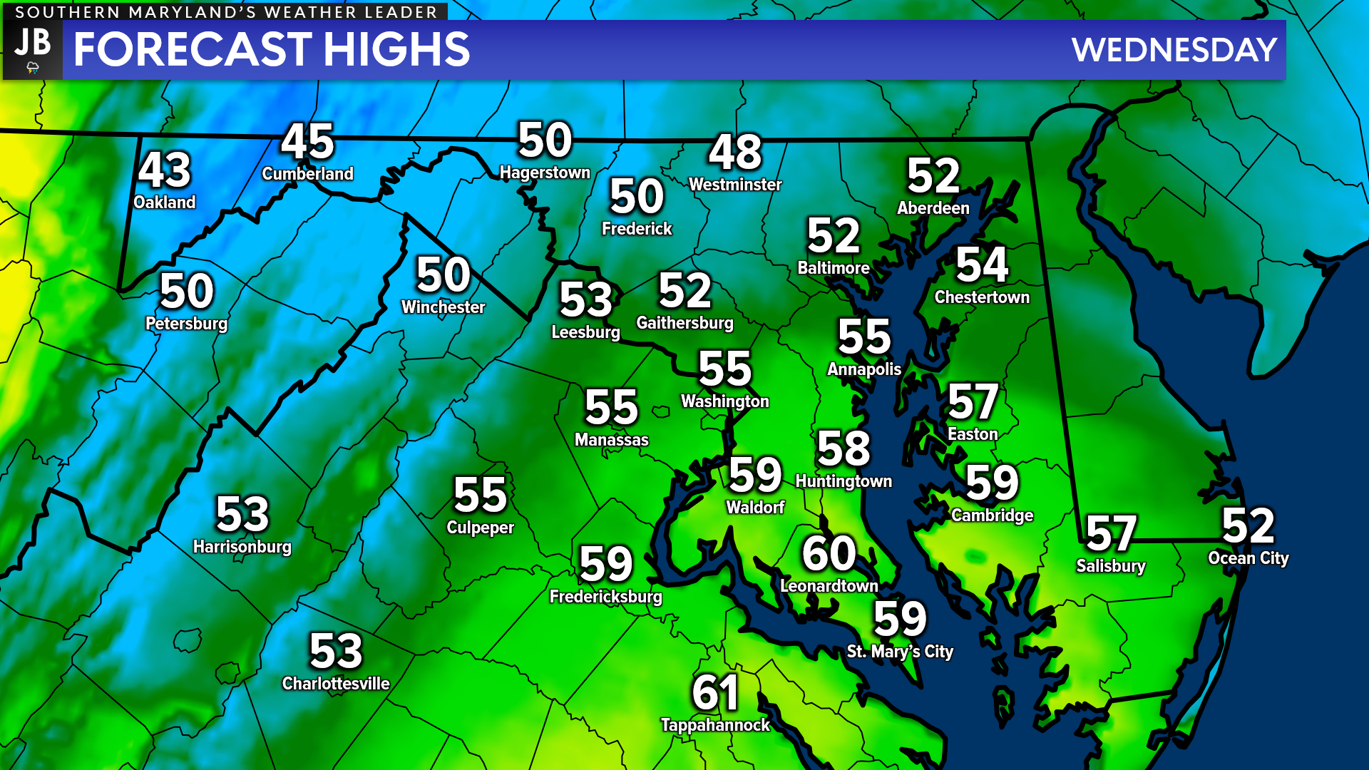
What will help to limit the storm threat today are the cool temperatures that we will have in place. Many locations today are likely to only top off in the 50s later on today. If temperatures were to warm into the middle 60s, then we might start to introduce somewhat higher storm chances. However, it seems much more likely that we are just talking about a cool, soaking rain today.
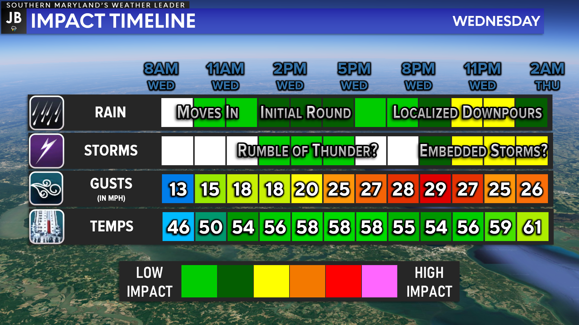
All in all, we have a rather wet day on tap. We are likely to see rounds of rain move through the region throughout the day. Some spots today could pick up as much as an inch of rain as periods of moderate to heavy rain move through. We are likely to see some of the heavier rains move through this evening and into tonight, which may have some embedded thunderstorms with them. Today’s cooler temperatures will help prevent a widespread severe weather outbreak. However, 1 or 2 severe storms may develop this evening, which will be something to watch closely. Temperatures will not likely fall much tonight, and may actually rise some as additional rounds of rain are set to move through tomorrow as well.
Stay with JB Weather for the latest information on Southern Maryland weather. You can always access my forecasts and updates here on the website, on Facebook, on Twitter, on Instagram, and on YouTube. Thankfully, I do not have classes today so I will be with you all throughout the day to provide updates!
-JB

Real Estate now! Not sure where to start? View our Southern Maryland inventory of homes, land, farms and commercial properties on penfedrealty.com. Engage with our planning tools to determine your next real estate lifestyle decision, choose your realtor as a trusted advisor. Experience the difference with service and support from real estate’s forever brand!
John Bordash
View More PostsJB Weather forecaster John Bordash is working around the clock to provide Southern Maryland, and neighboring communities, with accurate and reliable weather information.