Brought to you by Berkshire Hathaway HomeServices PenFed Realty
After a cooler, but still humid, day yesterday we will see temperatures warm back up today. Many spots are likely to max out in the middle to upper 80s today with plentiful humidity. With enough sunshine, we may see a few spots get into the low 90s.
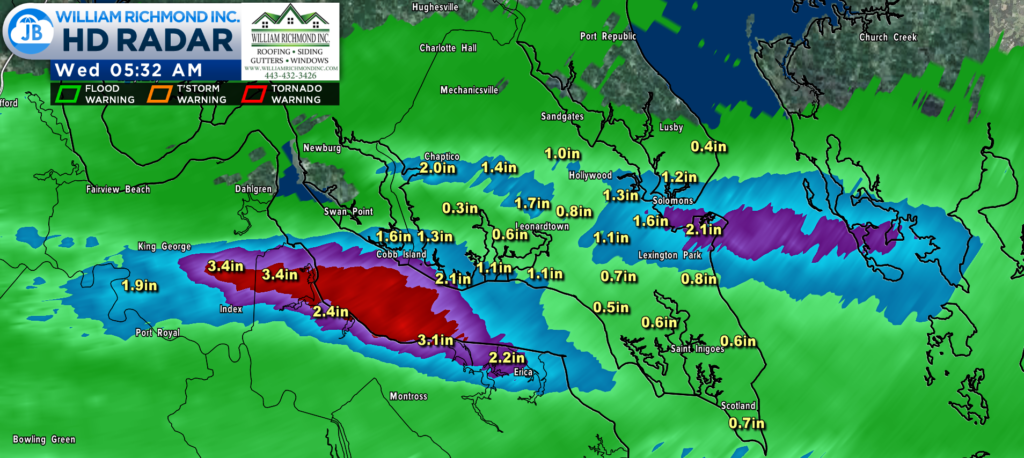
Yesterday, we saw scattered showers move through the region, especially during the evening and overnight hours. Some of the same spots that have seen the heaviest rain over the last month saw the heaviest rains last night. Radar estimates that some spots in St. Mary’s and southern Calvert Counties saw upwards of 1-2″+!
Pax River NAS, our official recording site for Southern MD, recorded 2.21″ of rain yesterday, bringing our monthly total to 7.64″. This also brings our yearly total to 28.84″, which is nearly 4″ above average for the year!
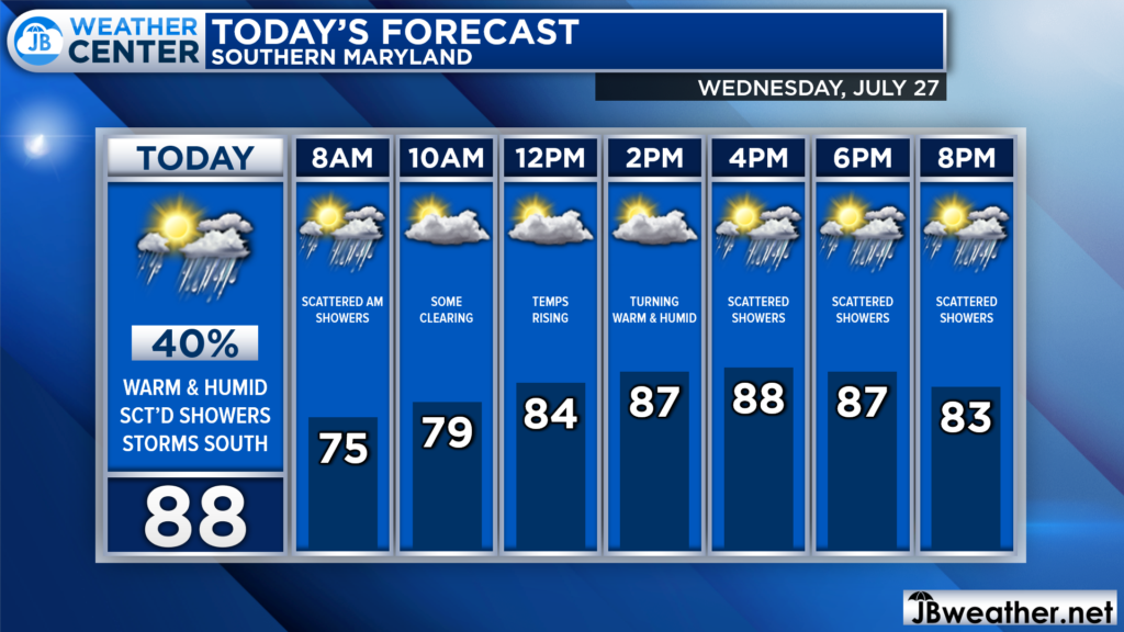
We have some showers out there this morning, which should begin to fizzle out later this morning. By mid to late morning, we should see some peeks of sunshine, which will allow temps to warm well into the 80s this afternoon. Enough sunshine will allow us to not get warm, but will also allow us to see some thunderstorm energy.
Futurecast seems to have a pretty good handle on today’s rain chances. It shows that any morning showers should burn off and give us some dry time by late morning. However, by mid-afternoon, we should start to see showers and low-end storms begin to bubble up to our west. These will try to move through the region throughout the afternoon and evening. These should not be overly heavy or widespread.
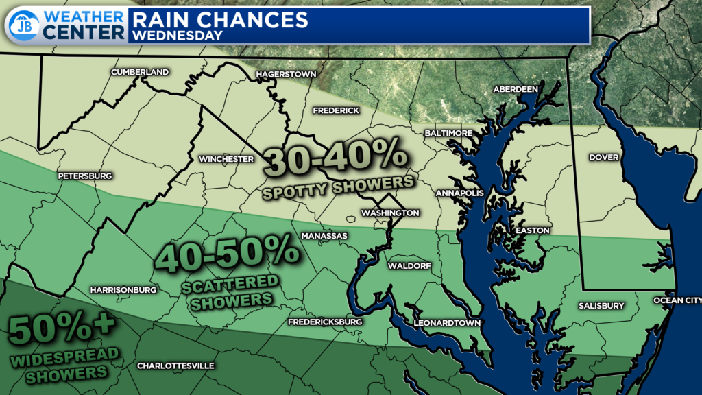
Rain chances today will be the highest after 3pm, and will be mainly focused from DC to the south and to the west. The further south you head this evening, the more likely you are to see scattered showers with some localized downpours. While the severe weather threat is not high today, we could see one or two thunderstorms with gusty winds and heavy rain move through the region.
If you have outdoor plans this afternoon and evening, I would plan on scattered showers moving through and bringing some impacts. While it may not rain everywhere all day, I would plan on moving outdoor activities inside to avoid any impacts. I would also keep the umbrella handy!
Stay with JB Weather for the latest information on Southern Maryland weather. You can always access my forecasts and updates here on the website, on Facebook, on Twitter, on Instagram, and on YouTube.
-JB

Real Estate now! Not sure where to start? View our Southern Maryland inventory of homes, land, farms and commercial properties on penfedrealty.com. Engage with our planning tools to determine your next real estate lifestyle decision, choose your realtor as a trusted advisor. Experience the difference with service and support from real estate’s forever brand!
