Brought to you by Chesapeake’s Bounty
The high pressure that has been responsible for the heat and humidity this week will slide off the coast this weekend. With the high pressure sitting offshore this weekend, we will see a stark southerly flow, continuing our warm and humid weather. However, this will also allow for thunderstorm chances throughout the weekend as a few pieces of atmospheric energy passes overhead.
Let’s break the weekend forecast down, starting with Saturday…
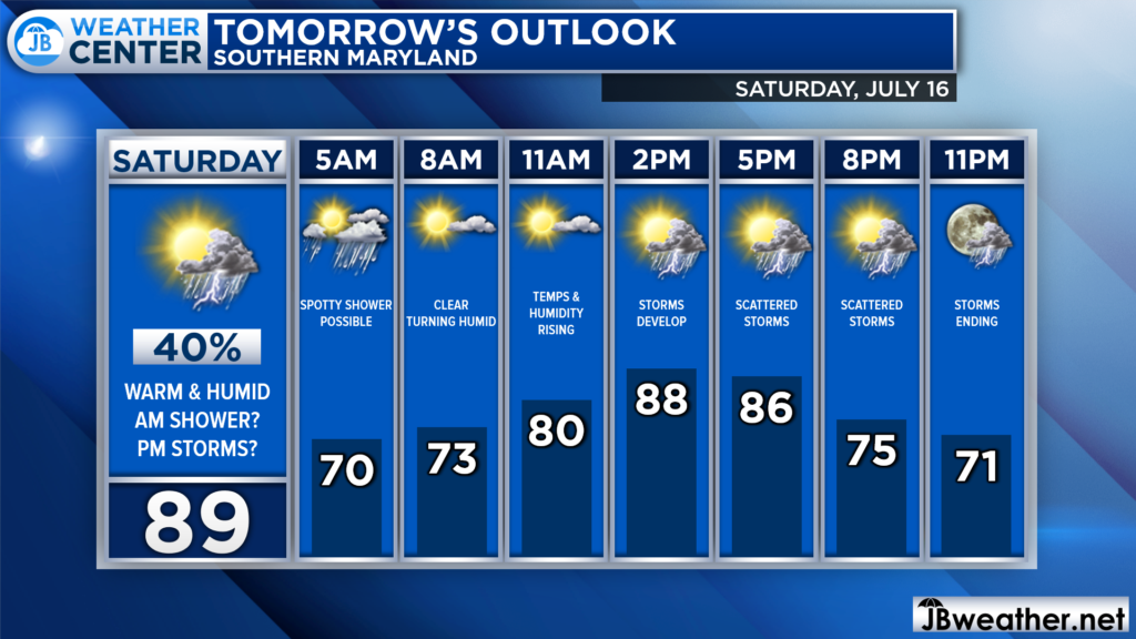
Saturday will start much like today. We may have a few showers around in the morning. This will set the stage for a warm and humid day. Midday clear will allow temperatures to soar well into the 80s by lunchtime. Then, a weak piece of atmospheric energy will move overhead, which will look to kick off some storms.
The amount of late-morning clearing and strength of the atmospheric energy will be key in determining how many storms develop, and how strong they can get. At the very least, at least some storms do look possible.
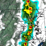
Futurecast seems to be rather aggressive with the storm development tomorrow, thanks to the atmospheric energy being strong and there being more available storm energy. Futurecast shows that any time after noon would be fair game for scattered storms to begin to develop. We could see these scattered storms move through the region throughout the afternoon and evening.
Again, I tend to think that this model may be a bit overdone with the strength and number of storms. With that said though, we could definitely see a few storms fire up, and a couple of those could turn severe.
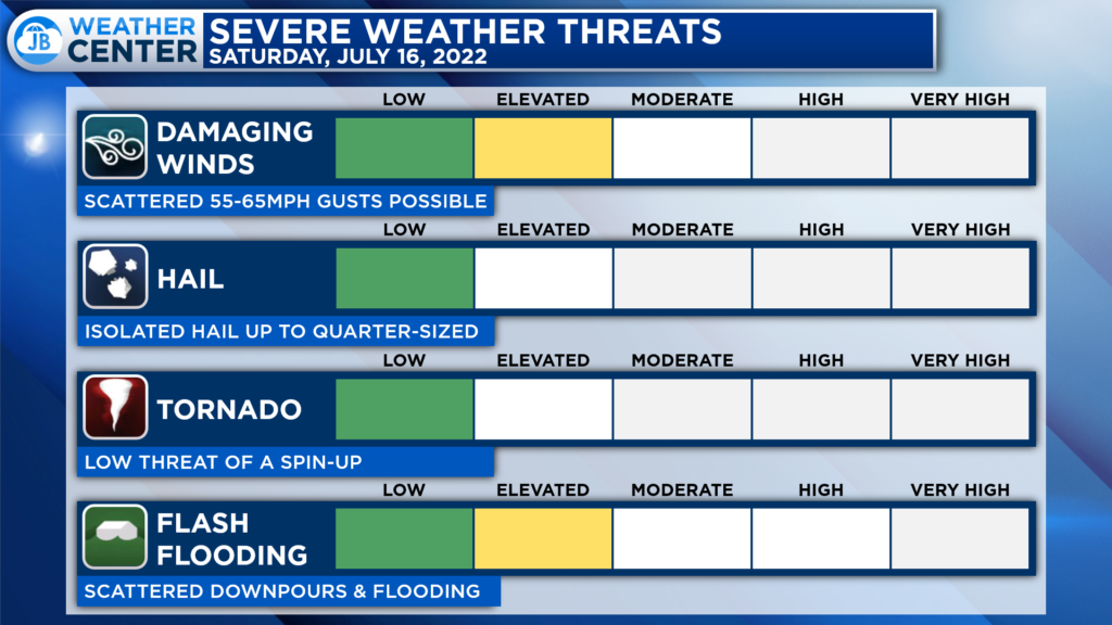
The Storm Prediction Center has not placed our region under an organized severe risk for Saturday, which I suspect will change. To me, any storms that fire up tomorrow could have the potential to possess 50-60mph winds and locally heavy rainfall that could lead to localized flooding.
While I would not cancel outdoor plans for tomorrow afternoon or evening, I would have a Plan B ready to go if storms do indeed develop and move through. This does not look like a severe weather outbreak. Rather, this looks like your typical setup for scattered PM thunderstorms.
Therefore, it is difficult to say with high confidence whether your exact community will or will not see storms tomorrow. As a result, you will want to stay weather aware throughout the afternoon.
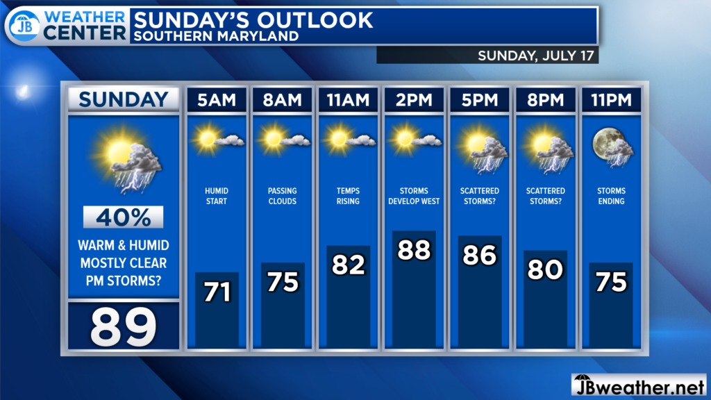
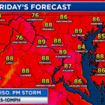
Sunday’s forecast looks a lot like Saturday’s forecast. We will start off with a few clouds and lingering humidity. Some midday clearing should allow temps to get back up into the upper 80s. The threat of storms on Sunday looks confined to 3-10pm, and they may not be as scattered or numerous as Saturday’s.
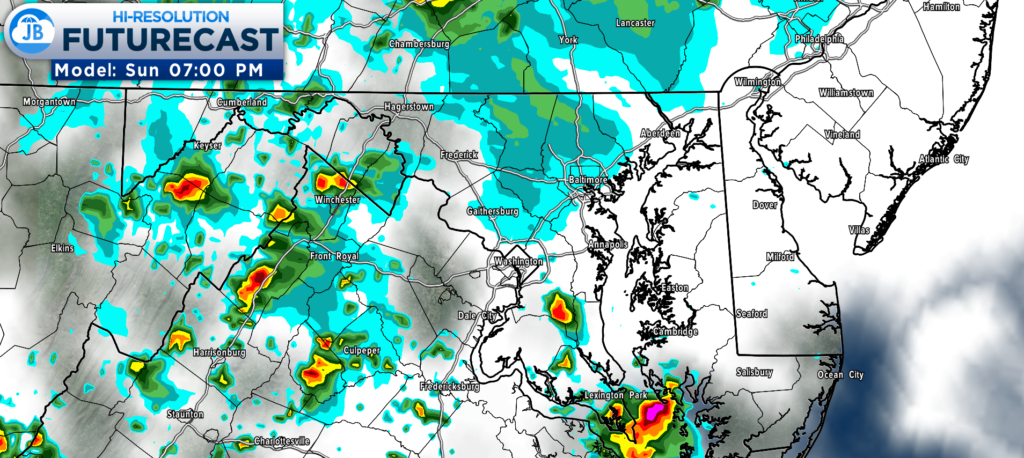
We are still a bit far out from Sunday’s storm threat, and Futurecast isn’t able to look that far out. What does seem apparent is that any storms that fire Sunday afternoon would likely be much more isolated and confined to the mountains (due to the terrain) and bayside locations (thanks to the higher humidity).
I do tend to think that the overall severe risk would be low. If you have plans on Sunday, I would not cancel them. With that said, do be aware of the threat of a storm or two potentially popping during the afternoon and evening hours.
Stay with JB Weather for the latest information on Southern Maryland weather. You can always access my forecasts and updates here on the website, on Facebook, on Twitter, on Instagram, and on YouTube.
-JB

Chesapeake’s Bounty is providing our community farm-fresh foods from the Chesapeake Bay region. Local seafood, produce, meats, dairy and more! Locations in Saint Leonard and North Beach. Make sure to stop by and also check out www.chesapeakesbounty.com
