A developing area of low pressure will move into the region over the next 24 hours, bringing periods of rain that could turn heavy at times, especially overnight and into early Thursday morning. Widespread totals of 1–3 inches are on the table, with the highest amounts most likely north of Washington and toward central Maryland and southern Pennsylvania. Some rumbles of thunder are also possible Thursday morning as the system deepens and pulls in more moisture.
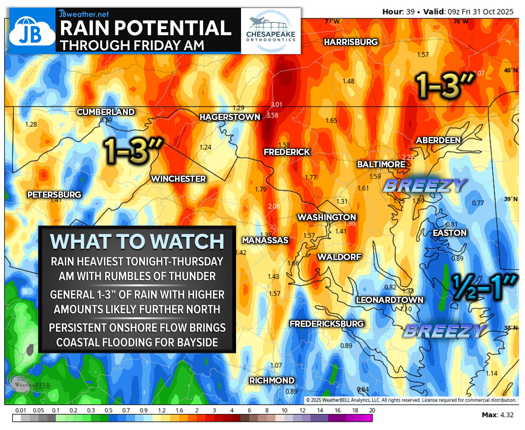
In addition to the rain, a strong onshore flow will set up, pushing water toward the western side of the Chesapeake Bay. This will elevate water levels by 1–2 feet, leading to coastal flooding concerns for Bayside communities. Areas prone to tidal flooding should plan for impacts during high-tide cycles, especially late tonight and Thursday morning. Winds will also turn breezy at times, adding to the unsettled feel of this storm system.
While this is not an all-day washout from start to finish, the heaviest rain and greatest impacts are expected from late tonight through Thursday morning. Conditions gradually improve by Thursday evening as the low pressure pulls away and winds begin to ease.
John Bordash
View More PostsJB Weather forecaster John Bordash is working around the clock to provide Southern Maryland, and neighboring communities, with accurate and reliable weather information.