Brought to you by G&H Jewelers, Inc.
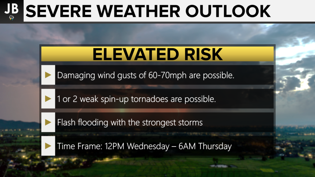
An incoming cold front will help to set off a couple of rounds of severe weather this afternoon and evening. The Storm Prediction Center has placed much of our region under either a Marginal Risk or an Elevated Risk of severe weather. All areas have a threat of damaging winds with any storms that fire up. 1 or 2 storms will also have the ability to rotate as well. While we are not expecting a widespread tornado outbreak today, this will be something to watch. Flash flooding will also be a concern with these storms. Anytime between lunchtime today and daybreak tomorrow will be fair game.
Our Chesapeake’s Bounty Futurecast continues to do a good job of depicting the severe storm potential. The model has backed off a touch in regard to any midday storms that fire up. I’m not ready to totally write off the threat of 1 or 2 storms around lunchtime though, so we’ll see what happens. While that may be good news for any lunch plans, this would help leave our atmosphere primed and ready for some storm development. The cold front will look to move through this evening into the overnight hours. The front may bring with it a couple of rounds of showers and storms. Our model continues to show the greatest threat for severe storms to the north of Southern MD, but I think all areas need to be on alert. Our model shows clearing as we approach daybreak on Thursday.
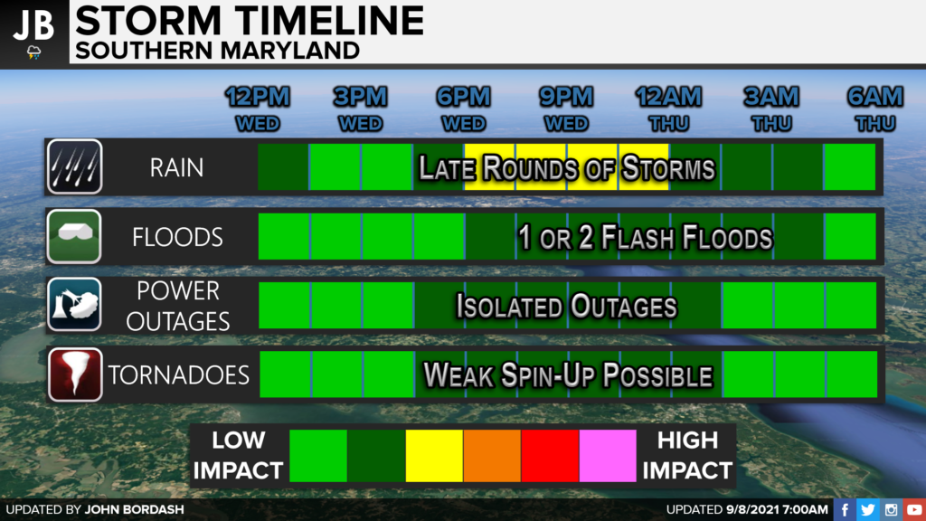
I think the primary time to watch for heavy rain and thunderstorms would be ~4/5PM through about ~2/3AM. While anytime after noon will be fair game, I think this time period likely offers our highest storm threat. Any thunderstorm will have the potential to put down an inch or two of rain quickly, so we will need to watch for the potential of 1 or 2 flash floods. I will not rule out a weak spin-up tornado today, but it is far from my primary concern. I think the higher tornado potential is across the Northeast and Hudson Valley today.
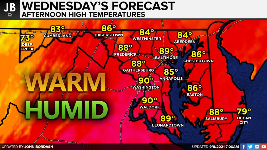
This threat of storms comes thanks to the warm and humid that is being brought northward today. Highs will look to get into the upper 80s and lower 90s for many areas this afternoon. Dewpoints will also be elevated, making it feel humid. This combination of heat and humidity will prime the atmosphere for storm development as the cold front moves through this afternoon and evening.
Stay with JB Weather for the latest information on impacts here in Southern Maryland. You can always access my forecasts and updates here on the website, on Facebook, on Twitter, and on YouTube. JB Weather is Southern Maryland’s Weather Leader, and I am working around the clock to keep you ahead of the storm!
-JB

Shop G&H Jewelers Today for Loose Diamonds, Fine Diamond & Colored Gemstone Jewelry, On-site Custom Jewelry Design (CAD) & Manufacturing, Jewelry Repair and GIA Graduate Gemologist Appraisal Services. Third Generation Family Owned & Operated Since 1965.
