Brought to you by Calvert Title Company
This Winter featured a lot of notable swings in our weather. We went from December being 5 degrees warmer than average to picking up between 1-2 feet of snow across the region throughout January! February continued to feature wide temperature swings, but the snow chances were limited.
March 1st marks the beginning of meteorological Spring! While the first day of astronomical Spring may not be until March 20th this year, this does mark a critical turning point in our weather. March is historically a key transition month as we slide from Winter into Spring. We have gone from 60s, to snow, right back to 70s before in March! But, what exactly can we expect this March?
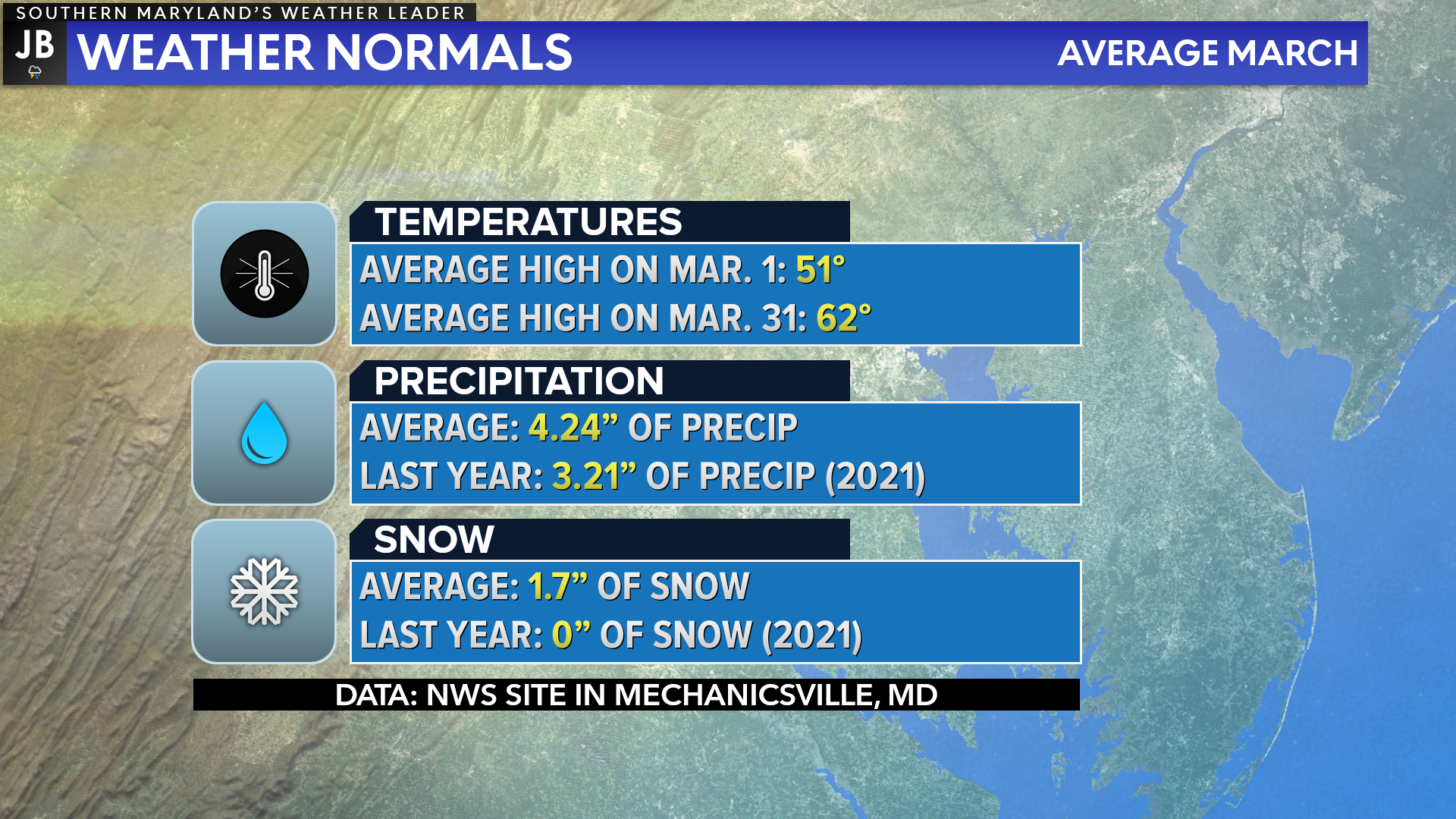
Let’s first touch on what typical March weather looks like in Southern MD. Unsurprisingly, our temperatures warm significantly throughout the month. Our average high rises by nearly 11 degrees throughout the month as we add more sunlight! March typically also offers a decent amount of precip as storms move by. On average, we do average a couple of inches of snow in March, too.
The last half of February looked a lot like these averages– at least temperature wide! We saw warmer weather return to our region, with snow chances decreasing. This has many wondering if the Groundhog was wrong in predicting 6-more weeks of Winter.

The latest temperature outlook from the Climate Prediction Center generally favors above-average temperatures this month. Given our rising average highs throughout the month, this would mean that we should have ample chance to get into the 60s and 70s this month! However, I wouldn’t put the winter coat away just yet…
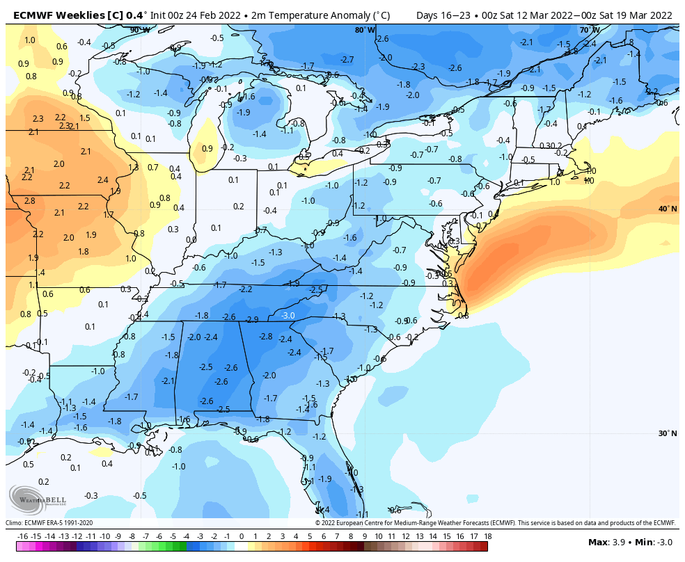
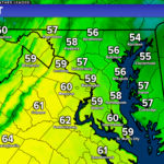
The first week or two of March does indeed look warm, with the few waves of cold air that do manage to enter the region only lasting a day or two. However, many of our long-range models indicate the potential for a brief mid-month cool down. The image above is from the European model showing the potential for temperatures to be a couple of degrees below average by the third week of March.
While this is not a strong signal for a massive arctic outbreak, this is a signal that we will likely see temperatures dip back down around St. Patricks Day. With that said, our average highs by the third week of March are in the middle 50s, with average lows in the upper 30s. Being a couple of degrees colder could mean afternoon highs in the 40s and lows in the 20s, not necessarily overly cold.
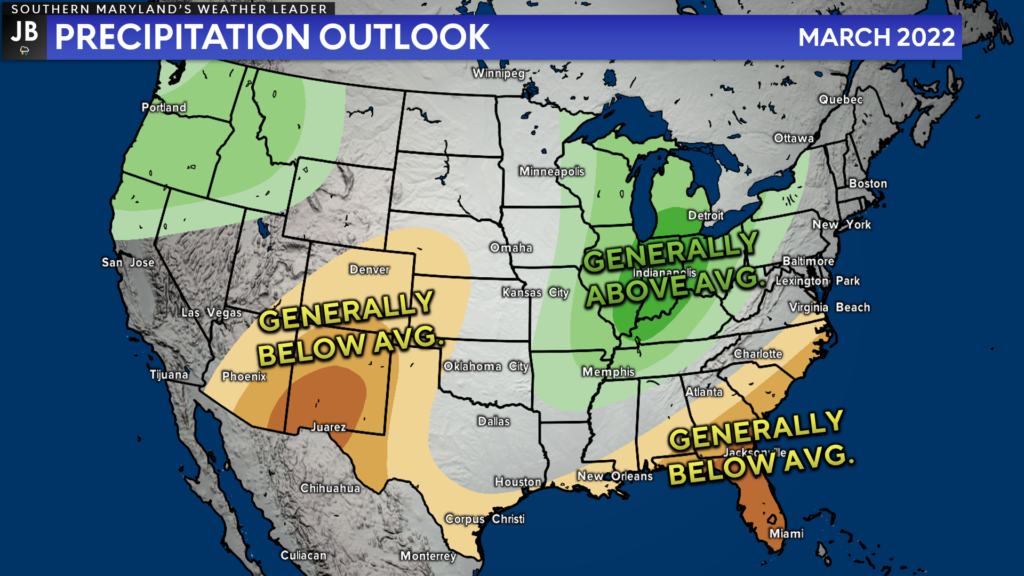
As we move into March, we should see the storm track generally favor areas to our north and west to see the bulk of the precip. The Jetstream will look to set up across the Ohio Valley and Great Lakes region. This placement favors above-average precip there with below-average precip well to the south of it, across the Southeast.
The current Climate Prediction Center outlook is for wetter than normal conditions to our northwest with drier than normal conditions to our southeast. I do tend to think that we will end up drier than average with the storm track so far to our west.
From December to February, we saw 9.04″ of liquid precip (including melted snow) in Southern MD. We typically see around 10″ of liquid precip during this timeframe. So while the Winter as a whole was not exceptionally dry, limited precip in March could cause abnormally dry conditions to set in by late month.
I don’t foresee any big outbreaks in the near-term future in terms of severe weather. March severe weather is typically focused across the Deep South and the Plains. Our severe weather season does not really get going until April and May. With that said though, we could see thunderstorm chances return by late-month.

Now, let’s turn our attention to the chance of snow in March. Those that have lived around here long enough know that March can produce big-time snows. The fact that we haven’t seen any meaningful March snows since 2018 is abnormal. We typically can score one last snow event in March before the transition to Spring!
Even though March has historically been a snow-producing month, I think that we may have a hard time reaching our snowfall average for the month.
Given the warm temperatures, it will be tough for our region to see snow during the first two weeks of the month. However, I do think that a window for potential winter weather be open during the middle of the month when the cooler pattern tries to set in. We all know that it is notoriously hard to forecast snow events weeks in advance. With that in mind, I cannot definitely say if we will see snow, or how much, during this potential window.
The pattern during the third week of the month does not necessarily look amazing for local snow lovers, but it will look better than the beginning of the month. Odds don’t favor a big storm during that period, but it will need to be a time period that is watched.
After mid-month, I think the threat for winter weather in our region will be close to zero. With the lack of big storm signals, I do tend to think that March will feature below-average snow if any at all. We will need to monitor the pattern though. As the storm in early January taught us, things can change on a dime.
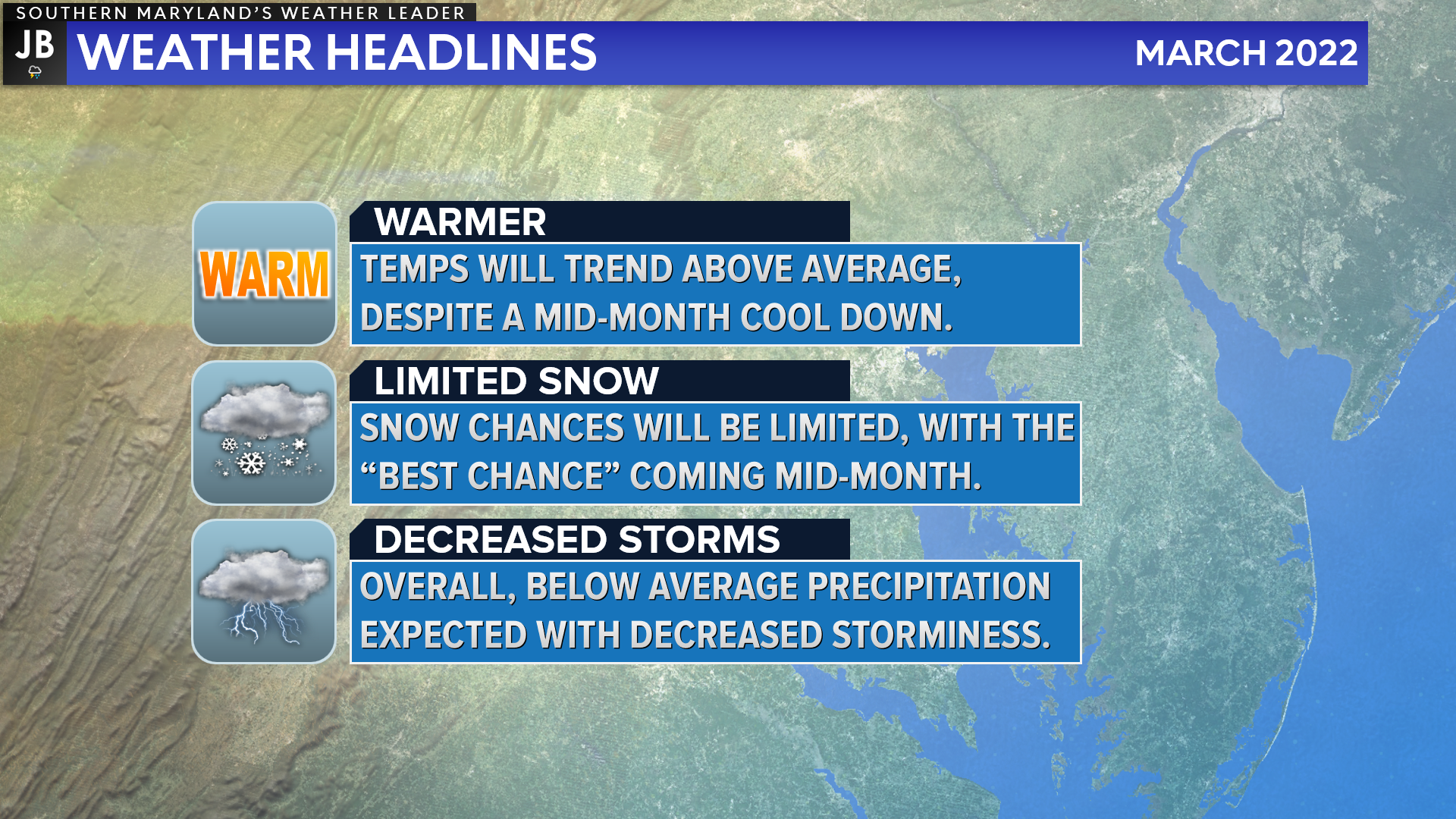
All-in-all, March looks like it will feature a clear transition to Spring. Above-average temperatures are likely for much of the month, with limited chances for rain and storms. Winter weather lovers’ last hope for snow is during the middle of the month, where a brief return to cooler temps returns. However, I do not favor above-average snow for this month. Actually, I think it is very possible that we are done with snow for the season. Only time will tell, though.
Stay with JB Weather for the latest information on Southern Maryland weather. You can always access my forecasts and updates here on the website, on Facebook, on Twitter, and on YouTube.
-JB
Brought to you by Calvert Title Company. Calvert Title Company is guiding you HOME one closing at a time! Check out https://www.facebook.com/calverttitle today!
John Bordash
View More PostsJB Weather forecaster John Bordash is working around the clock to provide Southern Maryland, and neighboring communities, with accurate and reliable weather information.

1 thought on “March Outlook: Trending Towards Spring”
Comments are closed.
[…] [ February 28, 2022 ] March Outlook: Trending Towards Spring Top Stories […]