Brought to you by Cedar Point Federal Credit Union
This week has featured weather has been much more like June than mid-April! Temperatures the last couple of days have gotten into the 80s with thunderstorms moving through yesterday. Those storms came with a cold front that has ushered in amazing weather to close out this week!
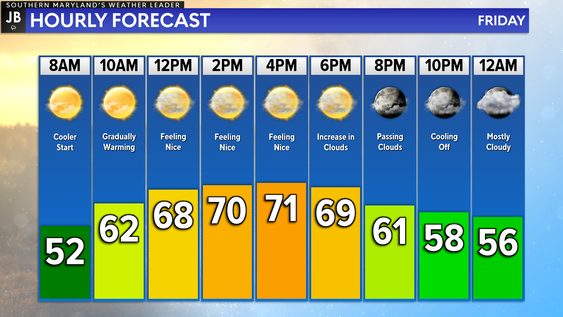
We are off to a rather cool start this morning with many spots in the 40s and 50s. We will gradually warm things up today with many spots getting into the 60s by lunchtime, and the 70s this afternoon. With rather low humidity and clear skies, this will feel pretty great! We will see a slight increase in cloud cover later on this evening.
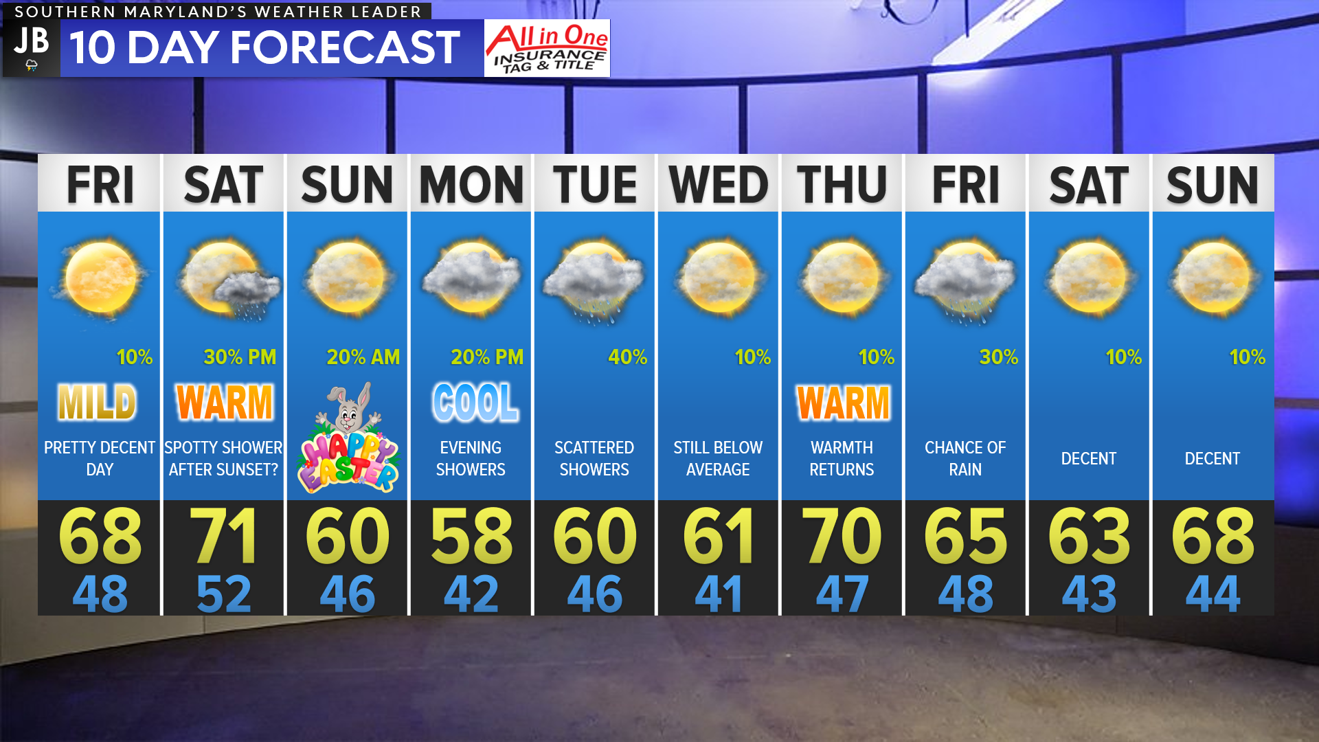
These nice temperatures will stick around for tomorrow before another cold front moves through in the evening and brings an overnight rain chance Saturday. Cooler temperatures will follow for Easter and early next week. We will see things bounce back in the temperature department by mid-next week.
Stay with JB Weather for the latest information on Southern Maryland weather. You can always access my forecasts and updates here on the website, on Facebook, on Twitter, and on YouTube.
-JB
Cedar Point has been providing trusted banking, lending and personal finance solutions to the Southern Maryland Community since 1945. Visit the credit union at any of its 6 locations in St. Mary’s, Charles and Calvert counties or online at www.cpfcu.com.
John Bordash
View More PostsJB Weather forecaster John Bordash is working around the clock to provide Southern Maryland, and neighboring communities, with accurate and reliable weather information.