Brought to you by Bill Oosterink, Realtor
January has brought with it quite the winter-feel with cold temperatures and winter weather! We are set to see more winter impacts as a coastal system is set to develop this weekend and bring widespread winter weather to the region on Sunday. Impacts and amounts will vary, but it will set the stage for a cold week!
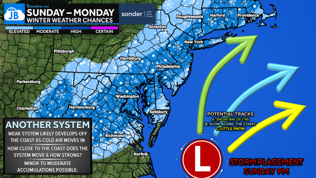
A cold front will move through the region on Saturday, which will help to usher in our next cold blast. An area of low pressure will develop along that front as it stalls to our southeast. This system will then move up the coast, close to the green Track C shown above.
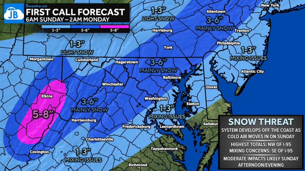
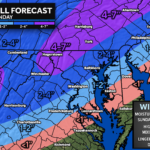
With a track closer to the coast, we are likely to see the heaviest snow totals northwest of I-95 which there will be fewer mixing concerns. A general 3-6″ of snow will be possible in that region. Rain and sleet will likely mix in earlier on for southeastern regions. This will help to keep totals lower, likely only 1-3″.
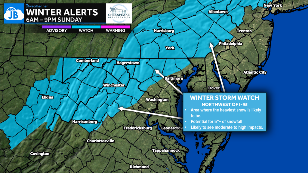
Winter Storm Watches were issued for those counties northwest of I-95 for Sunday. This shows that the National Weather Service is in agreement with the placement of the heaviest snow. These blue “watch” counties have the highest chances of potentially seeing 5″+ of snow.
Our Futureview model shows that precip is likely to overspread the region by mid-morning Sunday. Thinsg will likely start as snow northwest of I-95, where the cold air will be in place. Southeast of I-95 will start as rain and then gradually transition to snow as the cold air drives southward. How long will that transition take, though?
Regardless, our Futureview models shows the snow moving out of here Sunday night.
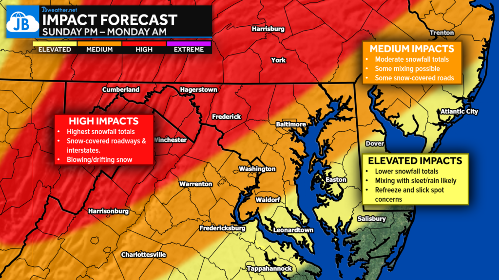
I would expect the highest impacts to be felt northwest of I-95. Expect snow-covered roads with some blowing/drifting. Travel in the red area will be difficult on Sunday. The orange zone will also see impacts with difficult travel, but the snow totals will be lower. Elevated impacts in the yellow zone as any rain, sleet, or snow mix will freeze quickly as the cold air rushes in.
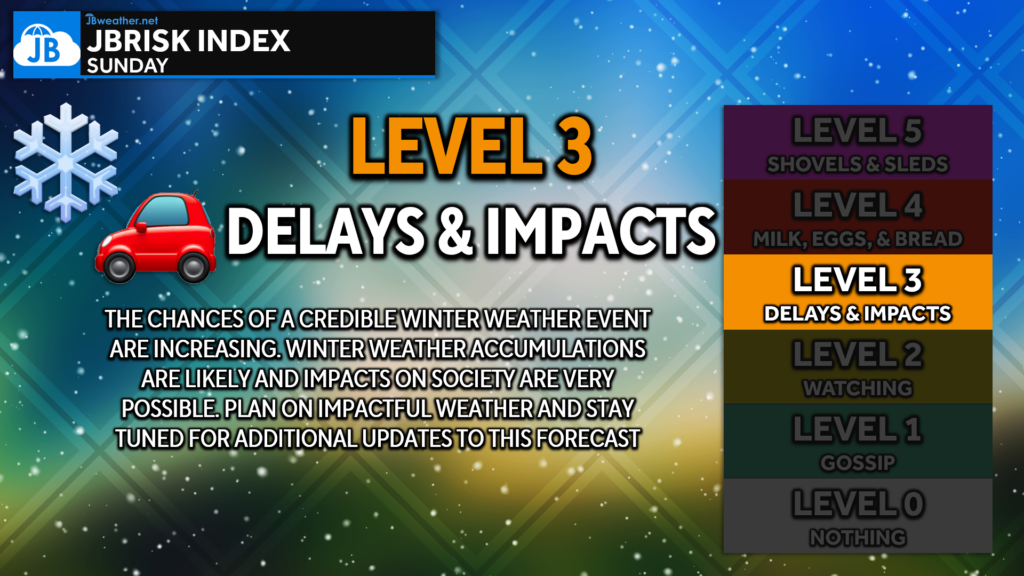
All in all, this system does not appear to be as severe as our storm earlier this month was. This storm will favor areas northwest of I-95, where 3-6″ of snow is likely with high travel impacts. Impacts will be lower south and east with mixing, but travel impacts after the storm are expected.
Stay with JB Weather for the latest information on impacts here in Southern Maryland and across the Mid-Atlantic. You can always access my forecasts and updates here on the website, on Facebook, on Twitter, on Instagram, and on YouTube. JB Weather is the Mid-Atlantic’s Weather Leader, and I am working around the clock to keep you ahead of any storm!

Buying. Selling. Investing. Ready when you’re ready! Check out www.somdDreamHome.com today!
1 thought on “First Call: Storm Set to Bring Winter Weather Sunday”
Comments are closed.
I live in Winchester, Va. and always go here first for my winter news. Good Job.