Our weather stays quiet through the end of the work week, but all eyes now turn to the weekend as our first true Nor’easter of the season develops off the Southeast coast.
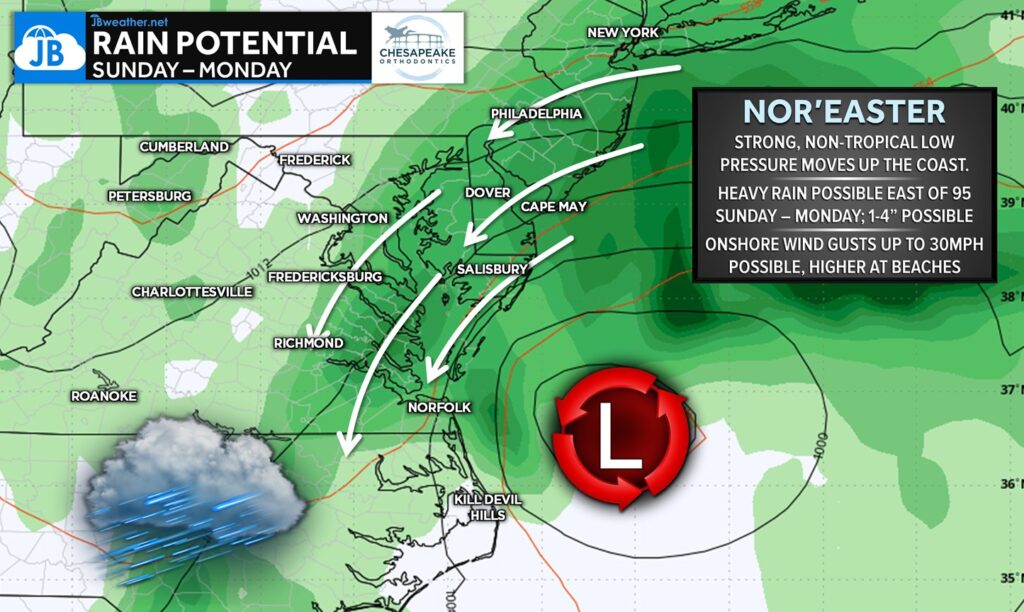
This system will strengthen quickly and move northward from Saturday evening through Monday, spreading periods of rain, gusty winds, and coastal impacts across the Mid-Atlantic. The heaviest rain is expected along and especially east of I-95, where persistent onshore flow enhances moisture. Widespread totals of 1–4 inches are possible, with the highest amounts likely for Southern Maryland, the Eastern Shore, and coastal New Jersey.
In addition to the rain, the Nor’easter will bring 30–40 mph wind gusts, and higher gusts are possible along the immediate coastline and at the beaches. These winds, combined with multiple rounds of heavy rain, may lead to localized flooding, rising tidal water, and some minor tree or power line issues. While this system is strong, it remains non-tropical, meaning it is driven more by sharp temperature contrasts and upper-level energy than by warm ocean waters.
And here’s a fun weather thought: if this setup were happening on January 12th instead of October 12th, we would be talking about a significant winter storm with heavy snow for many. Thankfully for now, it’s only rain—though a chilly, windswept, classic Nor’easter setup is certainly on the way.
John Bordash
View More PostsJB Weather forecaster John Bordash is working around the clock to provide Southern Maryland, and neighboring communities, with accurate and reliable weather information.