We’re starting off with another cold morning, and temperatures will stay below average through the day. A passing cold front will shape much of today’s weather, bringing a brief window for flurries and a breezy afternoon.
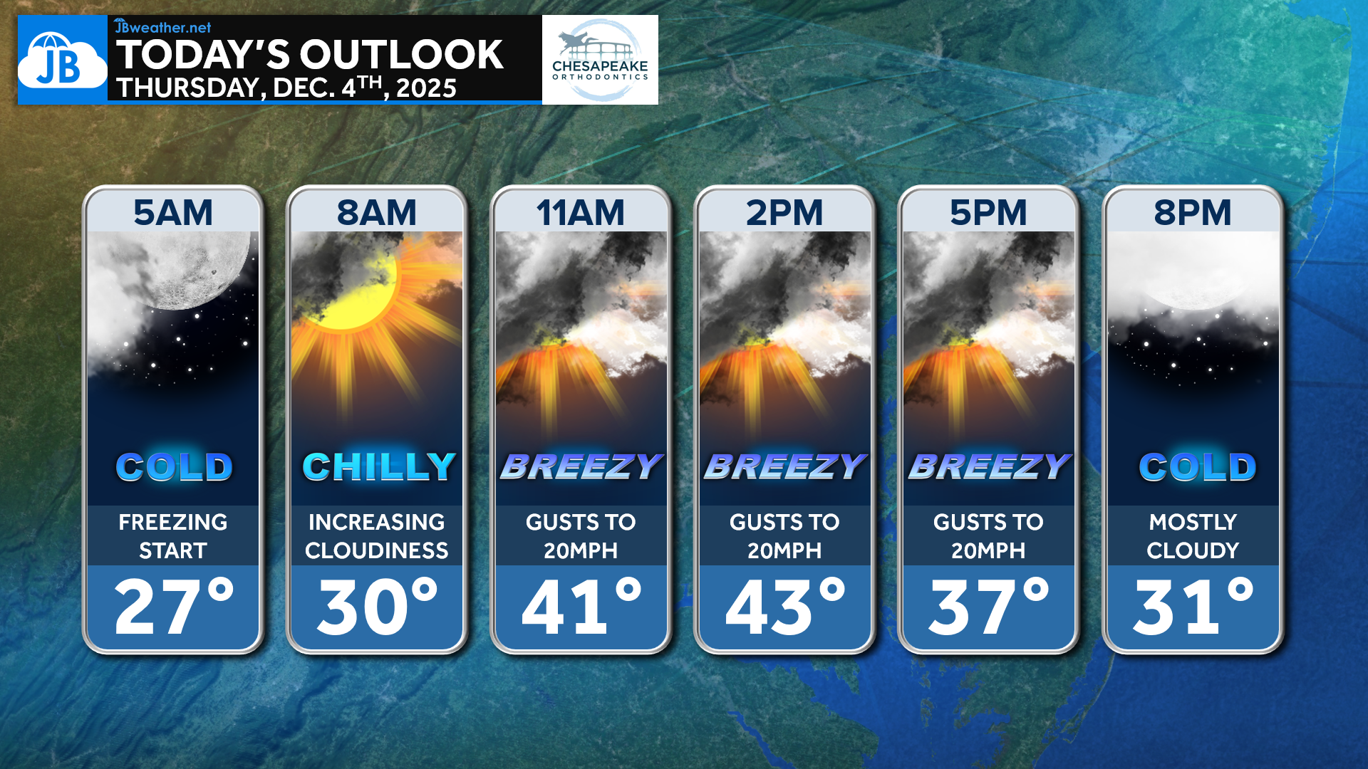
We’re off to a cold start this morning, and temperatures will stay below average all day. Clouds will increase through the morning ahead of a passing cold front, which may squeeze out a spotty flurry or two across northern areas. Highs reach the low 40s, but most of the day will feel noticeably colder.
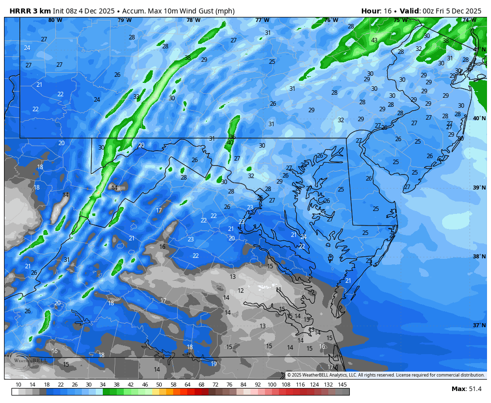
Behind the front, winds pick up this afternoon with gusts around 20 mph. Even as temperatures peak, the breeze will keep feels-like values locked in the 30s. Winds gradually ease this evening, but colder air settles back in overnight.
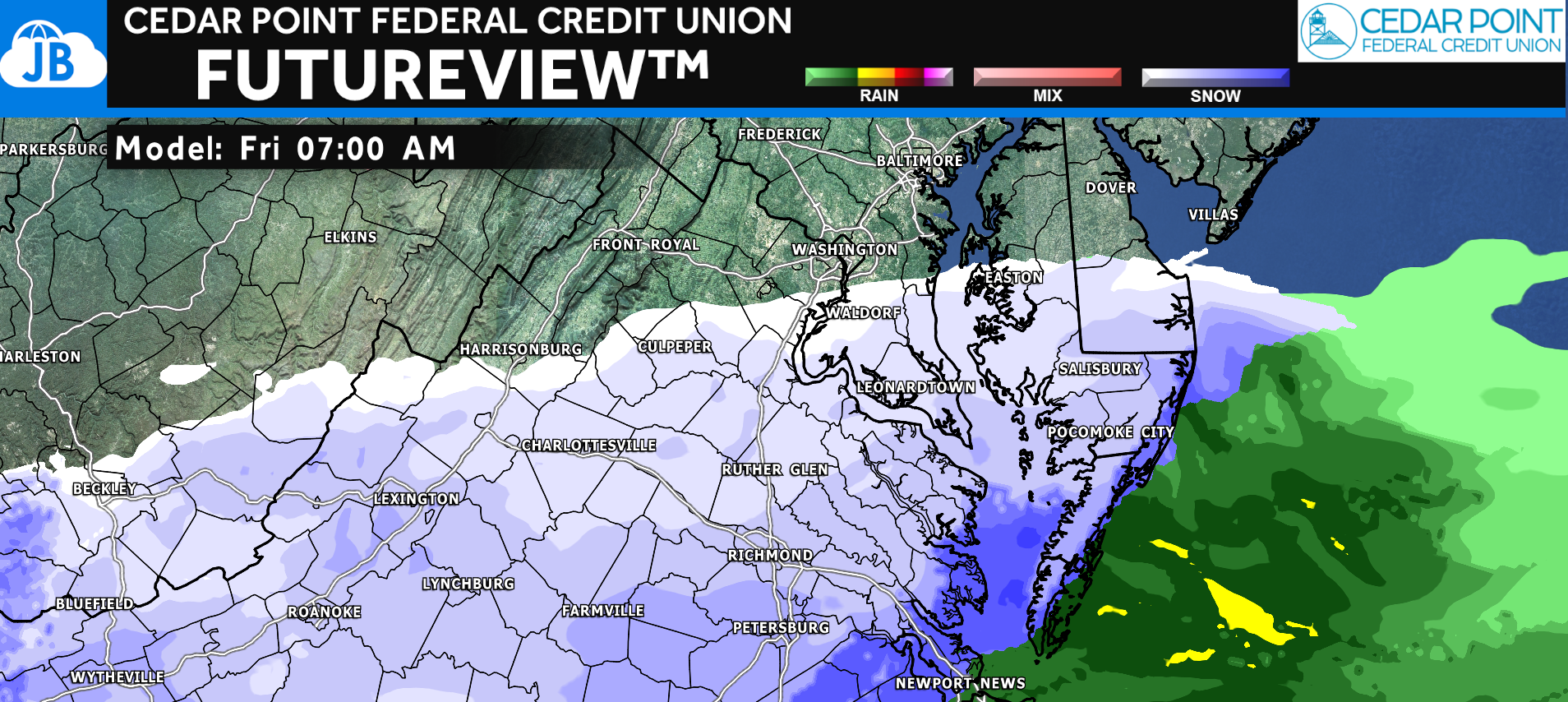
We’re also keeping an eye on the weak southern system arriving Friday morning. Overnight guidance continues to suggest that this storm will be suppressed to the south with our region on the northern edge. Snow could begin around 6am, especially south of Route 50, and light accumulations up to an inch remain possible. There will be plenty of dry air to overcome, so higher impacts still look unlikely. Yesterday I issued my First Call Forecast, and a full updated Final Call will be posted later this evening when I get home from school.
Stay with JB Weather for the latest information on impacts here in Southern Maryland and across the Mid-Atlantic. You can always access my forecasts and updates here on the website, on Facebook, on Twitter, on Instagram, and on YouTube. JB Weather is the Mid-Atlantic’s Weather Leader, and I am working around the clock to keep you ahead of any storm!
John Bordash
View More PostsJB Weather forecaster John Bordash is working around the clock to provide Southern Maryland, and neighboring communities, with accurate and reliable weather information.