Brought to you by Bill Oosterink, Realtor
Much of the week ahead looks quiet and seasonable across the Mid-Atlantic, with no major weather concerns through midweek. That changes late Thursday night into Friday as another shot of cold air arrives with a fast-moving northern clipper, which could bring a round of snow showers, especially northwest of I-95. Any snow at this point looks light and spotty, but it’s a signal that colder air is returning to close out the week.
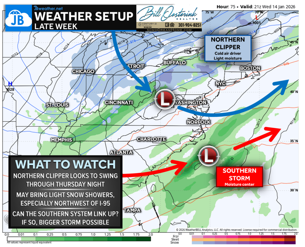
The bigger question is whether that northern clipper can phase with a southern system passing through on Friday. Most guidance keeps these systems separate, which would limit impacts, but a small number of models suggest a possible connection that could support a bigger winter storm. It’s not the favored outcome right now, but it’s a setup worth watching closely as we head into late week!
Stay with JB Weather for the latest information on impacts here in Southern Maryland and across the Mid-Atlantic. You can always access my forecasts and updates here on the website, on Facebook, on Twitter, on Instagram, and on YouTube. JB Weather is the Mid-Atlantic’s Weather Leader, and I am working around the clock to keep you ahead of any storm!
Brought to you by Bill Oosterink, Realtor. Buying. Selling. Investing. Ready when you’re ready! Check out www.somdDreamHome.com today!
John Bordash
View More PostsJB Weather forecaster John Bordash is working around the clock to provide Southern Maryland, and neighboring communities, with accurate and reliable weather information.