Brought to you by Chesapeake Orthodontics
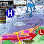
Confidence continues to increase that a high-impact winter storm will affect parts of the Mid-Atlantic late this weekend into early next week. Over the course of today, all major guidance — including the American model — has shifted farther north, a notable change that places much of the Mid-Atlantic firmly in play for significant winter weather. While important details remain unresolved, the overall signal has strengthened compared to previous forecasts.
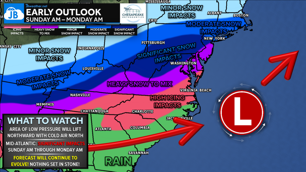
The early-outlook map highlights the expected timing and evolution of this system, showing precipitation moving into the region late Saturday night, close to midnight, expanding and intensifying through Sunday, and gradually tapering off early Monday morning. This northern shift has important implications for where the heaviest snow and any mixing set up. A more northerly track typically pulls the core of heavy snow farther inland, while also pushing the rain/sleet/freezing rain line northward, especially closer to the coast and southeast of I-95. How this storm behaves once it reaches the coast will determine the exact track, precipitation types, and ultimate impacts, leading to two primary scenarios that are now coming into focus.
Scenario 1 – Coastal Redevelopment (European Model favored):
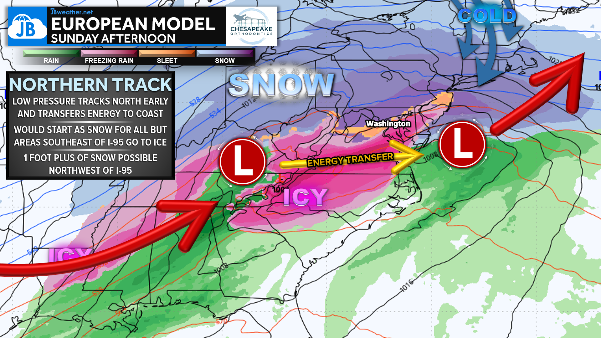
In this scenario, the initial storm transfers energy to a newly developing low pressure system near the Northeast coast — a process similar to a nor’easter. This allows the storm to slow down and intensify, producing prolonged, heavy snowfall across much of the Mid-Atlantic. Areas northwest of I-95 would have the highest potential for foot-plus snowfall, while locations closer to and southeast of I-95 would face mixing and icing concerns, which could reduce snow totals but increase overall impacts. Heavy snow would still fall southeast of I-95, but it would eventually give way to sleet and ice. This remains the solution I currently lean toward.
Scenario 2 – Offshore Track:
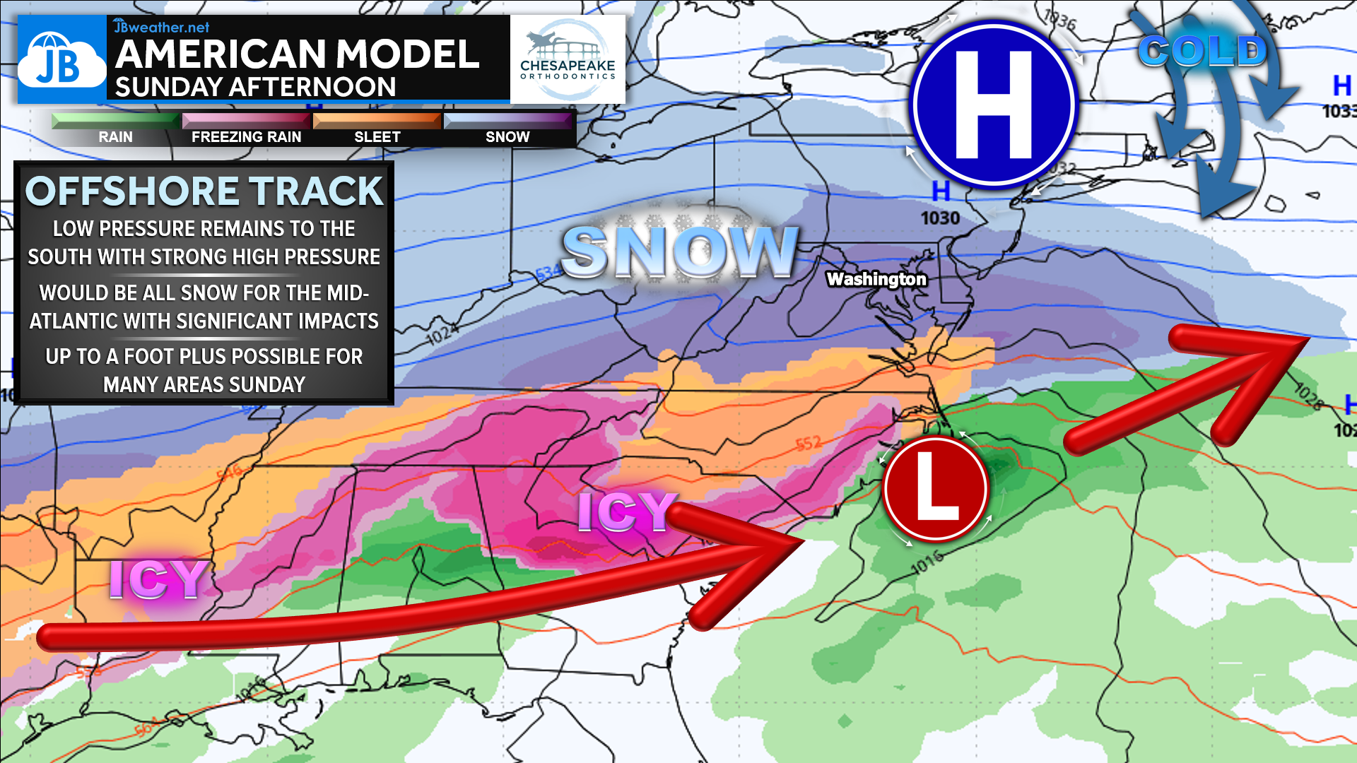
The second option keeps the storm more progressive, with energy sliding east and out to sea before a full coastal low can develop. While still impactful, this outcome would likely result in a shorter-duration event with somewhat lower snowfall totals compared to the coastal redevelopment scenario. Even so, current guidance still shows moderate to significant impacts for much of the Mid-Atlantic, reinforcing that this is not a “miss” scenario.
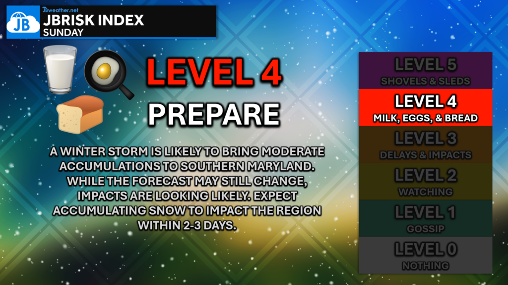
Bottom line: This storm appears increasingly likely to be a long-duration event, beginning late Saturday night and lasting through much of Sunday before wrapping up early Monday. While it is far too early to pin down exact snowfall totals or local impacts, the potential exists for someone to exceed one foot of snow, particularly northwest of I-95, with mixing concerns farther southeast. These details will be refined as we move into a higher-confidence window, with my first call expected tomorrow afternoon.
Stay with JB Weather for the latest information on impacts here in Southern Maryland and across the Mid-Atlantic. You can always access my forecasts and updates here on the website, on Facebook, on Twitter, on Instagram, and on YouTube. JB Weather is the Mid-Atlantic’s Weather Leader, and I am working around the clock to keep you ahead of any storm!
Dr. Thomas Hao and Dr. Dylan Schneider offer comprehensive orthodontic services for all ages. Schedule your free consultation today. Visit www.SOMDBraces.com today for more information!
John Bordash
View More PostsJB Weather forecaster John Bordash is working around the clock to provide Southern Maryland, and neighboring communities, with accurate and reliable weather information.
1 thought on “Confidence Growing in High-Impact Winter Storm Late This Weekend”
Comments are closed.
This event is long overdue in my book. Looking forward to see my mini doxie going out.