Brought to you by Sonder Studios
A bitterly cold air mass remains in place today, creating hazardous early-morning conditions and keeping temperatures well below average. While sunshine will help some, the cold isn’t going anywhere.
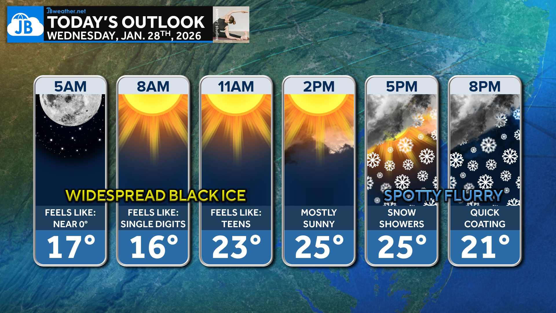
Temperatures started the morning in the teens with wind chills near zero, leading to areas of widespread black ice on untreated roads and sidewalks. Skies turn mostly sunny through the late morning and afternoon, allowing highs to slowly climb into the low to mid-20s, with a few southern locations nearing 30°. Despite the sunshine, persistent cold will keep wind chills in the teens and 20s for much of the day.

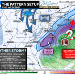
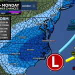
Late this afternoon into the evening, a weak disturbance may trigger spotty flurries or light snow showers, as shown on the latest Futureview guidance. Coverage will be scattered, but a brief coating is possible in a few locations, especially on colder surfaces. With temperatures remaining below freezing, any snow that falls could quickly refreeze, so use extra caution if traveling tonight.
Stay with JB Weather for the latest information on impacts here in Southern Maryland and across the Mid-Atlantic. You can always access my forecasts and updates here on the website, on Facebook, on Twitter, on Instagram, and on YouTube. JB Weather is the Mid-Atlantic’s Weather Leader, and I am working around the clock to keep you ahead of any storm!

SONDER STUDIOS® is home to Yoga, Pilates, Barre, and Strength classes in Calvert County. Wellness is our business, and belonging is at the heart of our culture. We are grateful for your trust for 6+ years. Sign up for an intro week at www.sonderstudios.us
John Bordash
View More PostsJB Weather forecaster John Bordash is working around the clock to provide Southern Maryland, and neighboring communities, with accurate and reliable weather information.