We have noticeably higher humidity values today, and they will be sticking around for the next several days! This helps create instability in the atmosphere, which in turn helps to generate storm energy. Weak frontal waves will try to tap into this over the next few days.
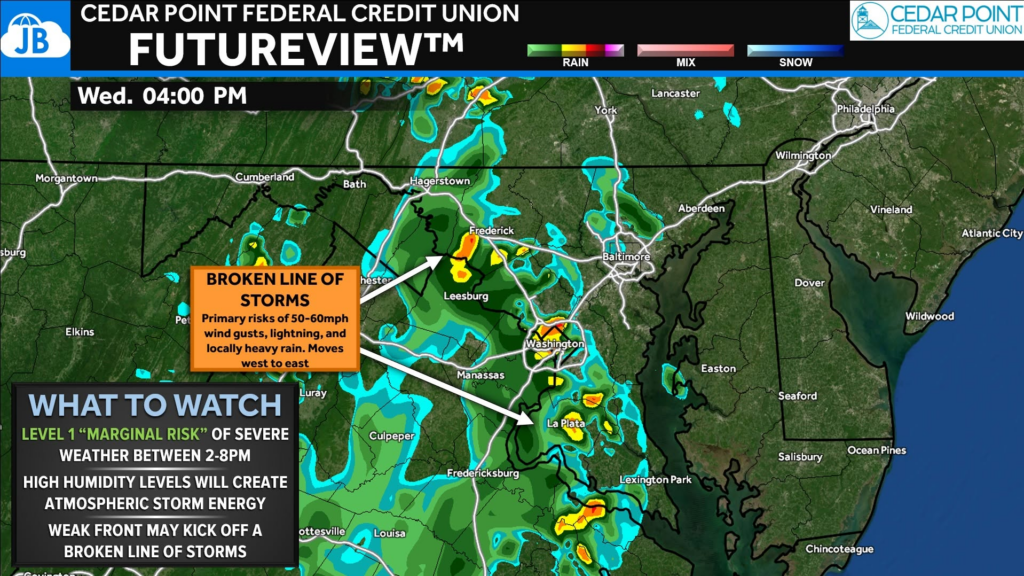
Up first, we have a 40-50% storm risk this afternoon. The overall severe threat is low, but a broken line of storms is possible, and they could bring some marginally severe wind gusts (50-60mph) and locally heavy rain. Stay weather aware!
Stay with JB Weather for the latest information on impacts here in Southern Maryland and across the Mid-Atlantic. You can always access my forecasts and updates here on the website, on Facebook, on Twitter, on Instagram, and on YouTube. JB Weather is the Mid-Atlantic’s Weather Leader, and I am working around the clock to keep you ahead of any storm!
John Bordash
View More PostsJB Weather forecaster John Bordash is working around the clock to provide Southern Maryland, and neighboring communities, with accurate and reliable weather information.