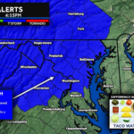
As expected, the severe weather threat is now shifting eastward toward the Chesapeake Bay, Southern Maryland, Delmarva, eastern Virginia, New Jersey, and coastal portions of the Mid-Atlantic. The Storm Prediction Center has issued a new Severe Thunderstorm Watch until Midnight as a strengthening squall line continues its push toward the coast this evening.
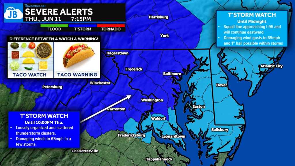
Unlike the earlier watch that focused on scattered thunderstorm clusters farther inland, this new watch is centered on a more organized line of storms that is expected to sweep east across the region over the next several hours. The Storm Prediction Center indicates that embedded bowing segments and stronger storm cores within the line could produce damaging wind gusts up to 65 mph, with isolated pockets of wind damage possible as the storms approach the I-95 corridor, Chesapeake Bay, Southern Maryland, and Delmarva. An isolated severe hail report up to 1 inch in diameter cannot be ruled out as well.
What Is Happening?
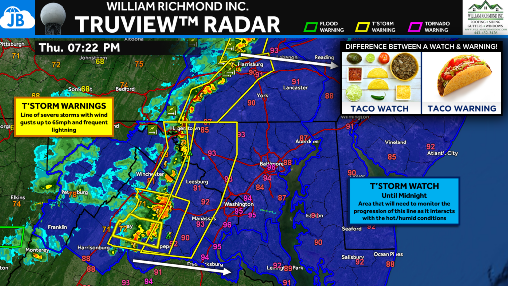
A well-organized squall line currently moving east through the Mid-Atlantic is expected to continue strengthening as it encounters a hot, humid, and unstable atmosphere. While the line may not appear particularly impressive on radar at all times, small-scale bows and surges embedded within the larger complex can quickly produce damaging straight-line winds capable of bringing down trees, power lines, and causing scattered power outages.
The highest threat will accompany the leading edge of the squall line as it moves toward coastal communities through the remainder of the evening.
Main Threats
🌬️ Damaging Winds: Wind gusts of 50-65 mph possible. Strongest storms could cause tree damage and scattered power outages. This is the primary concern tonight.
🧊 Large Hail: Isolated hail up to 1 inch in diameter is possible. Most likely within stronger storm cores embedded in the line.
⚡ Frequent Lightning: Dangerous cloud-to-ground lightning will accompany the storms.
🌧️ Brief Heavy Rain: Localized downpours may reduce visibility and create ponding on roads.
🌪️ Very Low Tornado Risk: Not the primary concern, but severe thunderstorms can occasionally produce brief spin-ups within squall lines.
Timing
⏰ Now through Midnight
The squall line will continue advancing eastward through the evening, likely reaching:
- Central Maryland and the DC/Baltimore corridor first
- Southern Maryland and Chesapeake Bay communities later this evening
- Delmarva and coastal areas before midnight
Residents should closely monitor weather conditions as storms approach, as severe thunderstorm warnings may be issued with relatively little lead time.
Watch vs. Warning
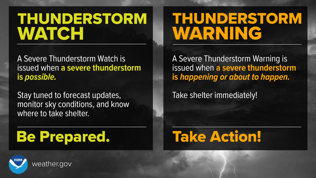
A Severe Thunderstorm Watch means conditions are favorable for severe thunderstorms to develop or move into the area. A Severe Thunderstorm Warning means a severe storm is occurring or imminent and action should be taken immediately. Remember:
🌮 Taco Watch = Ingredients are ready.
🌮 Taco Warning = Taco is in your hands.
Bottom Line
A new Severe Thunderstorm Watch has been issued for Southern Maryland, Delmarva, and other coastal portions of the Mid-Atlantic as a strengthening squall line pushes eastward. The primary threat will be damaging wind gusts up to 65 mph, though isolated severe hail is also possible. If you live across Southern Maryland or the Eastern Shore, now is the time to review your severe weather plan and ensure you have multiple ways to receive warnings as storms approach later this evening.
Stay with JB Weather for the latest information on impacts here in Southern Maryland and across the Mid-Atlantic. You can always access my forecasts and updates here on the website, on Facebook, on Twitter, on Instagram, and on YouTube. JB Weather is the Mid-Atlantic’s Weather Leader, and I am working around the clock to keep you ahead of any storm!
John Bordash
View More PostsJB Weather forecaster John Bordash is working around the clock to provide Southern Maryland, and neighboring communities, with accurate and reliable weather information.