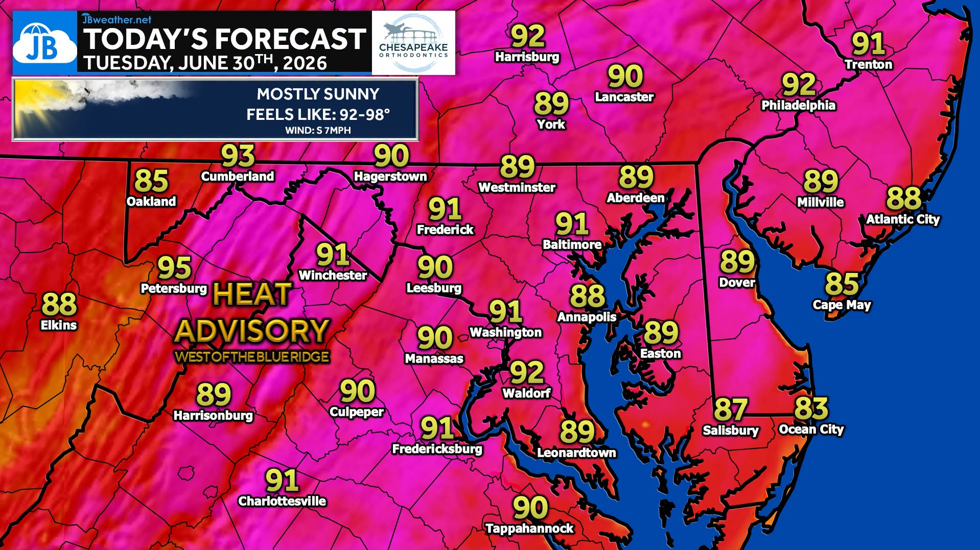
After a pleasant start to the day, we’ll enjoy mostly sunny skies with afternoon temperatures climbing into the upper 80s and lower 90s. While it will be warm area-wide, humidity will be noticeably higher west of the Blue Ridge, where Heat Advisories are in effect for portions of the Alleghenies as heat index values approach 100°. Most locations will remain dry, though a stray afternoon shower or thunderstorm can’t be ruled out over the mountains.
Today is just the beginning, however, as a strong ridge of high pressure continues to strengthen over the region. Temperatures and humidity will climb each day, with Wednesday through Friday expected to bring the hottest weather of the week. Many areas will approach 100°, while heat index values soar into the 100-110° range.
If you have outdoor plans later this week or for the July 4th holiday, now is the time to start preparing for dangerous heat. Stay hydrated, take frequent breaks if you’re outside, and be sure to check on those most vulnerable to the heat.
Stay with JB Weather for the latest information on impacts here in Southern Maryland and across the Mid-Atlantic. You can always access my forecasts and updates here on the website, on Facebook, on Twitter, on Instagram, and on YouTube. JB Weather is the Mid-Atlantic’s Weather Leader, and I am working around the clock to keep you ahead of any storm!
John Bordash
View More PostsJB Weather forecaster John Bordash is working around the clock to provide Southern Maryland, and neighboring communities, with accurate and reliable weather information.