Brought to you by R.E. Graves Heating & Air Conditioning
Yesterday offered quite a crazy weather day for the Mid-Atlantic. We saw precipitation spread overhead by lunchtime after starting off with temperatures in the 20s at daybreak. This primarily started as snow for many spots before quickly changing over to sleet/freezing rain and then to rain with gusty winds. By the evening, temperatures peaked in the 40s and 50s, with Severe Thunderstorm Warnings by 11pm!
Yesterday’s system comes on the heels of an active start to January, in which we saw two systems bring a combined season’s worth of snowfall in just one week. This has many asking, “What’s in store for us next?!” As I mentioned a few days ago, our long-range outlook favors below-average temperatures and an active storm track through the end of the month. While this does not guarantee snow over the next two weeks, I think this brings at least a few threats of winter weather.
As we enter into this colder and more active period this week, there has been plenty of online chatter about the multiple threat of snow over the next 7 days. In my 10-day forecasts over the last few days, I have highlighted these potential threats. Still, I have refrained from going too into detail on them. Now that we have last night’s system out of the way let’s get into some of those details.
I see three potential threats over the next 7 days, but I don’t think all three are big snow producers. With that said, the further out a potential threat, the lower the confidence is and the blurrier the details become. The information in this forecast is not meant to serve as a definitive outlook about what will happen in the coming week. Rather, this is to serve as a guide of what I will be watching for over the next 7 days. Additionally, this is my way of combating any online hype you may see with honest reporting.
Wednesday Night – Thursday Morning
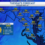
Behind Sunday’s system, we have seen cooler air and gusty winds take hold of the region. We will keep these conditions around for tomorrow before a brief warm-up on Wednesday. Temperatures on Wednesday will look to get into the upper 40s to lower 50s as a cold front moves closer to the region. That cold front will look to move through the area Wednesday night, which is when our first threat will come.
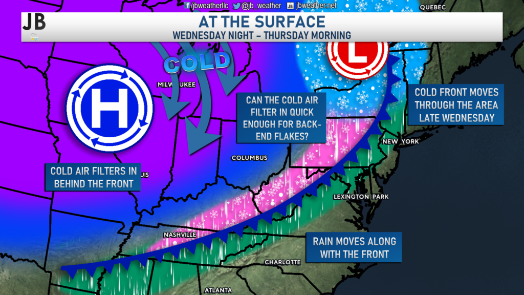
The cold front will likely work through between sunset Wednesday and sunrise Thursday. This cold front will bring some moisture along with it, in addition to the cold air behind it. After seeing temperatures max out around 50 on Wednesday, we should see this start as rain across much of the region. However, if the cold air can move in quick enough behind this front, we could see the precip end as a period of wintry weather. Below is a look at how our Chesapeake’s Bounty’s Futurecast handles this potential setup.
This is not necessarily a setup that I am too fond of. Typically in these setups, the cold air lags behind just a tad too much, and the precipitation has a way of not being nearly as robust as shown several days in advance. With that said, though, our guidance has been relatively consistent on this potential to see some light back-end flakes.
If this setup were to produce winter weather Thursday morning, it likely would not be a lot. I think we would only be talking about some conversational flakes with little accumulation. This likely would not be a significant, or even moderate, winter storm. This cold front will move through Wednesday night and usher in some cold air to close out the week regardless of the winter weather potential.
We are about two days away from this first potential winter weather event, and we’ll see if we can iron out the details. Again– as I see things right now, this does not look like a big deal at all.
Friday Night-Saturday
Behind the mid-week cold front, we will see cold air settle into the region by Friday. This cold air will look to have staying power as well! As noted in the introduction, we may see this cold air linger throughout the last 2 weeks of January. As that cold air gets established and the front pushes south, we may see a weak area of low pressure develop along it by the end of the week. This is when our second chance of potential wintry weather would come.
There is much less certainty (close to 0) with this potential than with Wednesday-Thursday (which already has low confidence). With that said, tread lightly as you read this, and remember that this can, and will, change a lot over the coming days.
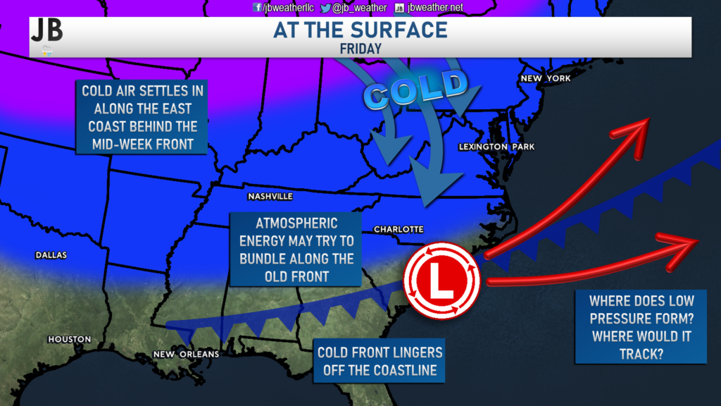
With this setup, we have several questions. Where does the cold front die out? Does energy bundle along it? If so, where would a low-pressure system end up forming? If low pressure does form, where would it track? If low-pressure forms, how strong would it be?
As you can see, there are plenty of questions with this potential, and we likely will not have any answers for a few days. Actually, not even all of our model guidance shows this potential. And, those models that do are not in agreement about it. With that said, I see the potential that could exist late Friday into Saturday. We would need things to fall in line rather perfectly to see any system form and potentially impact our area. Even if things fall into line, there is no guarantee that we will see a significant storm.
At this point, this potential is just something to watch. As I had mentioned in the introduction, the further out from today we get, the fewer concrete details I can provide. Details and confidence will increase in due time, though. With that said, let’s now move on to the third potential window I could see forming for winter weather.
Sunday-Monday
The Sunday-Monday potential window for winter weather looks almost similar to Friday-Saturday. With that said, I do not believe that both of these potential windows would both produce winter weather. In my experience, it will likely be one window that becomes the focal point. However, as stated previously, anything could happen and/or change. Especially with this window as it sits 5-7 days out.

As I stated, this threat looks very similar to the Friday-Saturday threat. We may see atmospheric energy move across the country’s southern tier late this week. We may then see that energy bundle and form an area of low pressure of the coastline. As with the prior threat, we have several questions to ask here. Where would a low-pressure system end up forming? If low pressure does form, where would it track? If low-pressure forms, how strong would it be? These are all questions that we will not be able to answer for some time.
Our model guidance is somewhat mixed on this potential with very little agreement. It is not clear how big any potential storm would be or our impacts. This only adds to the lower than normal confidence regarding this potential window. However, this is something that I will continue to monitor over the next several days.
Summary
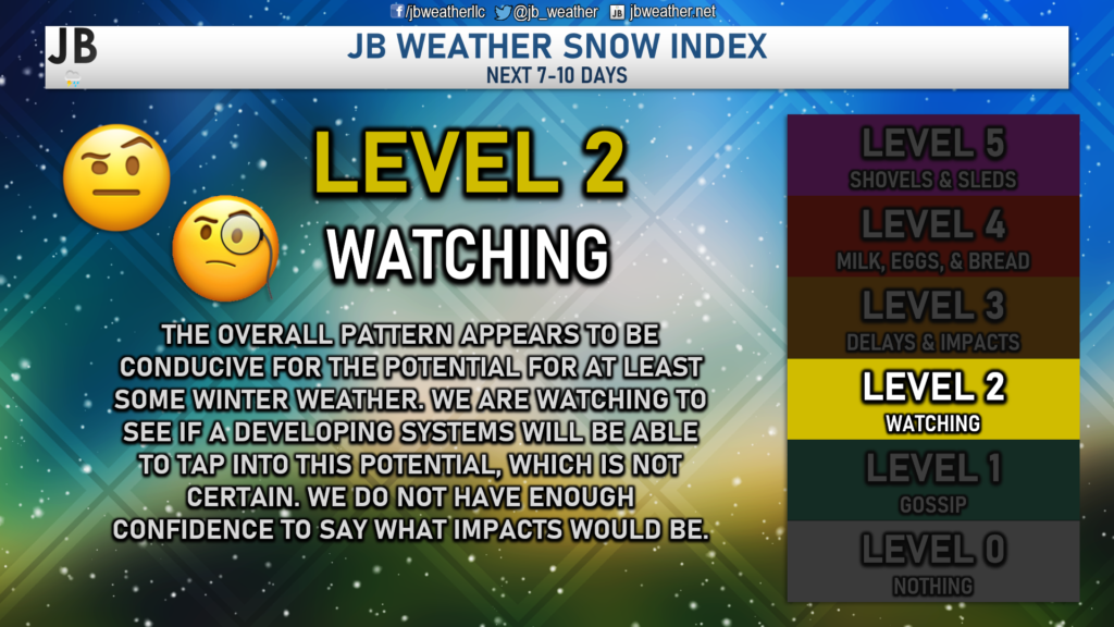
There is a lot to watch over the next week! Unfortunately, there are not many details I can give you on any three. I cannot answer questions about potential flight or travel impacts, snow totals, or school closures/delays on any of these. I can say, though, that this pattern is a good one for Mid-Atlantic winter weather lovers. There are several potentials to watch over the coming week, which is where you have to start. Details will come into better focus over the coming days on all of this. Right now, we are in a “wait and see” mode.
Stay away from personalities and outlets that are hyping up any snow potential. Nobody knows what will or will not happen with any of these threats. I would encourage you to stay tuned to JB Weather for hype-free reporting you can count on. I will not sugarcoat anything or publish outlandish articles just to get views. That’s not the way I operate. This forecast is here to serve as a launching pad for the rest of the week and show you why you may be hearing rumors of snow in the future. I will have more details on all of this and more in due time!
Stay with JB Weather for the latest information on impacts here in Southern Maryland. You can always access my forecasts and updates here on the website, on Facebook, on Twitter, and on YouTube. JB Weather is Southern Maryland’s Weather Leader, and I am working around the clock to keep you ahead of any storm!
-JB

R.E. Graves Heating & Air Conditioning is a ⭐️⭐️⭐️⭐️⭐️ HVAC Contractor serving St Mary’s & Calvert. Just mention JB Weather to Save 20% off your next Heating repair bill when you Book now! regraveshvac.net/jbweather20off
1 thought on “Active Weather Week on Tap With Winter Weather Chances”
Comments are closed.
[…] [ January 17, 2022 ] Active Weather Week on Tap With Winter Weather Chances Top Stories […]