Brought to you by Sonder Studios
Overnight, we have seen our winter storm move into the region as snow has overspread the region. Periods of snow are likely to continue throughout the day, with narrow bands of heavy snow also developing. Some sleet is also possible. This will make for a high-impact weather day!
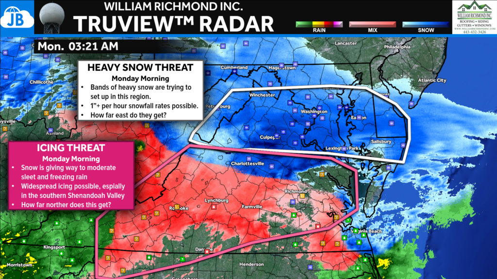
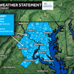
The National Weather Service has highlighted to zones to watch!
- The northern zone, in white, is where heavy snow bands may set up this morning! 1″+ an hour rates are possible. How far east of I-95 do they get?
- The second is in pink, where sleet and freezing rain are the primary concerns. Widespread icing will be possible in this region as slightly warmer temps inch north.
As you can see, our region is right on the line of heavy snow and mixing!
Our morning run of Futureview continues to show bands of snow moving through the region this morning before a potential “lull” in the activity this afternoon. You can also see that potential mixing line getting into the southern portions of our region. We then go back over to another round of snow this evening.
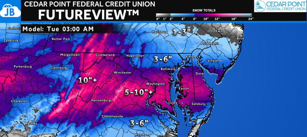
While I will not change my final call forecast of 4-8″ in Southern MD and 6-10″ near DC to claim a win (as we see some outlets do!) I want to show you our latest modeling. It is painting a widespread swath of 5-10″+ from the DC Metro area southward. If we do not see sleet, that is certainly possible! I continue to hold my reservations about a potential mix. However, without that, we will be on the higher side of my range.
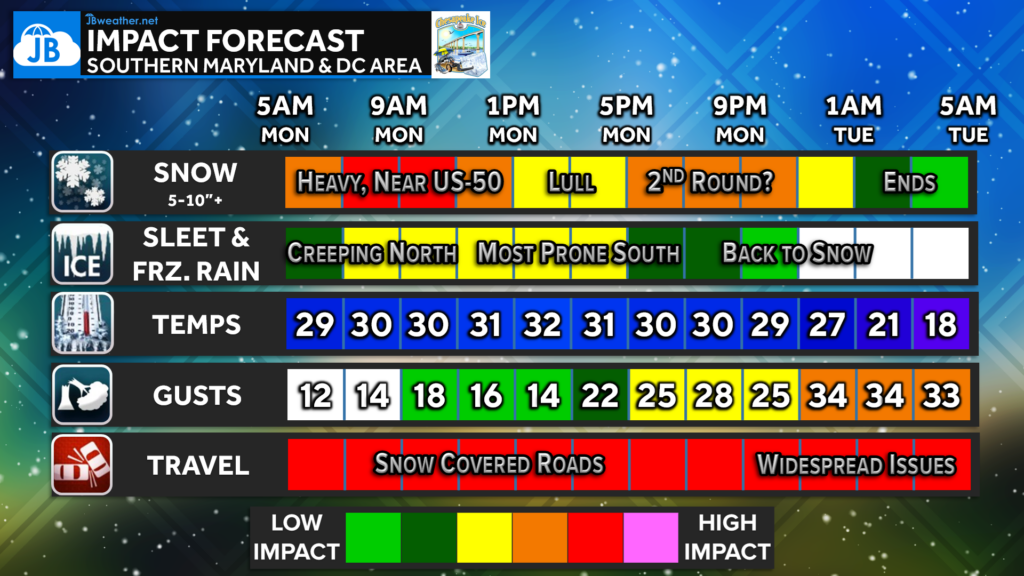
All in all, we continue to look at the increased likelihood of high impacts throughout the day today. Snow will continue this morning with a potential lull during the midday hours before another band of snow tonight. Expect snow covered roadways. Temperatures will drop this evening with fresh snowpack and gusty northwest winds. Wind could gust up to 30-35mph this evening as the snow begins to pull out. Isolated power outages are possible! And yes, I would expect impacts to linger into your Tuesday.
Stay with JB Weather for the latest information on impacts here in Southern Maryland and across the Mid-Atlantic. You can always access my forecasts and updates here on the website, on Facebook, on Twitter, on Instagram, and on YouTube. JB Weather is the Mid-Atlantic’s Weather Leader, and I am working around the clock to keep you ahead of any storm!

SONDER℠ Yoga studio. Barre studio. Fitness Studio. Classes, events & education for being well. Sonder is a mindful community, and you are invited. 5+ years in Calvert County, MD. We are grateful for your trust.
