Brought to you by Berkshire Hathaway HomeServices McNeils Group Properties
A classic southern sliding storm will move just south of the region today, wrapping in moisture and cold air, and producing a significant winter storm for our region. Rain or a rain/snow mix is likely early this morning before transitioning to wet snow by sunrise, which could be moderate to heavy at times. High impacts are possible throughout the morning, thanks to the heavy snow that will develop and the winds that will pick up. Most accumulation will be on grassy areas initially this morning. However, as snowfall rates pick up, slick roads and highways will become a possibility. The snow ends this afternoon as the storm system pulls away.
Early this morning, we can clearly see how this storm is taking shape as it begins to strengthen and mature. At 3:40AM, snow has begun to break out across the highest elevations in the mountains, as precip begins to move northward. What is a cold rain now will quickly transition over to winter weather by sunrise.
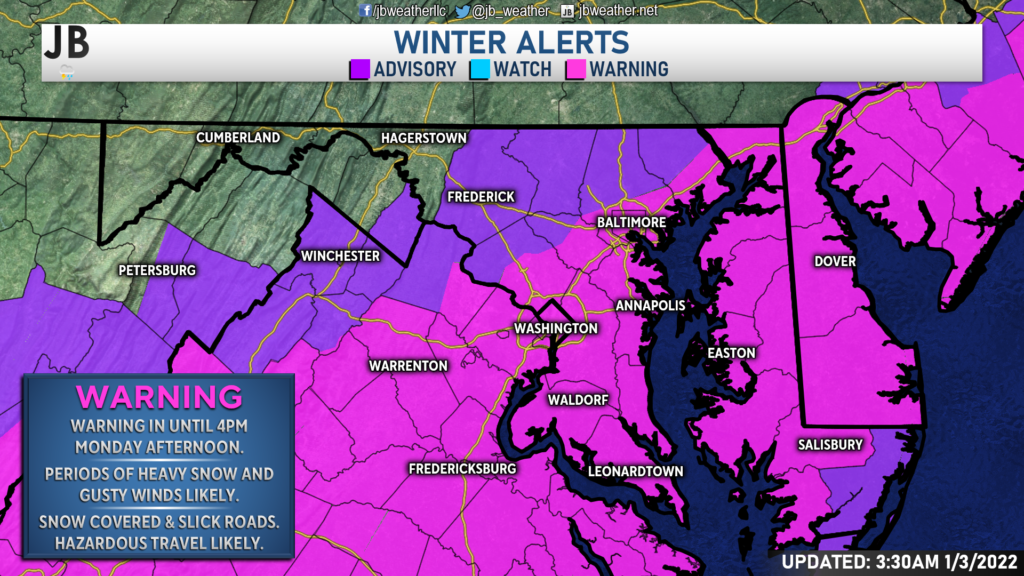
Our entire region remains under a Winter Storm Warning, which has now been extended until 4PM this afternoon. Periods of heavy snow and gusty winds will bring impacts to the warning area throughout the morning and early afternoon. Despite initially warm road temperatures, snow-covered roadways are likely by midday thanks to the high snowfall rates that will develop (the snow will fall quicker on the roads than it can melt). Travel will become hazardous by the afternoon, and remain difficult into tonight as temperatures stay below freezing.

Our Chesapeake’s Bounty Futurecast continues to show rain changing over to sleet and then to snow throughout the region between 4-8am this morning. Areas to the north will see the change over happen quicker, with areas across far southern St. Mary’s County likely holding on to the sleet for a few hours. Periods of moderate to heavy snow are likely to be set up by mid-morning. We will see the snow begin to tapper off by the early to mid-afternoon hours, and end by sunset.
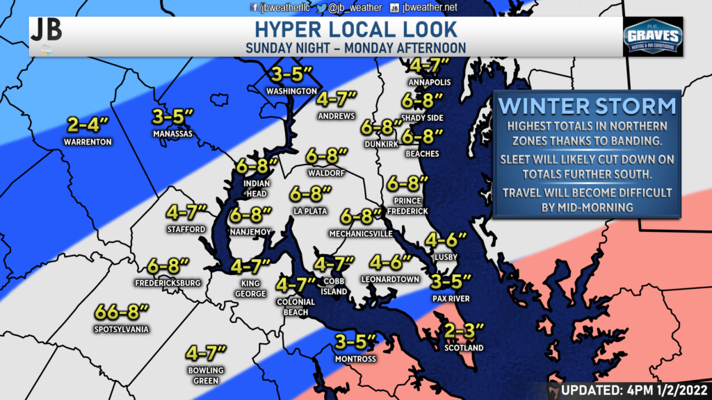
I still like where we sit in regards to my snowfall forecast. I think the white shaded areas are still on tap to see 4-8″ of snow, with the northern part of the area likely to see totals on the higher end of that– closer to 6-8″. Areas across southern Calvert and southern St. Mary’s Counties will likely see lower, yet still impressive, totals as the sleet hangs on a little longer out there.

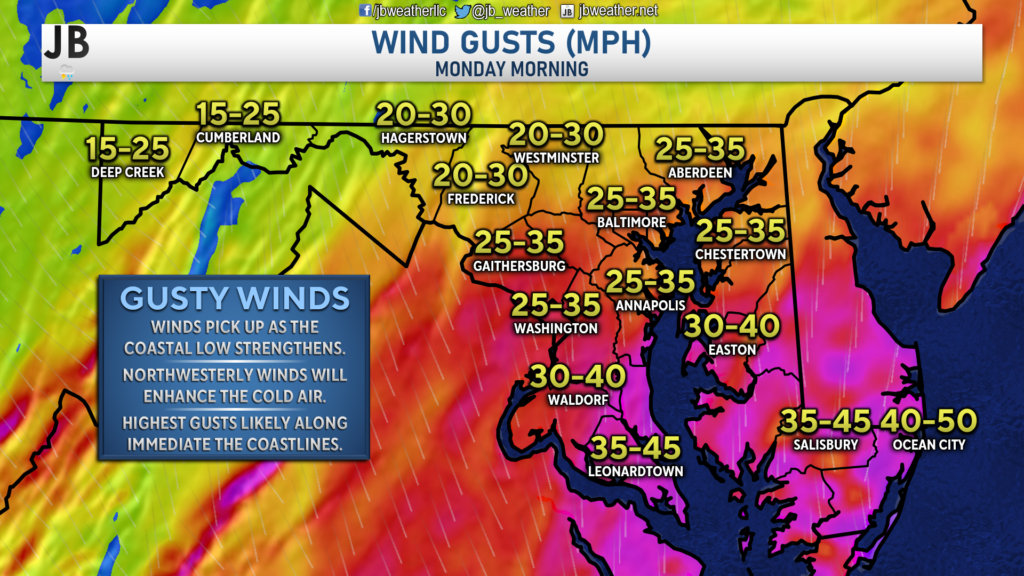
Winds will also become an issue across the region by mid-morning. We are likely to see wind gusts upwards of 30-45mph in some spots. The highest wind gusts are likely to be found for our immediate coastal locations. Some isolated power outages will be possible due to the wind, but I do not expect widespread outages. The wind will also make travel difficult by midday, causing blowing and drifting snow to occur.

All in all, we are on track to see the region’s most significant winter storm in nearly three years. Heavy snow, gusty winds, and falling temperatures will lead to high impacts across the region today. We should see the snow come to end by sunset, but with temperatures staying below freezing, travel will remain difficult into tomorrow morning across Southern MD.
It will be important to stay with JB Weather for the latest information on this winter storm and its impacts here in Southern Maryland. You can always access my forecasts and updates here on the website, on Facebook, on Twitter, and on YouTube. JB Weather is Southern Maryland’s Weather Leader, and I am working around the clock to keep you ahead of the storm!
-JB

Real Estate now! Not sure where to start? View our Southern Maryland inventory of homes, land, farms and commercial properties on mcnelisgroup.com. Engage with our planning tools to determine your next real estate lifestyle decision, choose your realtor as a trusted advisor. Experience the difference with service and support from real estate’s forever brand!

