Hurricane Erin has re-intensified into a strong Category 4 hurricane this morning as it churns over the open Atlantic. The storm will maintain major hurricane status over the next couple of days while beginning its long-anticipated turn to the north. This northward bend will position Erin to travel between the U.S. East Coast and Bermuda—well offshore of both.
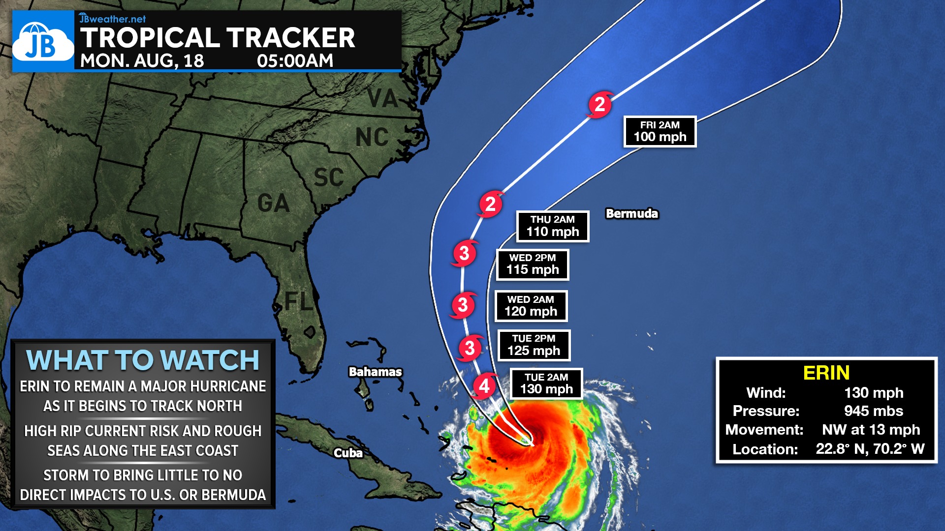
As Erin recurves out to sea, direct impacts to the United States are not expected. That includes Southern Maryland, which remains far removed from the storm’s wind field, rain shield, and any meaningful tropical influence. Bermuda also appears likely to avoid the core of the storm, though it will monitor the track closely as Erin passes to its west.
Even without a landfall threat, Erin’s size and strength will still generate rough surf, higher waves, and an elevated rip current risk along the East Coast later this week. These indirect impacts are common with powerful offshore hurricanes and can be dangerous for beachgoers. Otherwise, Erin will remain an ocean-going storm with no significant effects locally as she races safely out to sea.
John Bordash
View More PostsJB Weather forecaster John Bordash is working around the clock to provide Southern Maryland, and neighboring communities, with accurate and reliable weather information.