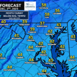
Our next system arrives Friday, and while this is not a big storm by any stretch, it does come with several forecast challenges. The placement and strength of a high-pressure system to the north will ultimately decide how far north the snow shield can reach. What we do know is that it will be cold enough for anything that falls to stick, with temperatures starting the day in the 20s and only climbing into the lower to mid 30s.
INTO THE FORECAST
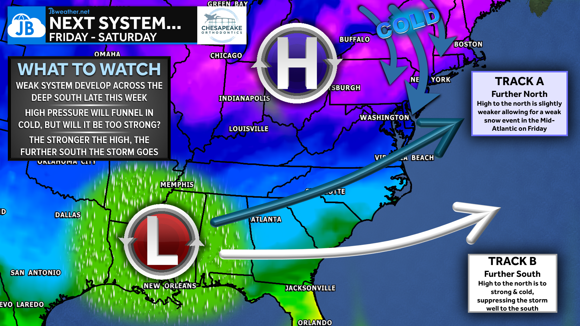
A strong high to the north will deliver plenty of cold air, creating a favorable thermal environment for snow. However, this same high also dries out the atmosphere and acts as a barrier to keep the storm suppressed to the south. Without a ridge building along the West Coast, this system never has the push it needs to come farther north, which limits how significant the event can become in our region. Even so, the storm may sneak just far enough north to bring light snow to portions of the southern Mid-Atlantic.
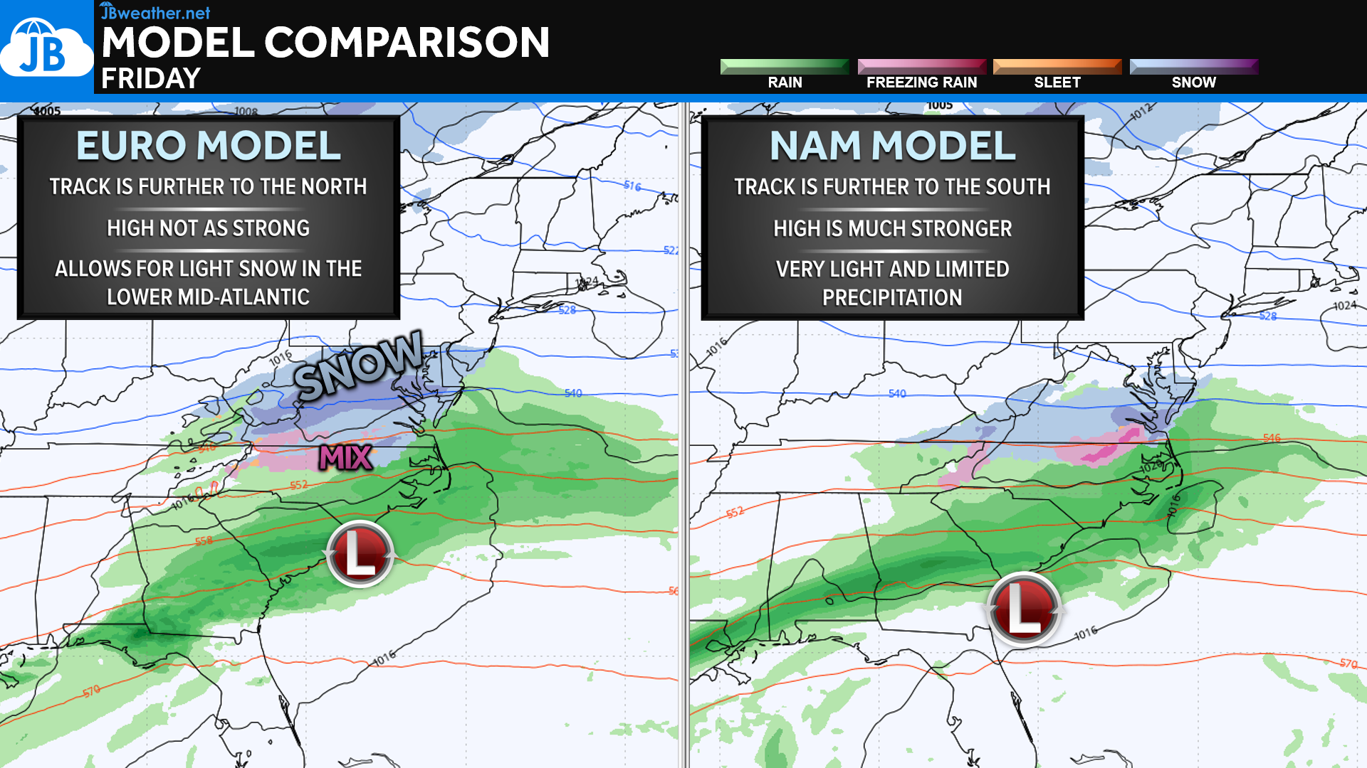
The model split remains one of the largest sources of uncertainty. The European model continues to be the most aggressive, tracking the system farther north and supporting a broader area of light snow—enough to bring minor travel impacts to southern Maryland, the Northern Neck, and parts of the Delmarva. The NAM, which performed very well with Tuesday’s storm, remains much weaker and keeps the northern edge of the precipitation near or even south of Tappahannock. If the NAM solution wins out, snowfall totals would be lighter and more limited, with many areas seeing little more than flurries.
SNOW FORECAST
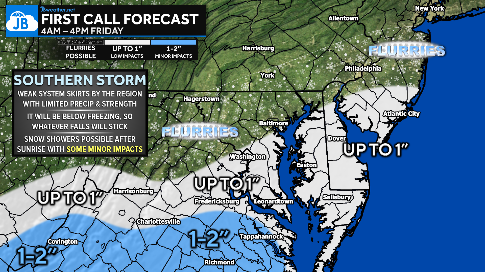
As for snowfall amounts, the highest confidence is across central Virginia, where 1–2 inches remain possible from the Richmond to Tappahannock corridor. For areas south of Route 50, including Southern Maryland, the lower Eastern Shore, and Tidewater Virginia, totals of up to 1 inch are possible—mainly depending on how far the moisture can push north. Farther north, toward the Baltimore–Philadelphia corridor, only flurries or trace amounts are expected.
TIMING & IMPACTS
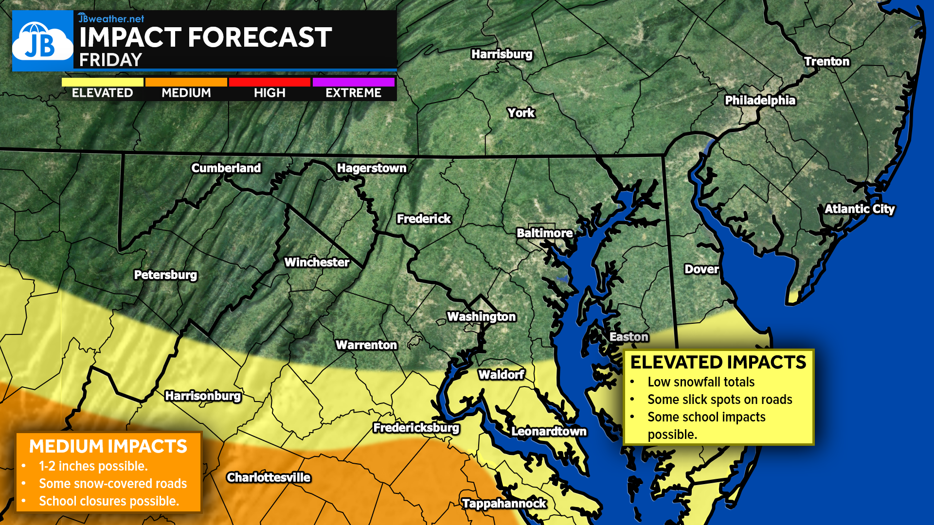
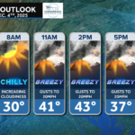
Timing looks to favor snow beginning shortly after sunrise Friday and continuing through the morning and early afternoon. This will not be a steady, all-day snow, but rather off-and-on rounds of light snow and snow showers. Because temperatures will be well below freezing, whatever falls will stick to untreated surfaces. Even with modest totals, this can cause slick spots and low to minor travel impacts, especially during the morning commute.
Impacts will be driven more by timing and temperatures than by snowfall amounts. It’s too early to speak confidently about school delays or closures, but given the cold surface temps, early-morning timing, and the potential for light accumulation, they will at least be in play. This is not a high-impact storm, but it’s enough to cause some disruptions—especially south of Route 50.
This remains a highly uncertain setup, and the ultimate track will depend on how quickly and how strongly the high to the north develops. A shift of just 50 miles in the moisture field would change totals meaningfully for our region. For now, expect a very minor system overall, but one that could bring the first accumulating snowfall of the season to our southern zones. Stay with JB Weather for the latest information on impacts here in Southern Maryland and across the Mid-Atlantic. You can always access my forecasts and updates here on the website, on Facebook, on Twitter, on Instagram, and on YouTube. JB Weather is the Mid-Atlantic’s Weather Leader, and I am working around the clock to keep you ahead of any storm!
✅ STORM FAQs
• Will it be cold enough for snow?
Yes. Temperatures will start in the 20s and only rise into the low–mid 30s, so anything that falls will stick.
• Who has the best chance for accumulation?
Central Virginia (Richmond–Tappahannock) where 1–2 inches are possible. Areas south of Route 50 could see up to 1 inch.
• Could this forecast still change?
Absolutely. Small changes in the high-pressure strength or storm organization could shift the snow field north or south.
• Which model is more trustworthy?
The Euro usually handles this pattern better, but the NAM nailed the last storm. This model disagreement is why the forecast remains uncertain.
• What about school delays/closures?
Too early to say. Light snow during the morning commute could lead to minor disruptions, especially south of Route 50.
• Is this a major storm?
No. This is a very minor system, but timing and cold temps could still create slick spots.
John Bordash
View More PostsJB Weather forecaster John Bordash is working around the clock to provide Southern Maryland, and neighboring communities, with accurate and reliable weather information.
2 thoughts on “First Call: Light Snow Possible Friday”
Comments are closed.
[…] First Call: Light Snow Possible Friday […]
[…] First Call: Light Snow Possible Friday […]