This evening’s snow will fade before a wintry mix builds back in overnight. We will see most zones transition from snow to a brief wintry mix and then to rain.
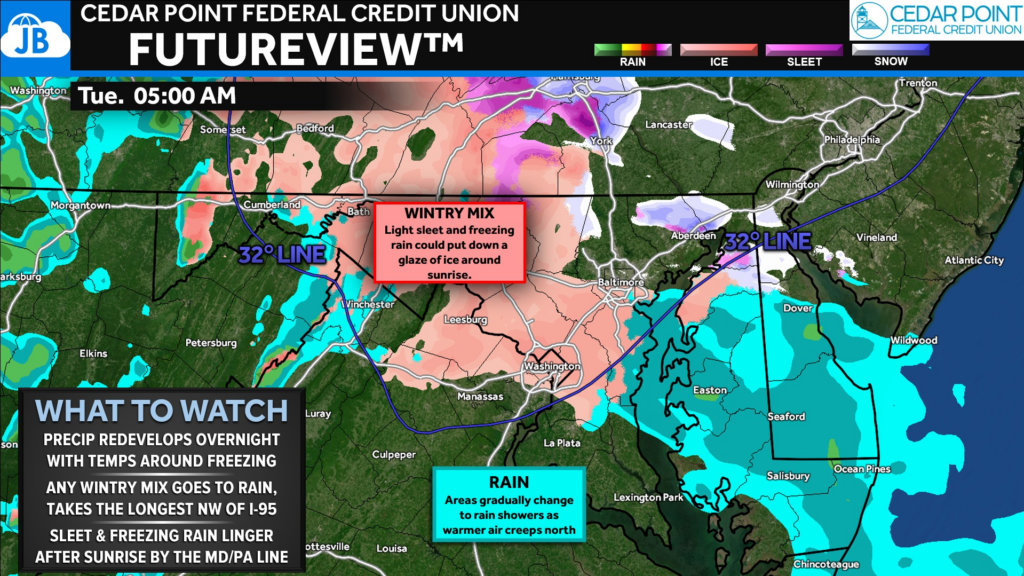
We are not looking at a lot of precip overnight, but there could be enough to cause issues for some Tuesday morning! Sleet and freezing rain will gradually give way to rain, but that icy mix will hold on the longest northwest of I-95!
We will see most zones transition from snow to a brief wintry mix and then to rain.
- This will happen the quickest southeast of I-95 with limited accumulation and impact. If temps stay a touch colder, we could see some freezing rain linger past midnight before going to all rain by sunrise.
- Northwest of I-95, this mix-to-rain process will take longer. I would expect sleet and freezing rain to linger until sunrise here, which could lead to some slick spots and cause elevated impacts and delays on the AM commute.
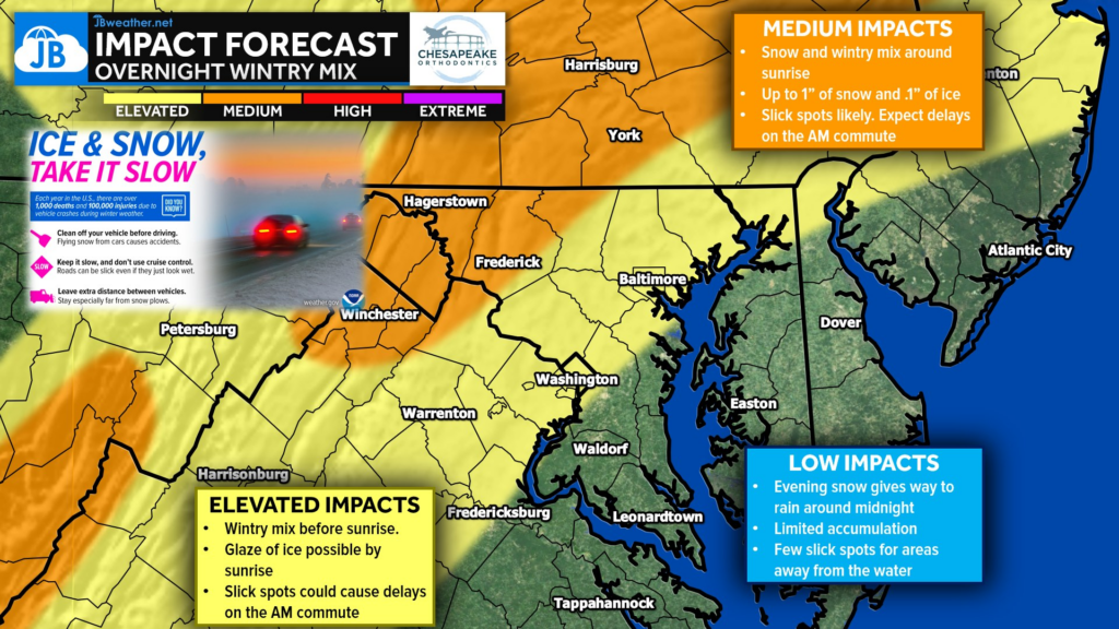
- The hills and valleys across northern MD and southern PA are likely to see the wintry mix stick around into the AM commute and cause widespread issues for the AM commute with up to an inch of snow and up to .1″ of ice.
We should see any wintry weather northwest of I-95 clear by mid-morning. Rain is likely for most of Tuesday afternoon! But, some delays will be possible in the yellow zone and likely for the orange zone!
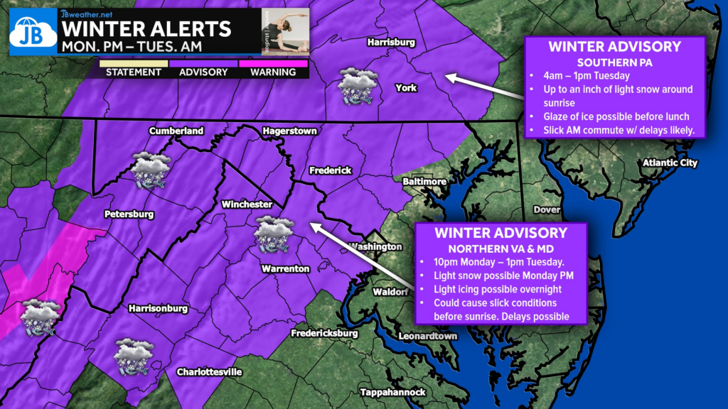
Winter Weather Advisories are in effect for areas northwest of I-95 where the overnight wintry mix could impact the morning commute!
Stay with JB Weather for the latest information on impacts here in Southern Maryland and across the Mid-Atlantic. You can always access my forecasts and updates here on the website, on Facebook, on Twitter, on Instagram, and on YouTube. JB Weather is the Mid-Atlantic’s Weather Leader, and I am working around the clock to keep you ahead of any storm!
John Bordash
View More PostsJB Weather forecaster John Bordash is working around the clock to provide Southern Maryland, and neighboring communities, with accurate and reliable weather information.