Brought to you by Sonder Studios
Our latest winter storm brought widespread impacts and 5-10″ of snow to the region on Tuesday! Our active pattern continues as, right on its heels, another wintry system will impact the region tonight! Granted, the impacts of tonight’s system will be focused northwest of I-95.
Our Cedar Point Federal Credit Union Futureview model shows precip moving back in after this afternoon’s lull in activity. With temperatures just above freezing, this will be a wintry mix-to-rain situation. Our model shows that sleet and freezing rain (denoted in pink) hold on throughout the night in the coldest valleys across the Piedmont region. A cold rain falls southeast of there. Everything clears out around sunrise tomorrow.
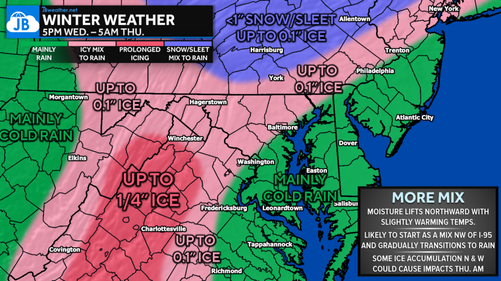
The freezing rain is not likely to last long for our northwestern zones but could last long enough to put down up to a tenth of an inch of ice glaze this evening. The Shenandoah Valley area could see up to a quarter of an inch of ice as the ice holds on longer there. Spots northwest of Baltimore may see a brief period of snow/sleet this evening before switching to some ice and then to rain.
Areas southeast of I-95 could see a brief bout of sleet, but this will be mainly a cold rain for the I-95 corridor, Southern MD, and Tidewater VA. Up to half an inch of rain is possible there.
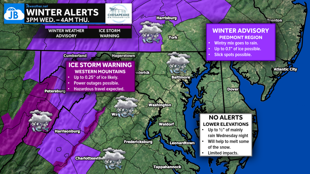
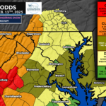
Ice Storm Warnings have been issued for the coldest spots west of I-95 where the highest amounts of ice are likely to be found. The Piedmont region and Southern PA is under a Winter Weather Advisory (light purple) where measurable ice and sleet are possible. These alerts run from 3PM Wednesday until 4PM Thursday.
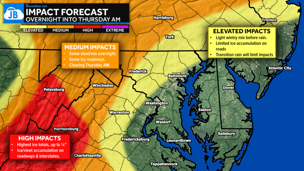
Impacts overnight will be the highest west of I-95, where icy roadways will be possible. A transition to rain will help to minimize those impacts Thursday morning, but slick travel conditions will be possible, especially northwest of I-95. School closures and delays are possible thanks to both Tuesday’s winter storm and tonight’s wintry mix. I would bank on widespread delays, with a few closures being possible. I will have my school odds published this afternoon after I get home from teaching!
Stay with JB Weather for the latest information on impacts here in Southern Maryland and across the Mid-Atlantic. You can always access my forecasts and updates here on the website, on Facebook, on Twitter, on Instagram, and on YouTube. JB Weather is the Mid-Atlantic’s Weather Leader, and I am working around the clock to keep you ahead of any storm!

SONDER℠ Yoga studio. Barre studio. Fitness Studio. Classes, events & education for being well. Sonder is a mindful community, and you are invited. 5+ years in Calvert County, MD. We are grateful for your trust. Check out sonderstudios.us!
John Bordash
View More PostsJB Weather forecaster John Bordash is working around the clock to provide Southern Maryland, and neighboring communities, with accurate and reliable weather information.
2 thoughts on “Forecast: Another Wintry Mix Possible NW of I-95”
Comments are closed.
[…] Forecast: Another Wintry Mix Possible NW of I-95 […]
[…] Story continues […]