Brought to you by Chesapeake Orthodontics
Throughout the last week, there has been a lot of talk online and on-air about the potential for a big snow producer for this coming weekend. As the picture has come into better focus over the last few days, it has become clear that this system would be far from a Mid-Atlantic snowstorm. With that said though, this system will still bring some impactful snows to the lower Mid-Atlantic, and some ice to southern parts of the Carolinas Friday night into Saturday morning.
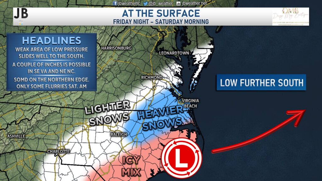
This developing system is riding along the old frontal boundary that brought some snow to the region yesterday. Some spots in southern Virginia have been seeing off and on snow showers throughout the night and into today. The development of this system tonight will increase the amount of moisture across these same regions.
Snow will look to become widespread across southeastern Virginia late tonight, after sunset. As we approach midnight, and head into the early hours of Saturday, that snow will attempt to work its way northward. However, since this system is weak, there will be a limited amount of moisture for it to tap into. As a result, the precipitation shield will have a hard time getting much further north than the Northern Neck and lower Eastern Shore as the system slides out to sea by Saturday morning.
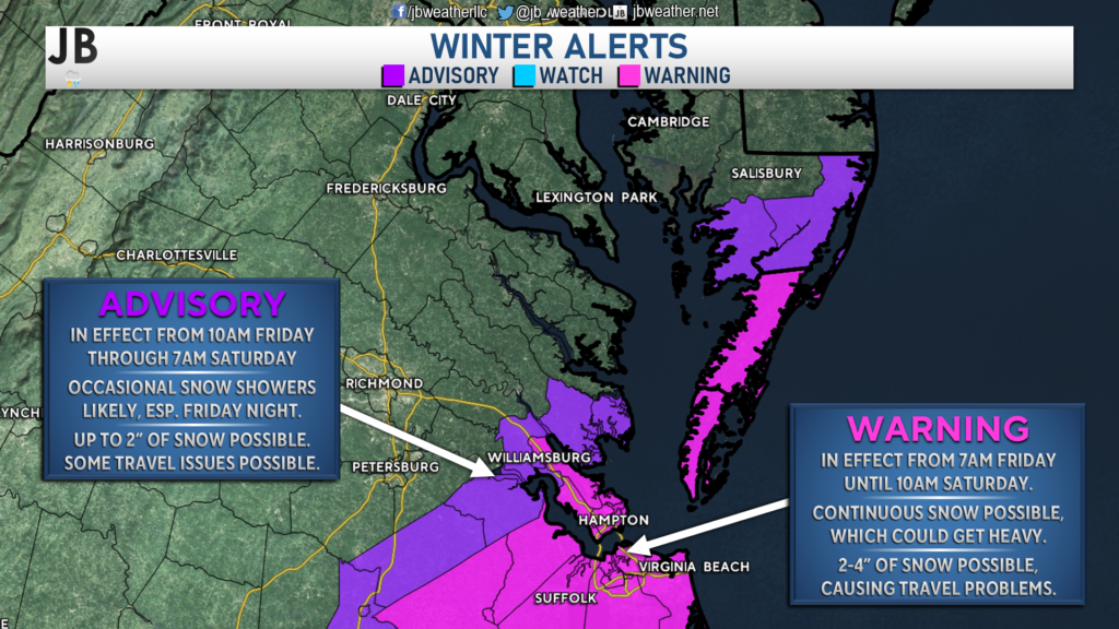
Where the more consistent snow is across southeastern Virginia and northeastern North Carolina, we could see a couple of inches fall. 2-4″ of snow does look likely across Hampton Roads and the lower Delmarva. There may even be a few spots that see locally higher totals of 4-6″. Amounts will drop off the further north and west you head, though. 1-2″ of powdery snow looks possible south of Richmond, south of Tappahannock on the lower Northern Neck, and on the lower Maryland Eastern Shore. Outside of that zone, only some flurries are possible overnight with little accumulation being expected.
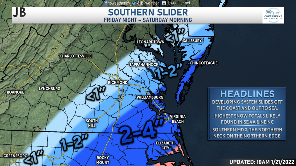
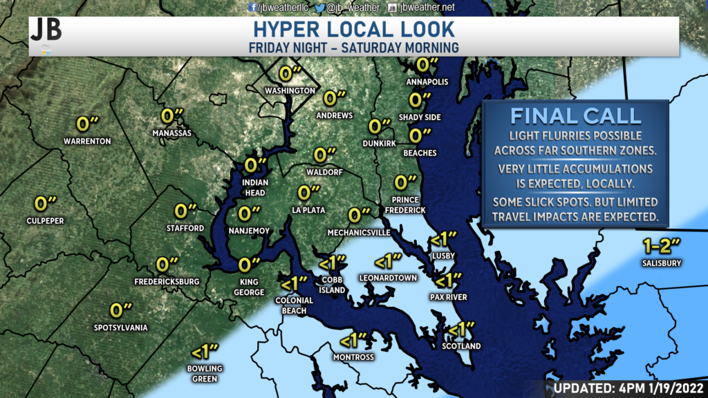
Locally, we are likely to see very little accumulation. Some of our far southern zones may see some flurries overnight, but I would not expect much. There may be one or two spots in southern Westmoreland & St. Mary’s Counties, such as Ridge and Kinsale that may pick up a half-inch of snow. However, outside of that, I would not expect more than a light dusting. As you get north of Prince Frederick and Mechanicsville, you may struggle to see much snow at all.
There are weather alerts in effect for the regions that are the most likely to see accumulating snow. Winter Storm Warnings are in effect for the pink shaded counties where 2-4″ of snow looks possible, which could lead to travel issues. Winter Weather Advisories are in effect for the purple shaded counties where an inch or two of snow may fall, causing some travel issues.
In Summary
All-in-all, this looks like more of a non-event across Southern MD and the Northern Neck. The slow forward motion of the cold front from yesterday, and the strong high pressure to the north are the reasons why this system will not be more impactful. While the next 10 days look to all feature below-average temperatures, the prospects of additional systems seem a tad uncertain. While I do not think that the Mid-Atlantic is done with snow for the season, the next 10 days may not offer much in the way of snow chances. With that said though, keep checking back as this forecast, especially in the longer range, is always subject to change as we learn more!
Stay with JB Weather for the latest information on weather impacts here in Southern Maryland. You can always access my forecasts and updates here on the website, on Facebook, on Twitter, and on YouTube. JB Weather is Southern Maryland’s Weather Leader, and I am working around the clock to keep you ahead of any storm!
-JB

Dr. Thomas Hao and Dr. Dylan Schneider offer comprehensive orthodontic services for all ages. Schedule your free consultation today. Visit www.SOMDBraces.com today for more information!
