Brought to you by G&H Jewelers, Inc.
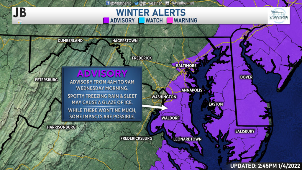
Just as residents begin to get power back and roads begin to clear up, we could be looking at a light icing event affect the area overnight. We would not be talking about a lot of ice, but some spotty areas of freezing drizzle will be possible. Out of an abundance of caution, the National Weather Service has gone ahead and issued a Winter Weather Advisory from 4am-9am for areas that are between I-95 and the Bay.
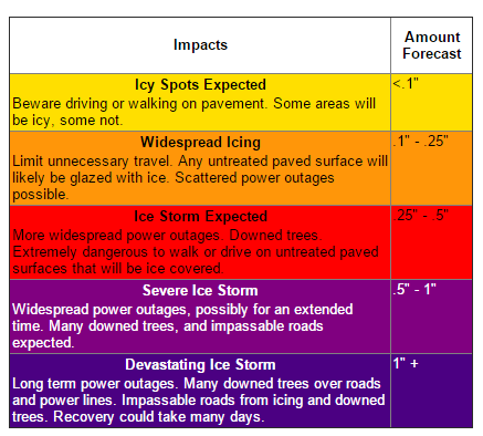
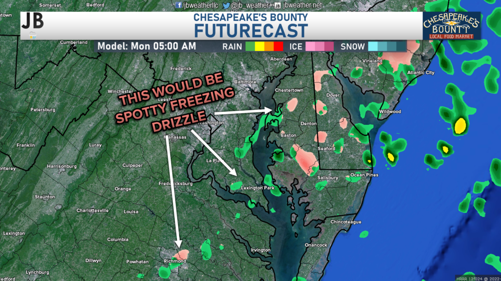
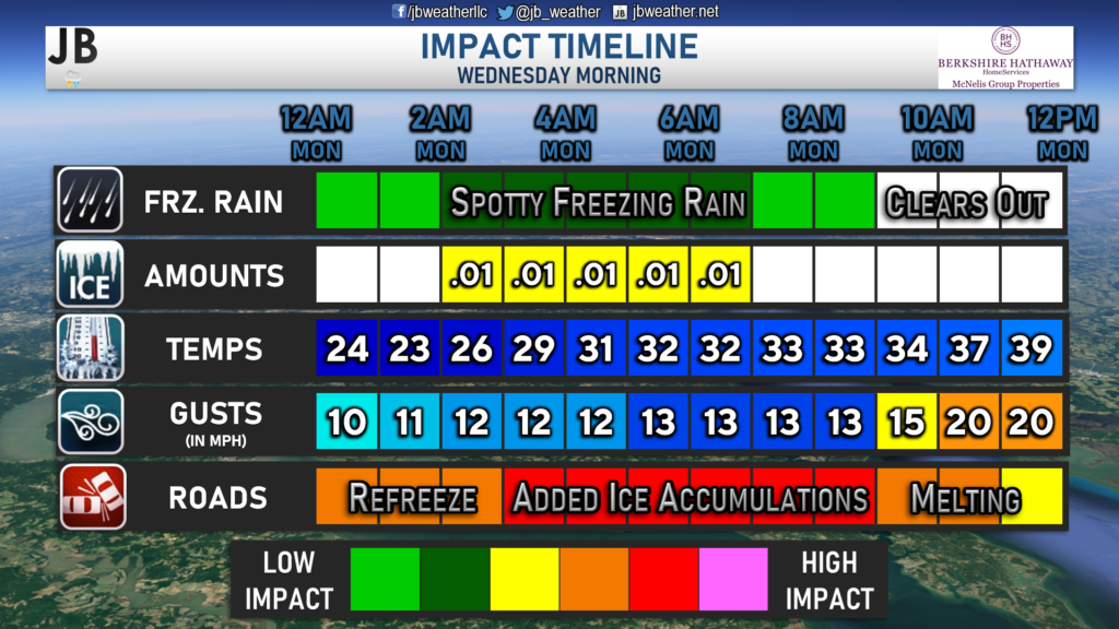
I do not think that we are talking about a lot of freezing though. Our Chesapeake’s Bounty Futurecast, which is shown below, does show some light areas of precip moving through the region tomorrow morning. With temperatures below freezing, this would likely be freezing rain or sleet. The coverage of the precipitation is a lot though and is mainly light because there is no strong moisture fetch. This should lead to very minimal ice accumulations, if at any. I would expect most areas to receive under a tenth of an inch of ice, like only a couple hundredths of an inch. However, as the graphic on the side shows that even small accumulations could still cause some slick spots.
Why will this be freezing rain or sleet and not snow or plain rain? Well, we will have a pretty cold layer of air here at the surface. However, there will be warm air working in overhead, a few thousand feet above our heads. That warm layer will cause the snowflakes that will initially fall from the sky to melt into raindrops. The warm layer here at the surface will likely not be enough to transition this back to ice pellets. Thus, the raindrops will make it to the surface, but could freeze right up on cold surfaces.
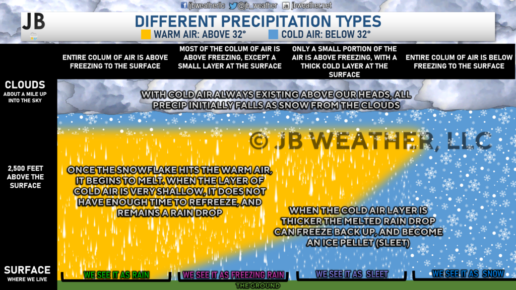
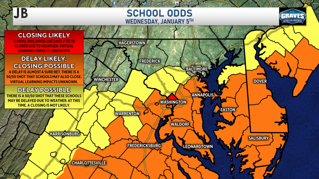
This light freezing rain could add additional impacts on tomorrow morning’s commute. Thankfully, many areas have been able to dig out today after yesterday’s snow, and we have seen slick spots on most (but not all) roads melting. However, we do still have a lot of power outages (upwards of at least 16k as reported by SMECO at 4PM) and we will likely have a refreeze tonight, in addition to the possible spotty freezing rain tomorrow morning. With all of that in mind, I would say that at least a delay is likely with a 50/50 shot of a closing for area schools tomorrow!
Shown below is the Impact Timeline graphic, which really tells the story. While we’re not talking about a lot of freezing rain, any added ice on top of the refreeze will make for a difficult morning commute. Driving conditions should improve by mid-to-late-morning with rising temperatures.
Stay with JB Weather for the latest information on impacts here in Southern Maryland. You can always access my forecasts and updates here on the website, on Facebook, on Twitter, and on YouTube. JB Weather is Southern Maryland’s Weather Leader, and I am working around the clock to keep you ahead of any storm!
-JB

Shop G&H Jewelers Today for Loose Diamonds, Fine Diamond & Colored Gemstone Jewelry, On-site Custom Jewelry Design (CAD) & Manufacturing, Jewelry Repair and GIA Graduate Gemologist Appraisal Services. Third Generation Family Owned & Operated Since 1965.
