Brought to you by Cedar Point Federal Credit Union
After the cold blast this weekend, we have seen the weather turn around in a big way! Pax River NAS recorded a high of 57° yesterday, 2° above the average high, and is on track for highs in the 60s both today and tomorrow. However, this string of fantastic Spring weather will come a holt by Thursday.
This afternoon, a developing system is currently tracking through the Deep South and can be clearly seen on the radar. This system is bringing with it the threat of severe weather across many southern states.
Areas in Texas were under the gun last night with some of the storms that developed with this system dropping 1-2″ sized hail across several communities.
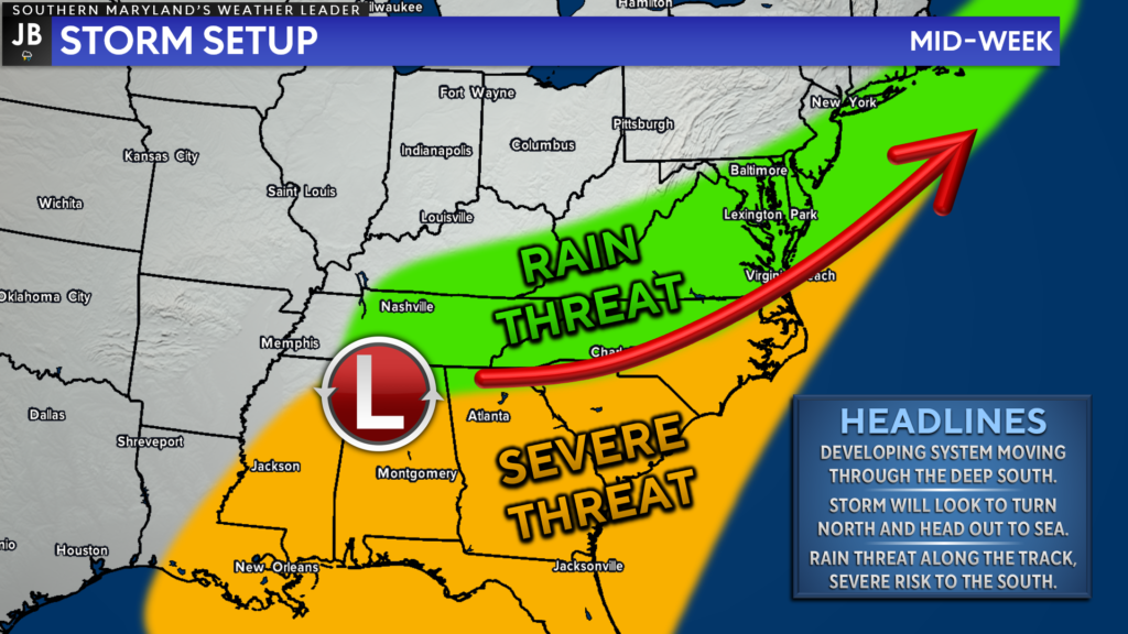
This developing system will continue moving through the Deep South, and eventually, turn northward and head out to sea. Over the last few days, the biggest question was, just how far north would this system come? It seems pretty likely that it will come far enough north to give rain to our region.
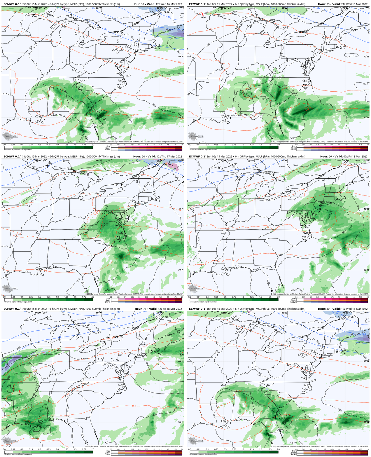
The European model looks to have a good handle on this potential setup. The animated GIF above depicts how this system will look to move up the coast tomorrow and into Thursday. Rain will begin to creep into the Southeast tomorrow before the system moves up the coast on Thursday. We will see the heaviest rain focused along the coast before the system moves out to sea late Thursday and into Friday.
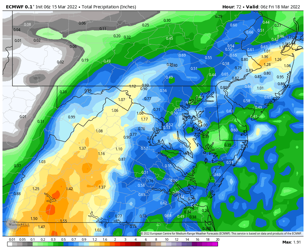
The European model suggests that our region could see between a half-inch to an inch of rain between midnight and mid-afternoon on Thursday. While there are still questions about just how much rain our area will see, I think that this seems like a pretty good starting point.
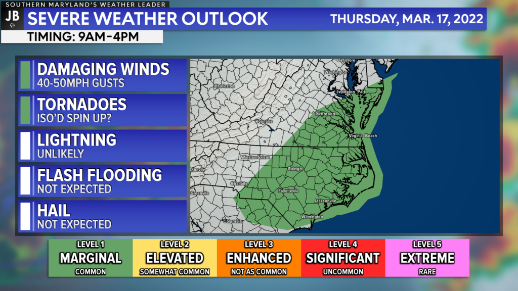
As mentioned earlier, the highest severe risk with this system will be to the south of its track. With this in mind, the highest severe weather threat, a Level 1 “Marginial Risk”, is centered in the Carolinas and southern Virginia for Thursday. Our region is on the cusp of this risk. If the storm track were to shift any further north, then this might include our region as well.
On Thursday, the severe weather main threat would be heavy rain and gusty winds upwards of 40-50mph within storms. There would be a non-zero tornado threat as well, but that does not appear to be a widespread or a high threat at this time.
These details will come into better focus tomorrow, and this forecast will change as we learn about this system. What does seem likely, in the very least, would be the chance for rain with cooler temperatures, in the 50s. Stay tuned for additional updates! In the meantime, get out, and enjoy the nice weather.
Stay with JB Weather for the latest information on Southern Maryland weather. You can always access my forecasts and updates here on the website, on Facebook, on Twitter, on Instagram, and on YouTube.
-JB

Cedar Point has been providing trusted banking, lending and personal finance solutions to the Southern Maryland Community since 1945. Visit the credit union at any of its 6 locations in St. Mary’s, Charles and Calvert counties or online at www.cpfcu.com.
