Brought to you by Cedar Point Federal Credit Union
This weekend has gotten off to a hot start across the region. Many spots this afternoon have high temperatures that are peaking in the middle 90s with heat indices near 100°. We will look to take things a step further tomorrow as the heat will look to intensify across the area.
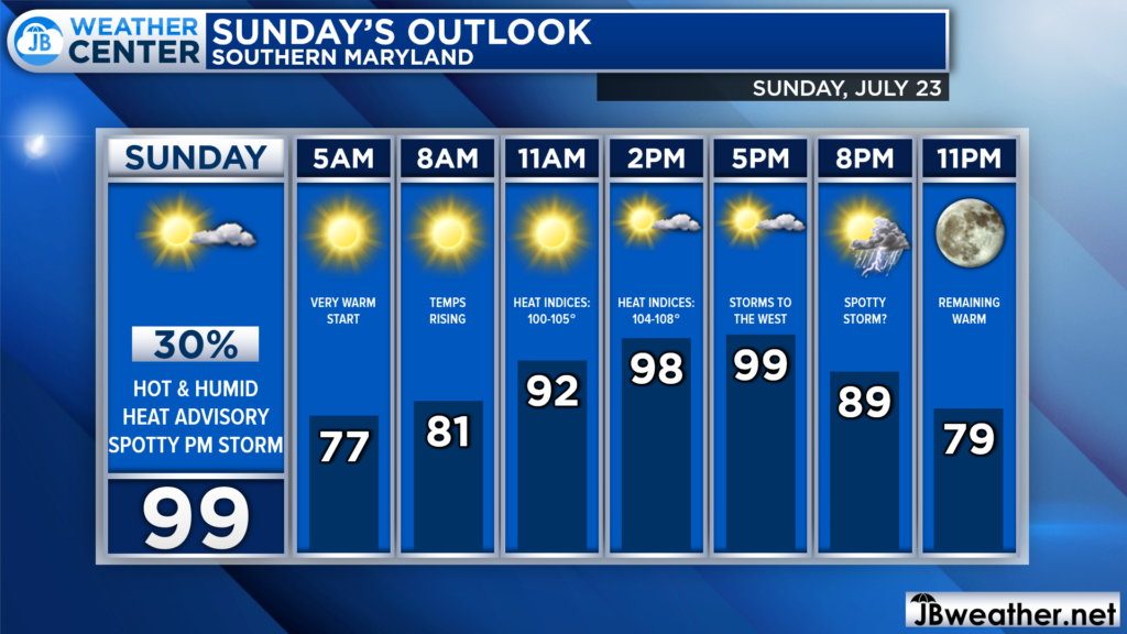
After a warm start in the morning, temperatures tomorrow afternoon will be able to max out well into the 90s. If we are, indeed, able to keep mostly sunny skies then many spots should be able to make it into the upper 90s! Much like today, the humidity will also be quite oppressive.
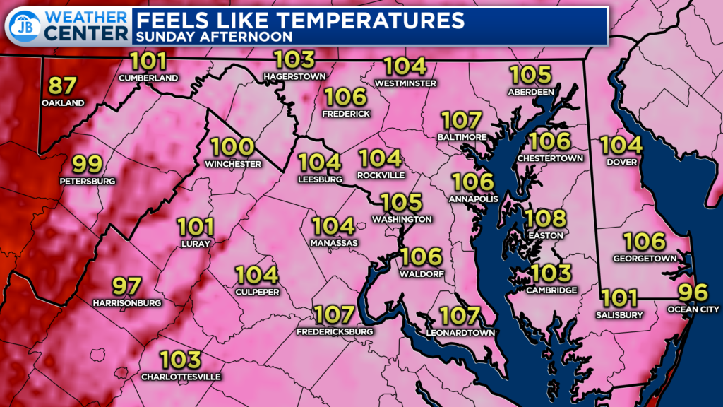
The combination of highs in the upper 90s and dewpoints in the 70s will create dangerous heat indices. Many spots, especially east of the mountains, will likely have heat indices that max out near or over 105° tomorrow afternoon.
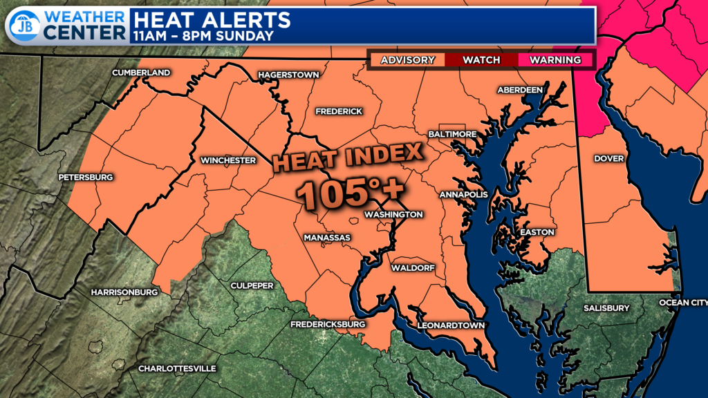
This is why the National Weather Service has issued a Heat Advisory for much of the region for Sunday. The areas shaded in orange are the most likely zones to see the heat impacts as heat indices look to get near 105°+. This will be in effect from 11am until 8pm, indicating the time period when the heat will become the most dangerous.
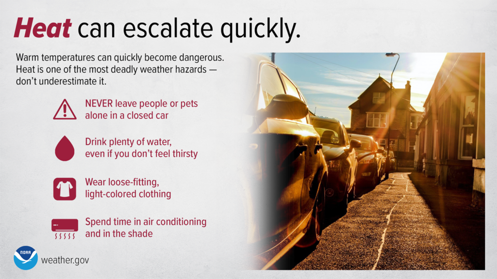
Heat is one of the leading weather-related killers in the United States, resulting in hundreds of fatalities each year. Heat can be very taxing on the body; heat-related illnesses that can occur with even a short period of exposure. Everyone can be vulnerable to heat, but some more so than others. Below are some safety tips
- Reduce, eliminate or reschedule strenuous activities until the coolest time of the day (before 8am or after 8pm).
- Wear lightweight, loose-fitting, light-colored clothing to reflect heat.
- Focus on drinking non-alcoholic and decaffeinated fluids. Drink water even if you don’t feel thirsty so that you stay hydrated.
- Spend time in air-conditioned locations to stay cool.
- Minimize direct exposure to the sun. Sunburn reduces your body’s ability to dissipate heat.
- Be aware of infants, older, sick, or frail people, and pets.
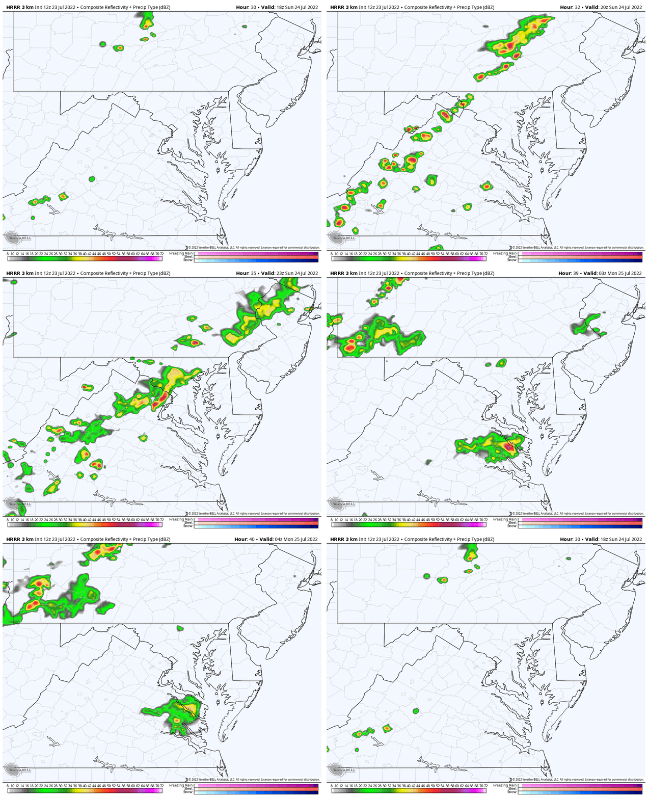
Something else I will be monitoring is the slight uptick in rain chances for Sunday evening. As a weak piece of atmospheric energy moves overhead, we may see a few storms get kicked up. With the heat and humidity, there will be a decent amount of atmospheric energy for any storm to tap into.
Our modeling suggests that the highest chances, around 40%, to see a few storms fire up will be west of I-95. However, we may see a storm or two wander across I-95 and into our region tomorrow evening, after 6pm.
At this time, the Storm Prediction Center does not have our region under an organized severe weather threat. Rain chances for Southern MD sit around 30%. However, we will need to see how this potential evolves.
Stay with JB Weather for the latest information on Southern Maryland weather. You can always access my forecasts and updates here on the website, on Facebook, on Twitter, on Instagram, and on YouTube.
-JB

Cedar Point has been providing trusted banking, lending and personal finance solutions to the Southern Maryland Community since 1945. Visit the credit union at any of its 6 locations in St. Mary’s, Charles and Calvert counties or online at www.cpfcu.com.

