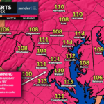
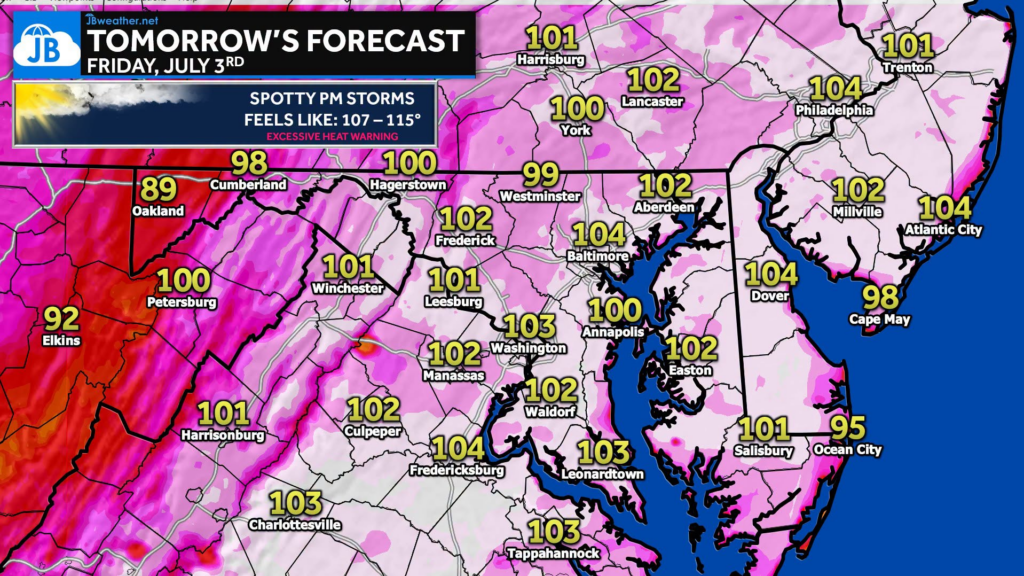
After yesterday’s near-record heat, today is shaping up to be just as hot… if not hotter! An Extreme Heat Warning remains in effect as temperatures climb into the upper 90s to around 102°, with heat index values reaching 107° to 115° this afternoon.
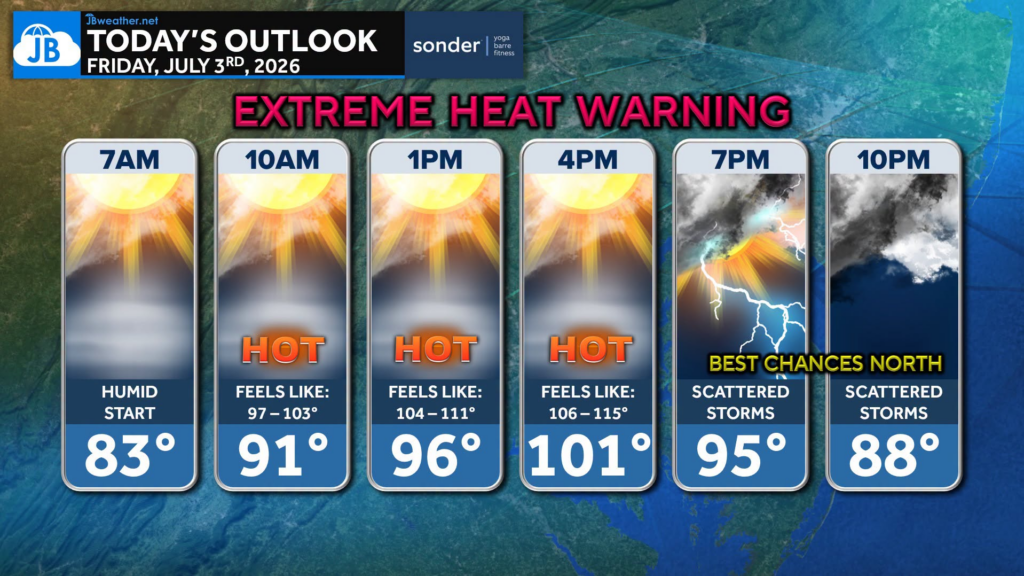
Skies will be mostly sunny, albeit hazy, through much of the day, allowing temperatures to soar once again. While an isolated shower or thunderstorm can’t be ruled out late this afternoon or evening, the best chance for any storms will be along and north of I-70. Most communities will stay dry and see little relief from the heat.
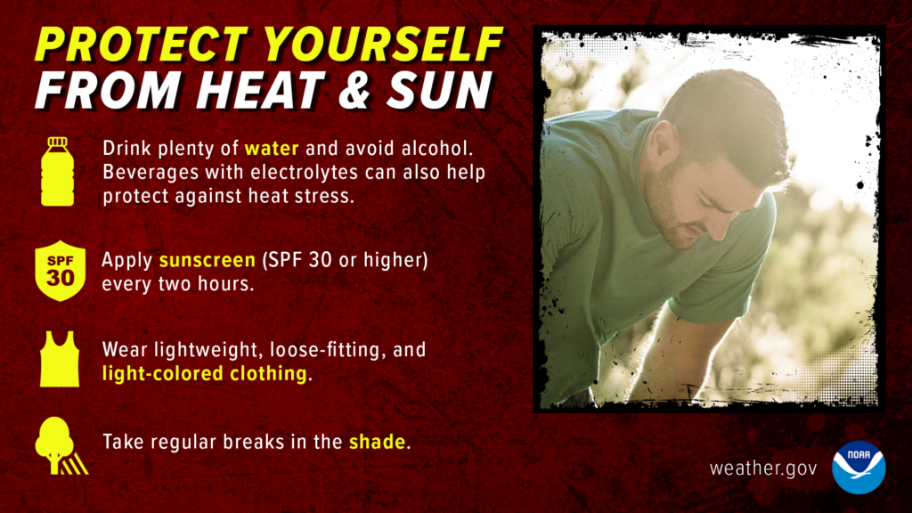
This remains a dangerous heat event. Limit time outdoors during the afternoon, stay hydrated, take frequent breaks in air conditioning or shade, and never leave children or pets in a parked vehicle. The heat continues through the holiday weekend, with thunderstorm chances increasing Saturday and Sunday.
Stay with JB Weather for the latest information on impacts here in Southern Maryland and across the Mid-Atlantic. You can always access my forecasts and updates here on the website, on Facebook, on Twitter, on Instagram, and on YouTube. JB Weather is the Mid-Atlantic’s Weather Leader, and I am working around the clock to keep you ahead of any storm!
John Bordash
View More PostsJB Weather forecaster John Bordash is working around the clock to provide Southern Maryland, and neighboring communities, with accurate and reliable weather information.