Brought to you by Cedar Point Federal Credit Union
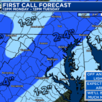
Ahead of our main event Monday night & Tuesday morning, some spots may see some light snow Monday morning. While this will not be much, this is something that southern zones will need to be aware of, especially west of I-95.
Our Cedar Point Federal Credit Union Futurecast shows moisture trying to move northward overnight. With cold air in place, any precipitation would fall as snow. However, the air will be quite dry. So, snow will have a hard time making it to the ground. Futurecast shows that this is the most likely to happen west of I-95 through the morning hours.
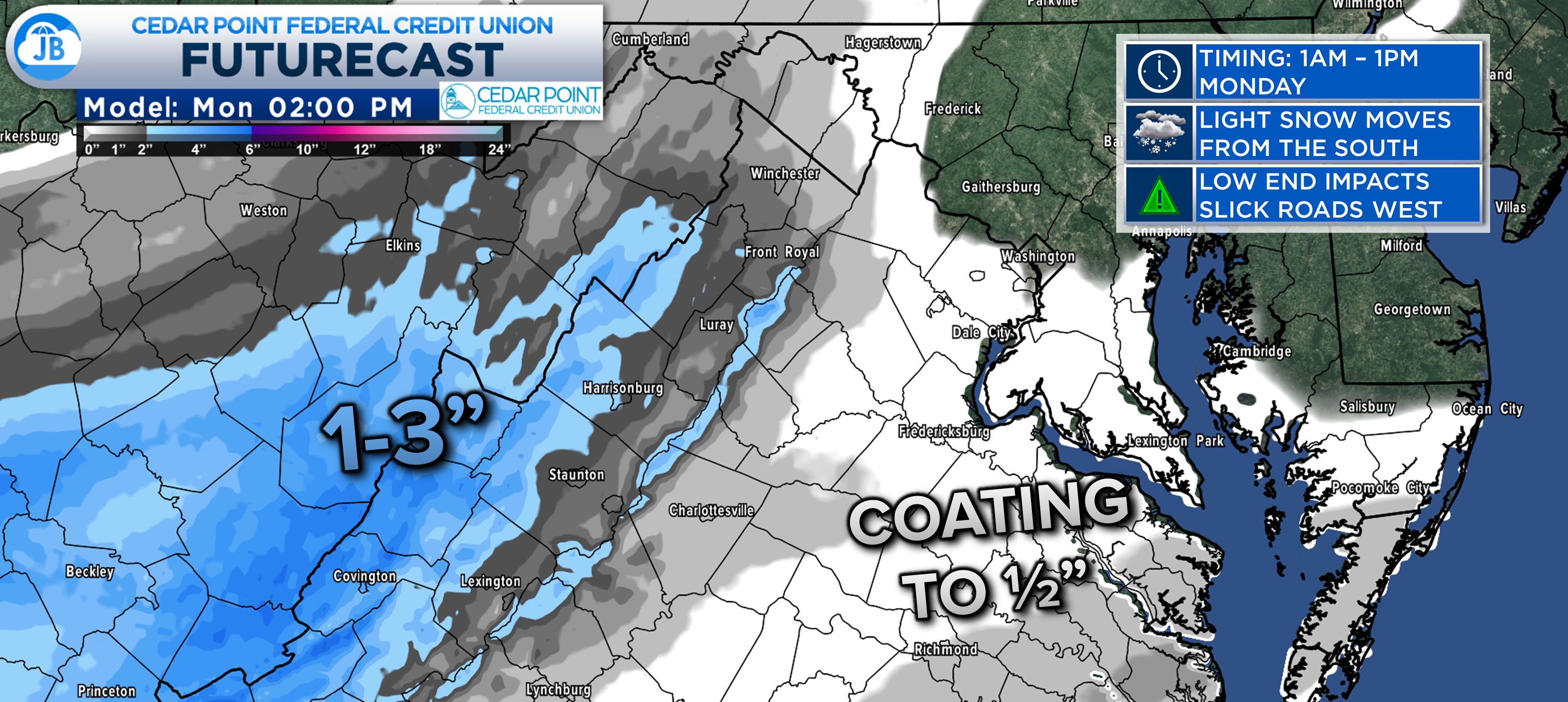
I like what Futurecast is doing with snowfall potential for this. This initial round of snow Monday morning is likely to drop an inch or two west of I-95, through the higher elevations. Further east, locations may see a spotty coating to half an inch of snow between sunrise and lunchtime.
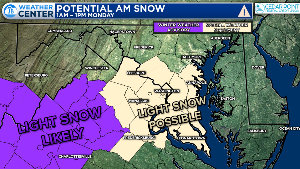
With all of this in mind, the National Weather Service has issued a Winter Weather Advisory (shown in purple) for western spots where snowfall accumulation is the most likely. A Special Weather Statement (in tan) is in effect along and east of I-95. This is where widespread accumulation is not expected, but could cause some hit-and-miss slick spots.
For the Special Weather Statement, the National Weather Service states: “There is a potential for hazardous commuting conditions for the Monday morning morning commute. A period of snow is POSSIBLE (a
40 TO 60 percent chance) late tonight into Monday morning across the Washington metro area into Fredericksburg and southern Maryland with up to an inch of accumulation along with the potential for snow-covered roads.
If this threat does materialize during the late tonight through the Monday morning commute, many roads could quickly turn snow covered. This could lead to dangerous traveling conditions, multiple accidents, and extensive delays.”
Again, while this is not expected to be much snow, at all, to be aware of it’s potential! A greater, and more widespread, light snow threat exists for Monday night. You can get more details of that threat, here:
Stay with JB Weather for the latest information on impacts here in Southern Maryland. You can always access my forecasts and updates here on the website, on Facebook, on Twitter, and on YouTube. JB Weather is Southern Maryland’s Weather Leader, and I am working around the clock to keep you ahead of any storm!
-JB
Cedar Point has been providing trusted banking, lending and personal finance solutions to the Southern Maryland Community since 1945. Visit the credit union at any of its 6 locations in St. Mary’s, Charles and Calvert counties or online at www.cpfcu.com.
John Bordash
View More PostsJB Weather forecaster John Bordash is working around the clock to provide Southern Maryland, and neighboring communities, with accurate and reliable weather information.