Brought to you by Calvert Title Company
We saw a decent bit of rain yesterday evening as we saw a warm front begin to try to work through the region. This will set us up for a warm and humid day today. More importantly, this will also set our region up to potentially see significant severe weather this afternoon and evening.
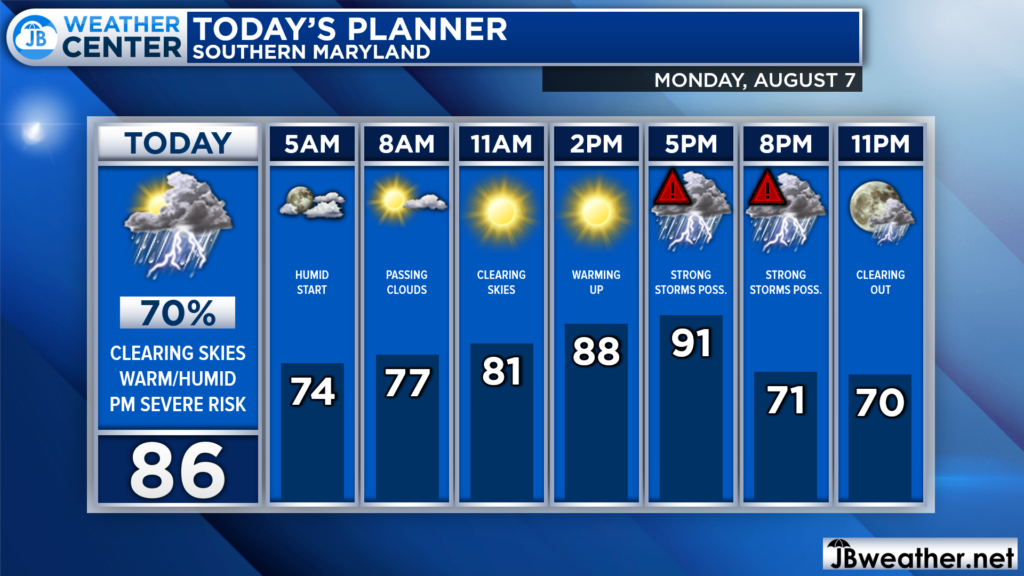
We are off to a humid start this morning with temperatures in the 70s. We have some clouds around this morning which should burn off by mid-morning. Just how quickly those clouds burn off will be key to today’s severe weather threat. Severe storms are possible after lunchtime, and especially this evening, as a cold front works through.
Our Hi-Resolution Futurecast seems to have a good handle on today’s severe weather threat. While we will start the day quiet, it will not stay that. The quicker we can burn off the morning cloud cover, the more atmospheric storm energy will develop, which could potentially support strong storms.
Futurecast shows a broken line of storms pushing out of the mountains after lunchtime. This area of storminess will gradually work its way eastward through the afternoon. Futurecast believes that this may move through Southern Md this evening. It is important to note here to not take this one model depiction as gospel.
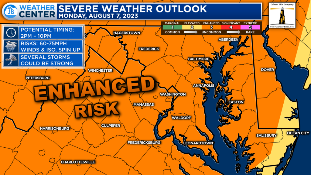
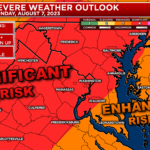
Will the higher levels of atmospheric support for potent severe weather, the Storm Prediction Center has placed much of the Mid-Atlantic under a Level 3 “Enhanced Risk” of severe weather for today. Now, this is not a promise or guarantee of storms. This just highlights a higher probability of potentially seeing storms.
Think of this stage of the game as having items to make tacos on your grocery list to see if the store will have them. That’s to say, there is no guarantee that this will deliver. I have seen several setups like this in the past bust. However, we have also seen setups like this deliver big-time storms before.
While this is nothing to freak out over, we need to take this threat seriously.
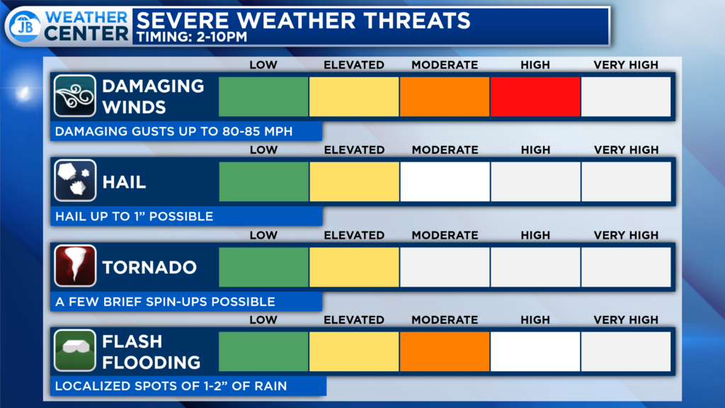
The highest threat today is seeing damaging winds between 60-85mph with any storms that develop. The storms we saw last week contained winds that high, which left tens of thousands of SMECO customers in the dark. There is also an elevated tornado threat. To me, it seems like the highest chance of a spin-up tornado will be north of DC, but all regions have the threat.
Stay safe today and take the threat of severe weather seriously! You can stay with JB Weather for the latest information on Southern Maryland weather. You can always access my forecasts and updates here on the website, on Facebook, on Twitter, on Instagram, and on YouTube.
-JB

Brought to you by Calvert Title Company. Calvert Title Company is guiding you HOME one closing at a time! Check out https://www.facebook.com/calverttitle today!
1 thought on “Monday’s Forecast: Enhanced Risk of PM Severe Weather”
Comments are closed.
Thank you John for your dedication as our local meteorologist. You ROCK!