Brought to you by Berkshire Hathaway HomeServices McNeils Group Properties
The humidity from yesterday did not go anywhere, leading to some patchy dense fog out there to start the day. Any fog should burn off by 8-9am. We will warm up quickly today, likely topping off in the lower 90s by this afternoon. With dewpoints getting into the upper 60s and lower 70s, our Heat Indices are likely to be in the middle to upper 90s.

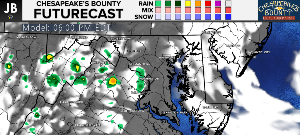
A spotty thunderstorm is possible across the region between 3-8pm. The severe threat is low today, with locally heavy rain being the main threat. Our Chesapeake’s Bounty Futurecast shows this threat below. Again, these are likely to be hit-and-miss storms, not widespread.
Stay with JB Weather for the latest information on Southern Maryland weather. You can always access my forecasts and updates here on the website, on Facebook, on Twitter, and on YouTube.
-JB

Brought to you by Berkshire Hathaway HomeServices McNelis Group Properties. Real Estate now! Not sure where to start? View our Southern Maryland inventory of homes, land, farms and commercial properties on mcnelisgroup.com. Engage with our planning tools to determine your next real estate lifestyle decision, choose your realtor as a trusted advisor. Experience the difference with service and support from real estate’s forever brand!

