Brought to you by Cedar Point Federal Credit Union
Yesterday was warm, with temperatures returning into the upper 80s and lower 90s! Thanks to a southerly flow, we will keep that warm and humid feel across the region today. This low will also increase the likelihood of scattered showers and storms throughout the day!
We have scattered showers across the region this morning. However, we should be able to log a couple of dry hours this morning, which would allow us to get near 80 this afternoon. However, scattered showers and storms look likely this afternoon as a cold front approaches the area. It has been very dry across the region, so this rain chance is welcomed with up to a quarter-to-half an inch of rain possible!

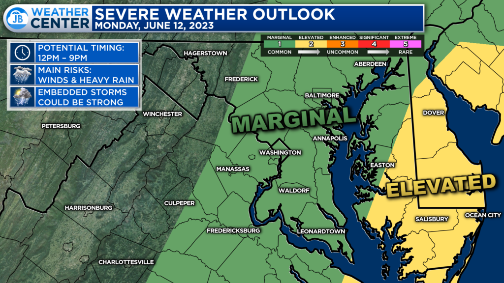
The Storm Prediction Center has placed areas along and east of the Bay under a Level 2 “Elevated Risk” with areas west of the Bay under a Level 1 “Marginal Risk.” This shows the higher chances of strong to potentially severe storms will be out east, where you can log more sunshine today.

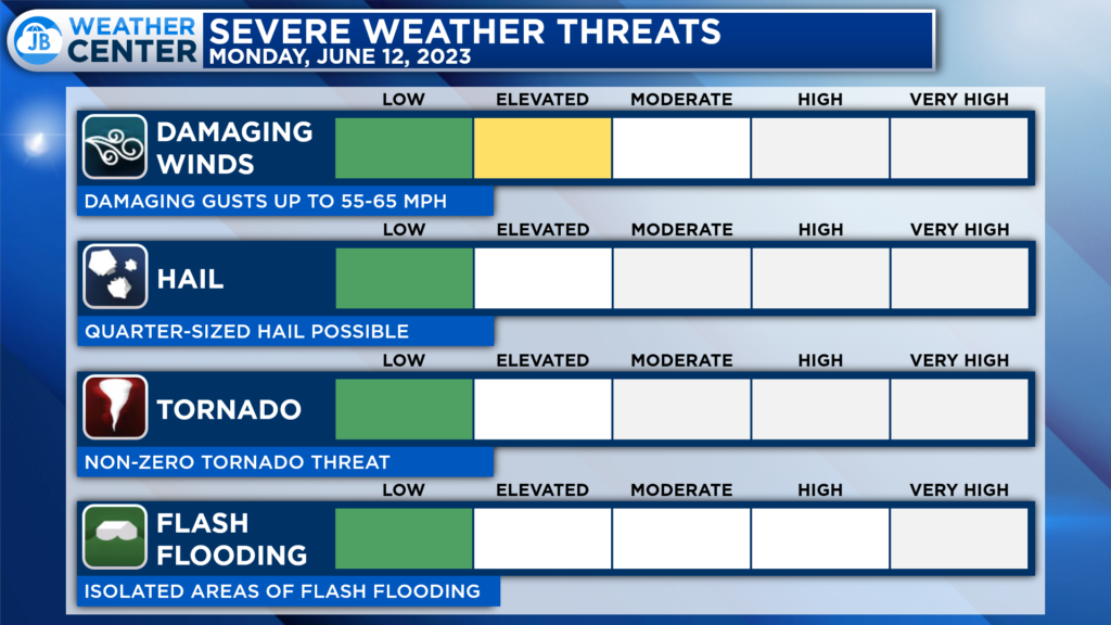
Heavy rain and gusty winds are the primary threat with any thunderstorms this afternoon. Some storms may contain small hail, and we have a non-zero tornado risk (which is to say it’s existent but very low). I am not expecting a widespread severe outbreak, but a storm or two may pack a punch!
If you have outdoor plans this afternoon and evening, I would plan on scattered showers moving through and bringing some impacts. While it may not rain everywhere all day, I would plan on moving outdoor activities inside to avoid any impacts. I would also keep the umbrella handy!
Stay with JB Weather for the latest information on Southern Maryland weather. You can always access my forecasts and updates here on the website, on Facebook, on Twitter, and on YouTube.
-JB

Cedar Point has been providing trusted banking, lending and personal finance solutions to the Southern Maryland Community since 1945. Visit the credit union at any of its 6 locations in St. Mary’s, Charles and Calvert counties or online at www.cpfcu.com.

