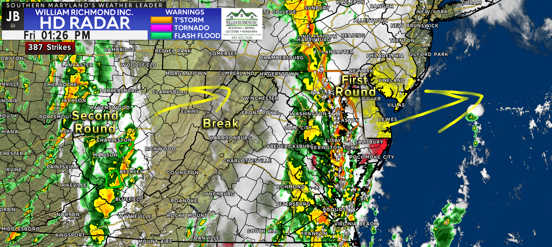
We saw our first round of storms push through the region early this afternoon. A line of storms led to multiple Severe Thunderstorm Warnings and Tornado Warnings across Maryland during the lunchtime hours. The worse of this first line has now pushed eastward, across the Bay, and on to the Eastern Shore. It will not be until 4pm when this line clears the Eastern Shore, causing impacts to traffic.
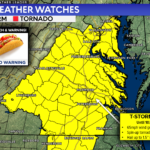
The Tornado Watch has been allowed to expire across Southern MD. However, the Tornado Watch does continue until 6pm for Southeast VA and the Delmarva.
Locally, we will see the rain come to an end over the next few hours. We are likely to see a bit of a break across much of the Mid-Atlantic during the afternoon as the first round pushes out. Skies are likely to remain cloudy, but a few peeks of sunshine cannot be ruled out. Actually, the amount of sunshine we could see is very important to this evening’s forecast.
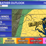
Any additional sunshine we see this afternoon will help warm temperatures, increase the humidity, and rebuild thunderstorm energy across our region. This would make the atmosphere rather unstable and prime for additional severe weather chances as our second round pushes through this evening. I am skeptical of how much of this happens.
Our Chesapeake’s Bounty Futurecast shows how this evening’s forecast is likely to play out. Our model does show the potential for some limited clearing of the skies, but not widespread clearing. Nevertheless, this could be enough to cause some instability to develop in the atmosphere.
Futurecast shows the second wave of rain pushing through between 7pm-2am. Initially, we may see 1 or 2 strong to severe thunderstorms work through between 7-9pm. If storms do indeed develop, they could contain gusty winds, heavy rain, and some minor rotation. Granted, the severe weather threat is likely to be much lower than this morning.
Regardless of whether we see storms initially or not, periods of heavy rain will look to move through after sunset. These periods of heavy could cause flooding, especially in the areas that saw the worst weather this afternoon. We will see things gradually clear up as head towards midnight.
SUMMARY
It will be important to stay weather aware throughout the afternoon and evening. While we are likely to see a break in the activity this afternoon, another round of heavy rain is likely to push through this evening and into the overnight hours. The severe weather potential with these storms is highly dependent on how much clearing we see beforehand. At the very least, heavy rain is likely tonight, which could lead to flooding.
I would hold off any travel until after 11pm tonight, especially if you are headed eastward towards the shore. Stay aware of quickly changing weather conditions, and a have plan to take action if any additional warnings are issued.
Stay with JB Weather for the latest information on impacts here in Southern Maryland. You can always access my forecasts and updates here on the website, on Facebook, on Twitter, on Instagram, and on YouTube. JB Weather is Southern Maryland’s Weather Leader, and I am working around the clock to keep you ahead of the storm!
John Bordash
View More PostsJB Weather forecaster John Bordash is working around the clock to provide Southern Maryland, and neighboring communities, with accurate and reliable weather information.