Brought to you by Berkshire Hathaway HomeServices McNeils Group Properties
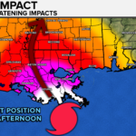
Hurricane Ida made landfall in Lousiana as a powerful Category 4 hurricane around 12:55PM EDT on Sunday. Widespread catastrophic impacts have been reported across the immediate Louisana coastline. 150mph winds, 10-20″ of rain, and a 7-15 foot storm surge have ravaged these areas. Hurricane Ida will continue to move north through the Deep South Sunday night into Monday. Ida will then take a northeasterly turn, and move towards the Mid-Atlantic and Northeast later this weekend. While Ida will be weakening as it comes north, there will still be moderate to high impacts that spread into the Ohio River Valley and Mid-Atlantic.

We will see the moisture from Ida surge northward into our region as we approach mid-week. We will see an increase in humidity, due to the surging tropical air, begin on Tuesday. Rain will begin to overspread the region late Tuesday night, and into Wednesday. How long the rain lasts will depend on how quickly the remnants of Ida move out of here. Some models keep the rain in our region through late Thursday. Other models, like our Futurecast that is shown below, suggest the rain may be over by early Thursday morning. Regardless, we are likely to see areas of heavy rain develop.
Where the highest rain totals set up will be dependent on the exact track. A track further north would put the highest totals to our north, and a southerly track would put totals to the south, potentially across SoMD. The current forecast from the National Weather Service, which is shown below, goes along with that northern scenario. Their forecast is suggesting that as much as 4-6″+ of rain may fall across West Virginia, Pennsylvania, and western Maryland. This forecast would put 2-4″ of rain across much of the southern Mid-Atlantic, including southern Maryland. With this said, it is possible that we see these totals go up or down for southern Maryland, depending on the exact track of Ida’s remnants.

We will not see the winds that they have seen along the Gulf Coast. Hurricanes lose their wind power fairly quickly once they move onshore. Thankfully, that will happen here. With that said though, we are still likely to see some gusty winds as the remnants of Ida move through. The National Hurricane Center is forecasting for the remnants of Ida to have winds around 25mph, with locally higher gusts.
Our Futurecast model, shown below, depicts the wind threat as the remnants of Ida move through. Our model seems to suggest that higher wind gusts, close to 30-40mph, could be possible. I don’t know if I buy that they will be that strong, but it is certainly a possibility.
All in all, we are likely to see a moderate impact event across the Mid-Atlantic as the remnants of Ida move through on Wednesday and Thursday. We could see widespread flooding issues as 2-4″+ of rain looks possible. Gusty winds are also possible, but I am not worried about the power outage threat at the moment. With decaying tropical systems, we also have to discuss the potential for brief spin-up tornadoes. We could a1 or 2 weak tornadoes spin up in our region Wednesday afternoon and evening. I don’t think the threat is as high as it was with Elsa earlier this Summer, or with Isaias last year.

It will be important to stay with JB Weather for the latest information on Ida, and the impacts here in Southern Maryland later this week. You can always access my forecasts and updates here on the website, on Facebook, on Twitter, and on YouTube. JB Weather is Southern Maryland’s Weather Leader, and I am working around the clock to keep you ahead of the storm!
-JB

Real Estate now! Not sure where to start? View our Southern Maryland inventory of homes, land, farms and commercial properties on mcnelisgroup.com. Engage with our planning tools to determine your next real estate lifestyle decision, choose your realtor as a trusted advisor. Experience the difference with service and support from real estate’s forever brand!
1 thought on “Remnants of Ida to Bring Moderate Impacts by Mid-Week”
Comments are closed.

[…] [ August 29, 2021 ] Remnants of Ida to Bring Moderate Impacts by Mid-Week Top Stories […]