Brought to you by Chesapeake Ice
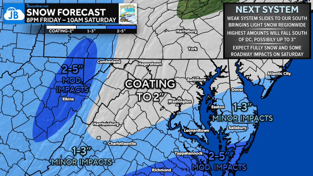
Our next system will slide to the south of our region and is expected to remain weak. However, this will likely bring measurable snow to our region well after sunset Friday before getting out of here by mid-morning Saturday. 1-3″ looks very possible in Southern MD with 2-5″ for Tidewater VA.

Overall, I am not expecting high impacts from this system… especially in comparison to Monday’s storm! With that said, I would expect this light, fluffy snow to accumulate on roadways and cause some issues Saturday morning. The highest impacts will be found further south.
Any slight ticks north could lead to high totals. This system has about a 10-15% chance of overachieving in our region, bringing 3-4″+. Something to watch, especially in southern St. Mary’s. Given the timing though, this should just be a nice system to watch with almost no impacts on schools.

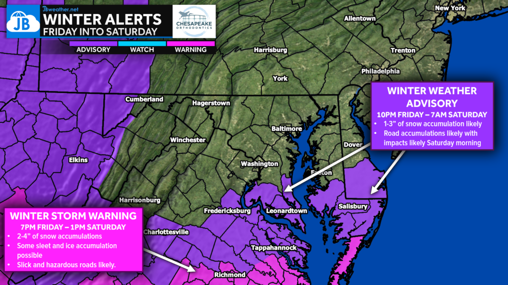
Winter Weather Advisories (shaded in purple) have been issued from 10pm-7am for southern Maryland, southern Delmarva, and central Virginia. This is where 1-3″ of snow is likely overnight with some accumulation on roadways. Winter Storm Warnings (shaded in pink) have been issued for central Virginia for higher impacts.
Stay with JB Weather for the latest information on impacts here in Southern Maryland and across the Mid-Atlantic. You can always access my forecasts and updates here on the website, on Facebook, on Twitter, on Instagram, and on YouTube. JB Weather is the Mid-Atlantic’s Weather Leader, and I am working around the clock to keep you ahead of any storm!

Chesapeake Ice is your local Ice Distributor and Manufacture for Southern Maryland. Please contact us now for your summertime Ice and Canned Artisan Water needs. Please check out our Facebook and website chesapeakeice.net.

