Brought to you by Cedar Point Federal Credit Union
All eyes have been looking to early next week for our region’s first widespread winter weather threat. While that threat is certainly one to watch, we may have some snowflakes flying before then! A weak system will look to pass by the region on Friday, and could kick off some winter weather.
An upper-level low-pressure system will move out of the Great Lakes early Friday morning. It is likely to die out as hits the Appalachian Mountains. As it dies, it will transfer its energy to the coastline and develop a new system. As this transfer of energy happens, it will likely set off some precip.
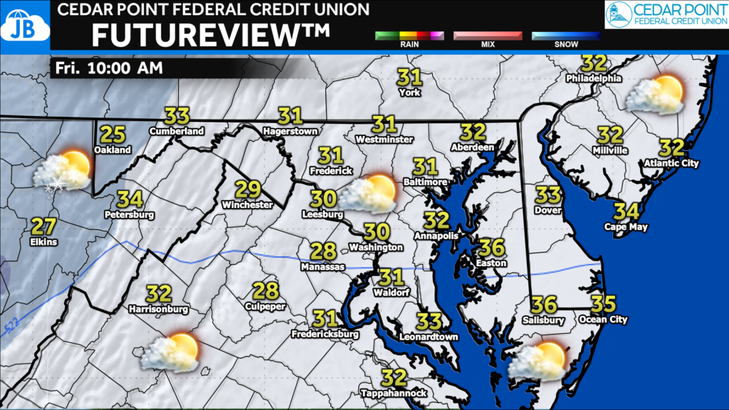
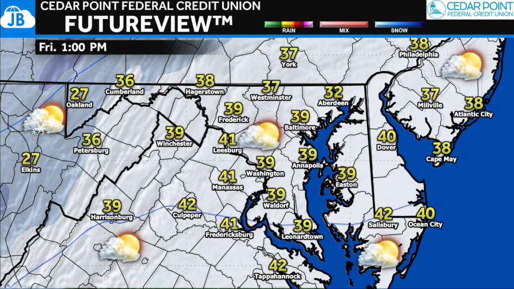
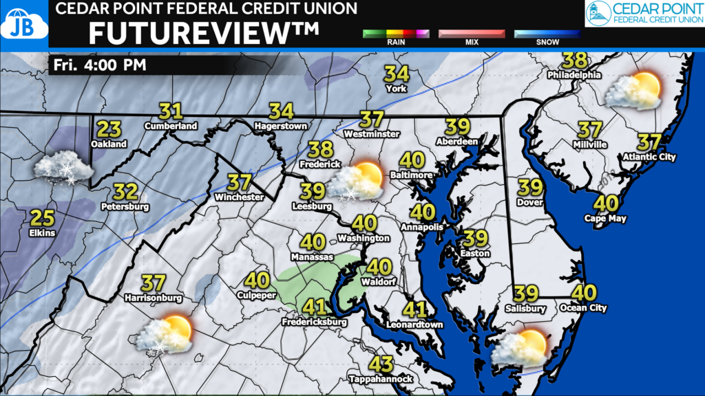
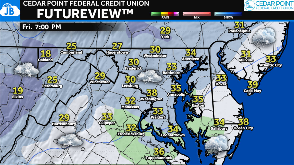
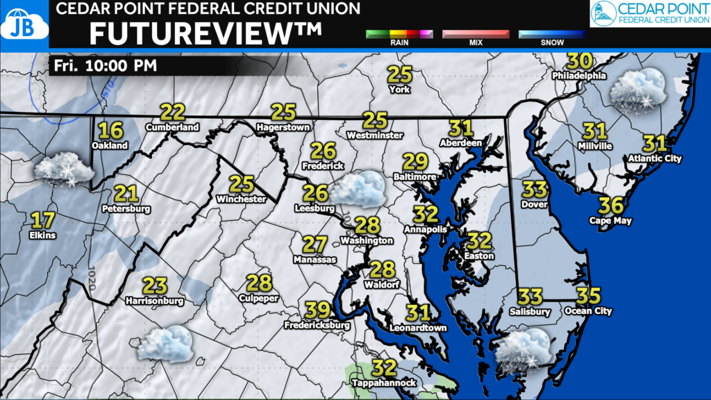
Our Cedar Point Federal Credit Union Futureview model (powered by WeatherBell) shows this potential quite well. In the morning, we are likely to see ongoing snow showers in the mountains. As the afternoon wears on, though, those snow showers will try to spill over the mountains into the Piedmont and then to the Coastal Plain by the evening.
Outside of the mountains (thanks to upsloping) none of this precip is likely to be heavy. With that said, chilly temperatures in the 30s would allow for much of this to fall as light snow. This will be especially true after sunset when a fresh injection of cold air arrives.
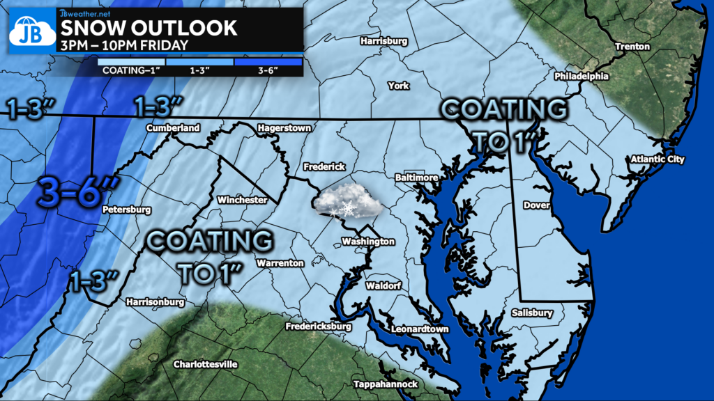
Given the light nature of the precipitation and the initial marginal temperatures, this is not expected to be a big event. Most areas outside of the mountains will likely only see a coating to an inch of snow at most.
This snow may have a hard time sticking to roads and warmer surfaces. It will most likely only stick to grass, car tops, and cooler/elevated surfaces. As a result, I would not expect much of an impact on the evening commute. However, wet roadways will be possible.
Again, we’re not looking at a big event on Friday evening. We’re likely just talking about passing snow showers. While impacts are likely to be low, it will help set the stage for a cold weekend. This, in turn, may help allow for a more widespread winter weather event early next week. I will have more details on that later today and throughout the week.
Stay with JB Weather for the latest information on impacts here in Southern Maryland. You can always access my forecasts and updates here on the website, on Facebook, on Twitter, on Instagram, and on YouTube. JB Weather is the Mid-Atlantic’s Weather Leader, and I am working around the clock to keep you ahead of any storm!
-JB

Cedar Point has been providing trusted banking, lending and personal finance solutions to the Southern Maryland Community since 1945. Visit the credit union at any of its 6 locations in St. Mary’s, Charles and Calvert counties or online at www.cpfcu.com.
1 thought on “Snow Showers Possible Friday PM”
Comments are closed.
[…] Source link […]