Brought to you by Bill Oosterink, Realtor
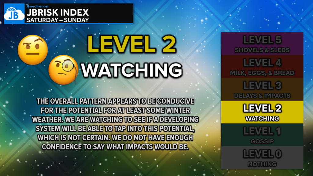
The weather pattern going into this weekend is one that can support a strong storm in the Atlantic. Cold air will be pushed south into the eastern U.S., and the overall setup may allow a storm to slow down and strengthen once it forms offshore. Because of this, confidence is fairly high that a storm will develop — the uncertainty is how close it comes to the East Coast.
That distance matters a lot. A small change in the storm’s path can be the difference between minor impacts or a more noticeable snow event, especially near the coast.
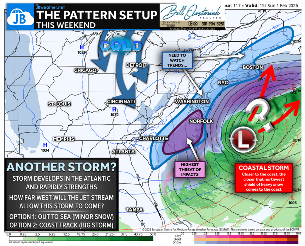
Right now, weather models are split on how far west the storm is allowed to move. Think of this like a guardrail in the atmosphere — if that guardrail stays farther east, the storm stays mostly out to sea. If it shifts west, the storm can get closer to the coast.
Because the storm hasn’t fully formed yet, models are still adjusting, which is why forecasts continue to change from run to run.
Scenario 1: Mostly Out to Sea (European Model)
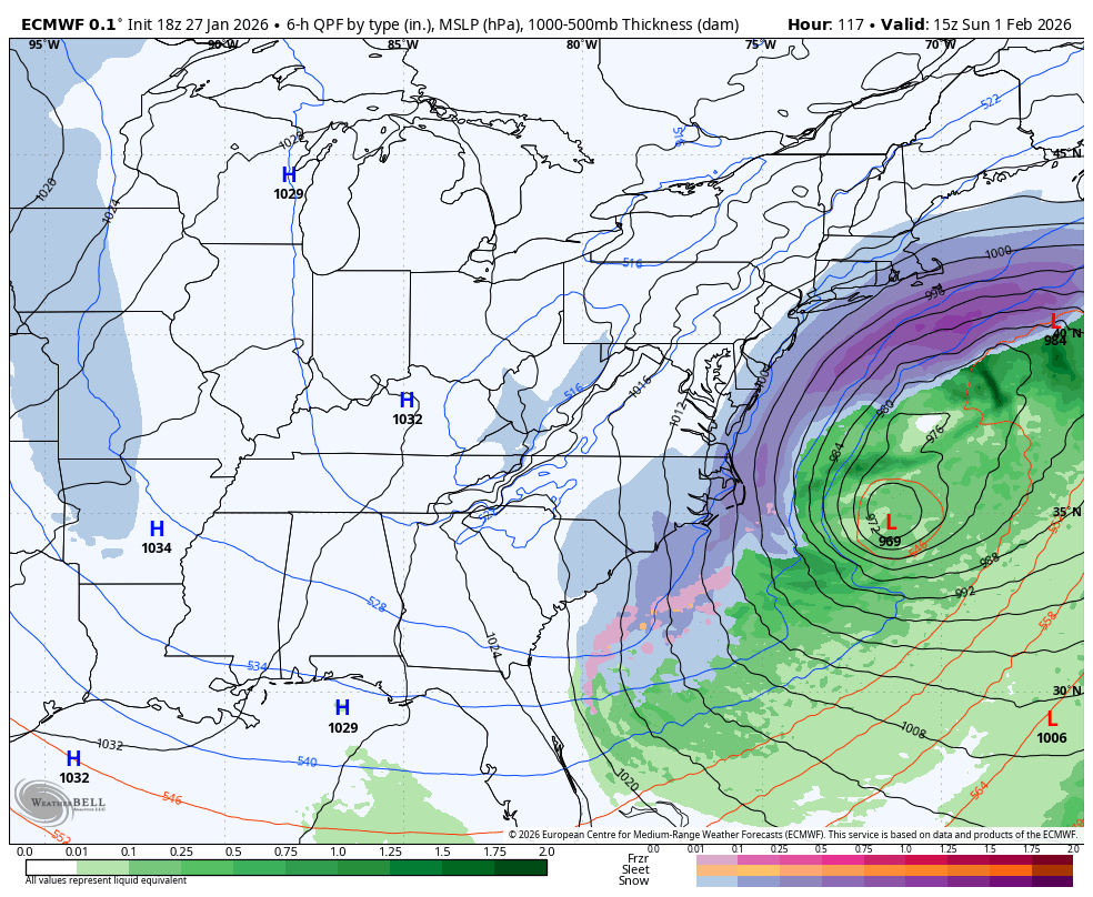
One set of forecasts (the European model) shows the storm staying farther offshore. In this case, the storm develops and strengthens, but passes just far enough east to limit impacts.
If this scenario plays out, most inland areas would see little to no impact, and even coastal locations would likely see only light snow or minimal effects. This would be considered a near miss.
Scenario 2: Closer to the Coast (American Model)
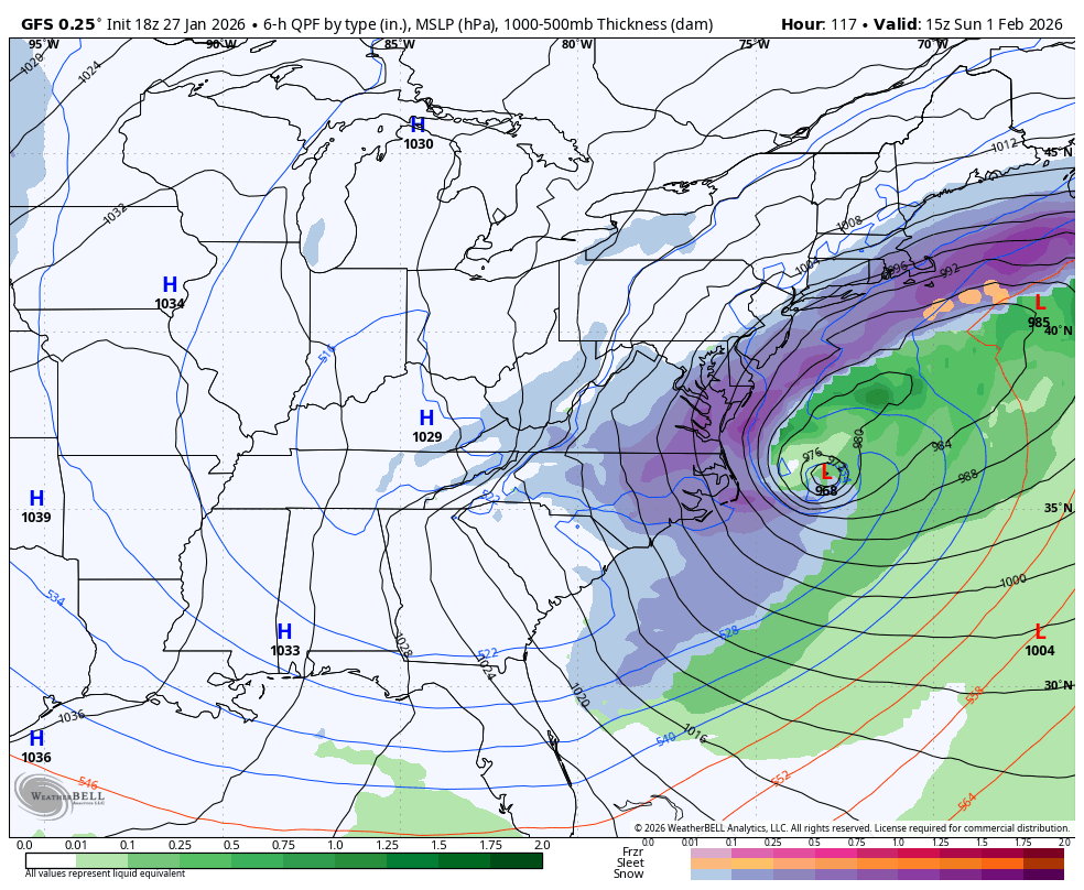
Another set of forecasts (the American GFS model) allows the storm to come closer to the coastline. This brings more moisture back toward land and increases the chance for snow along the coast.
In this scenario, the Carolinas and parts of the VA/MD/DE/NJ coastal areas could see measurable snowfall, with some impacts extending slightly inland. This is not a guaranteed major blizzard, but it would be a more noticeable winter storm than the offshore solution.
Bottom Line
In setups like this, storms often trend closer to the coast as we get closer in time, which is why this system deserves monitoring even though nothing is locked in yet. The key question is no longer if a storm forms — it’s how close it comes.
A storm is likely to develop this weekend, but impacts depend entirely on its track. Right now, outcomes range from a near miss with minor impacts to a closer coastal storm that brings snow to areas that may not be expecting it. We’ll continue refining the forecast as the picture becomes clearer over the next couple of days.
Stay with JB Weather for the latest information on impacts here in Southern Maryland and across the Mid-Atlantic. You can always access my forecasts and updates here on the website, on Facebook, on Twitter, on Instagram, and on YouTube. JB Weather is the Mid-Atlantic’s Weather Leader, and I am working around the clock to keep you ahead of any storm!
Brought to you by Bill Oosterink, Realtor. Buying. Selling. Investing. Ready when you’re ready! Check out www.somdDreamHome.com today!
John Bordash
View More PostsJB Weather forecaster John Bordash is working around the clock to provide Southern Maryland, and neighboring communities, with accurate and reliable weather information.