Brought to you by Sonder Studios
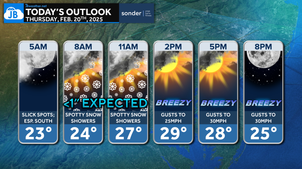
We have a chilly day on tap where temps may struggle to break freezing. This will help to keep slick spots around through the morning from last night’s snow. Additional snow showers are possible between 7-11am, but not expecting much. Winds pick up this evening!
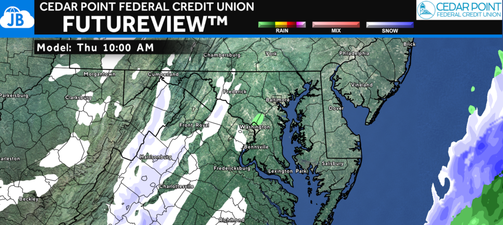
Our Cedar Point Federal Credit Union Futureview shows that not much is expected, with the snow showers likely to be widely scattered. The mountains out west will try to do their best to break up the moisture field. But, stay aware this morning.
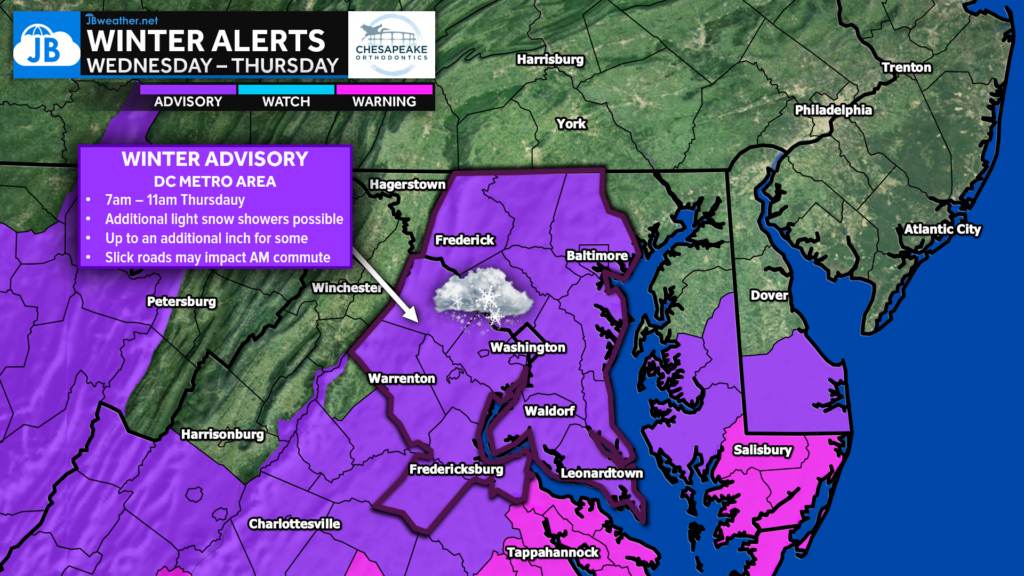
Nevertheless, a Winter Weather Advisory is up for the region from 7-11am. Up to an additional inch of snow is possible, which may pose impacts on the Thursday AM commute.
School impacts are possible. Several schools in central Virginia, including Fredericksburg City, King George, Spotsylvania, and Westmoreland Counties, have already closed for the day. St. Mary’s County Schools in MD are delayed. You can stay up to date on the latest closings at the link below.
Stay with JB Weather for the latest information on impacts here in Southern Maryland and across the Mid-Atlantic. You can always access my forecasts and updates here on the website, on Facebook, on Twitter, on Instagram, and on YouTube. JB Weather is the Mid-Atlantic’s Weather Leader, and I am working around the clock to keep you ahead of any storm!

SONDER℠ Yoga studio. Barre studio. Fitness Studio. Classes, events & education for being well. Sonder is a mindful community, and you are invited. 5+ years in Calvert County, MD. We are grateful for your trust. Check out sonderstudios.us!
John Bordash
View More PostsJB Weather forecaster John Bordash is working around the clock to provide Southern Maryland, and neighboring communities, with accurate and reliable weather information.

1 thought on “Thursday’s Forecast: Chilly with Scattered Snow Showers”
Comments are closed.
thankyou