Brought to you by Calvert Title Company
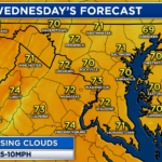
After a chilly weekend, we have seen seasonal conditions return to the region to kick off this weekend! The last few days have featured mainly sunny and dry conditions with highs in the lower 70s. Good things can’t last forever, though. A cold front will move through tomorrow and bring rain and storms.
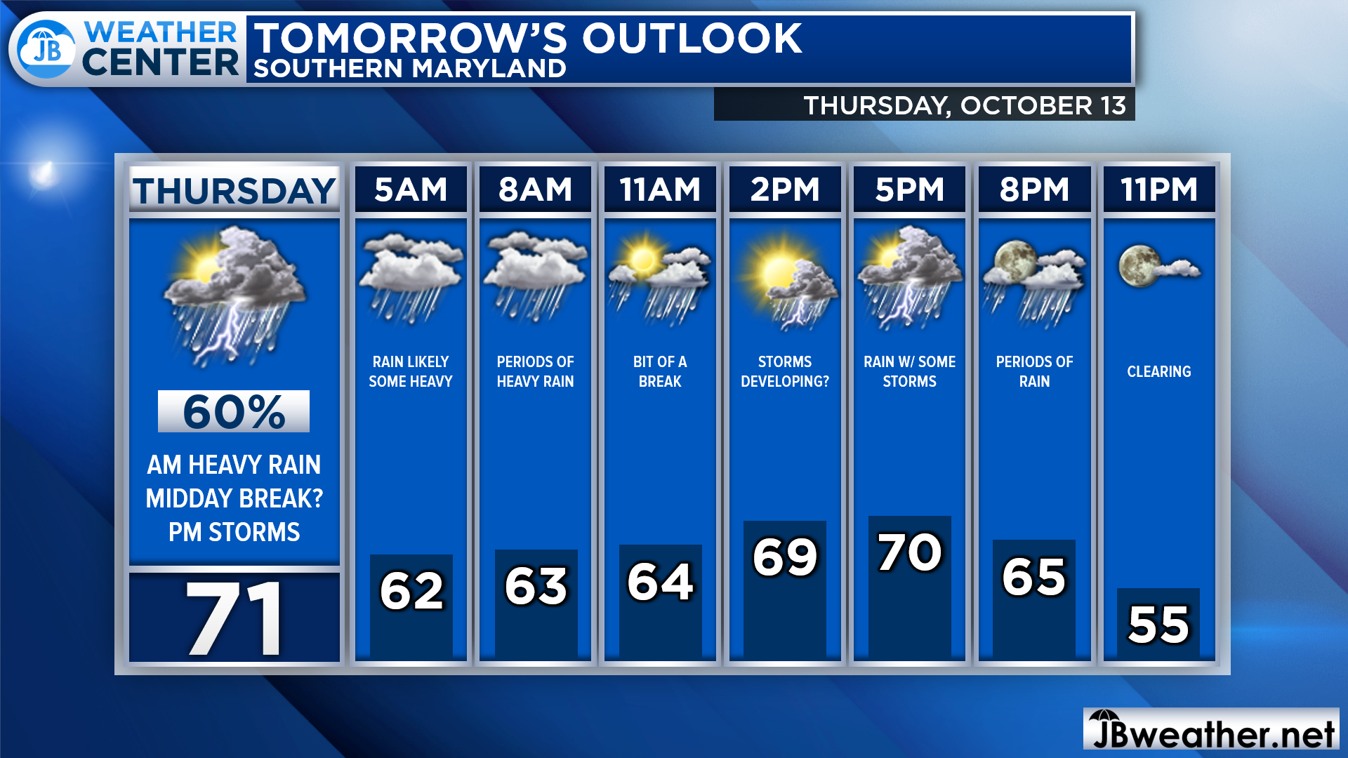
We have seen the cloud cover increase today, and we are likely going to see the rain move in tomorrow morning. As you head out of the door, rain will be likely for most. We should see the rain continue until lunch when we may get in on a break. Then another wave of rain/storms looks possible before clearing late tomorrow evening.
Futurecast is doing a good job of depicting tomorrow’s weather situation. You can see the widespread rain tomorrow morning, with some pockets of heavy rain, as you head out of the door. After that midday break, we are likely to see that second round of rain move through with the chance of a few embedded storms that could be strong.
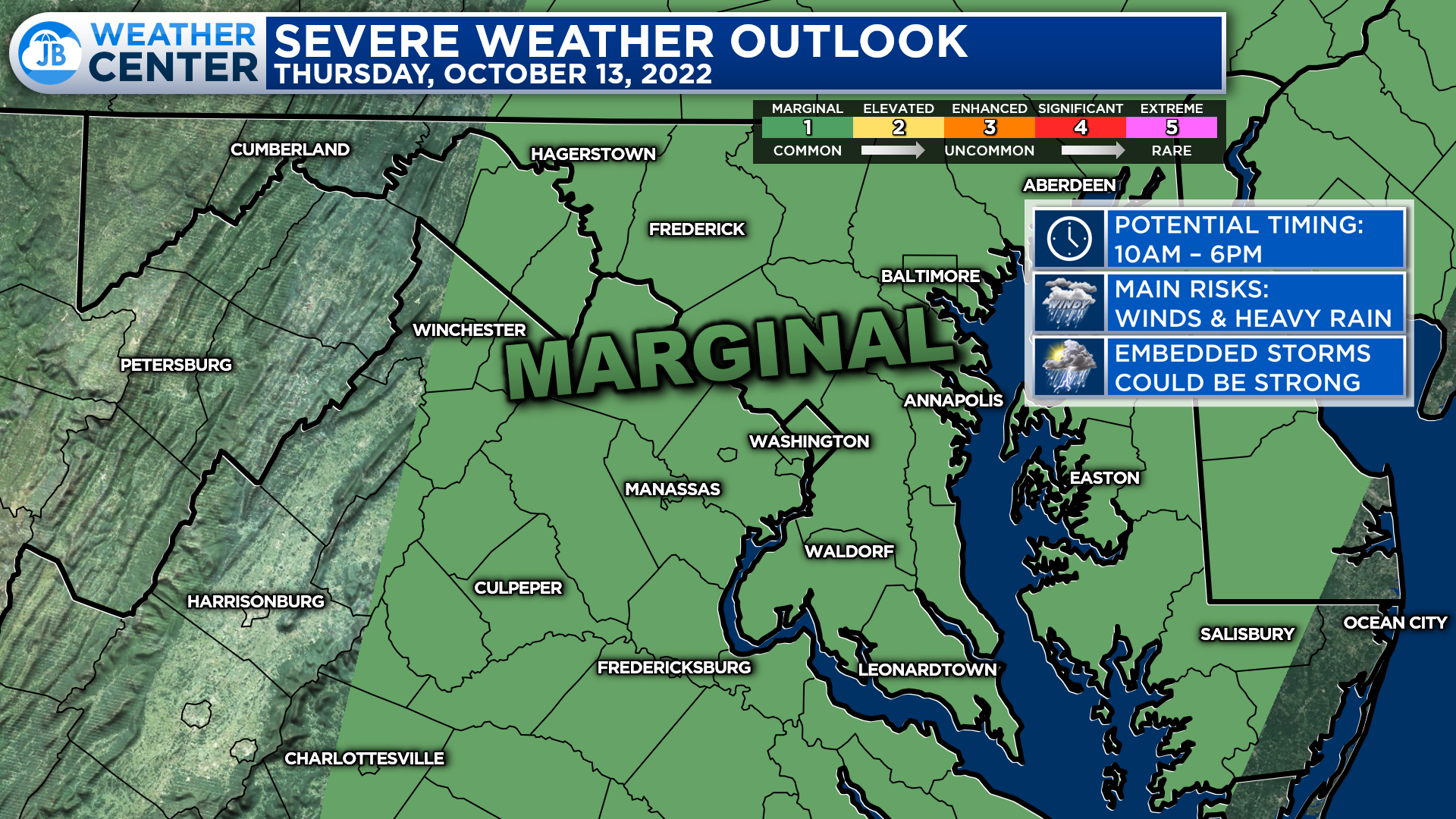
It’s been a while since we have had to talk about the threat of strong or severe storms. The Storm Prediction Center has actually placed our region under a Level 1 “Marginial Risk” of severe weather for tomorrow. This highlights the threat of seeing 1 or 2 storms turn strong to severe. The time frame to watch for these would be 10am-6pm.
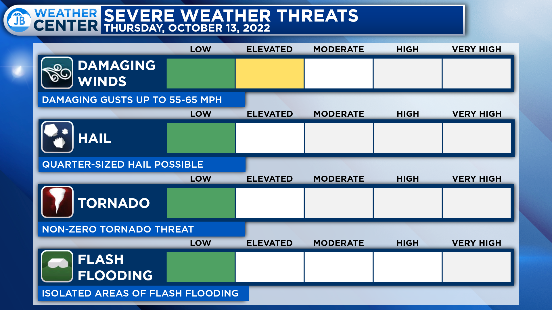
The primary threat from any storms tomorrow would come from damaging winds. In addition to periods of heavy rain, we could see storms containing wind gusts up to 55-60mph. There is also a low, but not zero, threat of hail and a weak tornado. These are both things that will need to be monitored, but I do not expect a widespread severe weather or tornado outbreak.
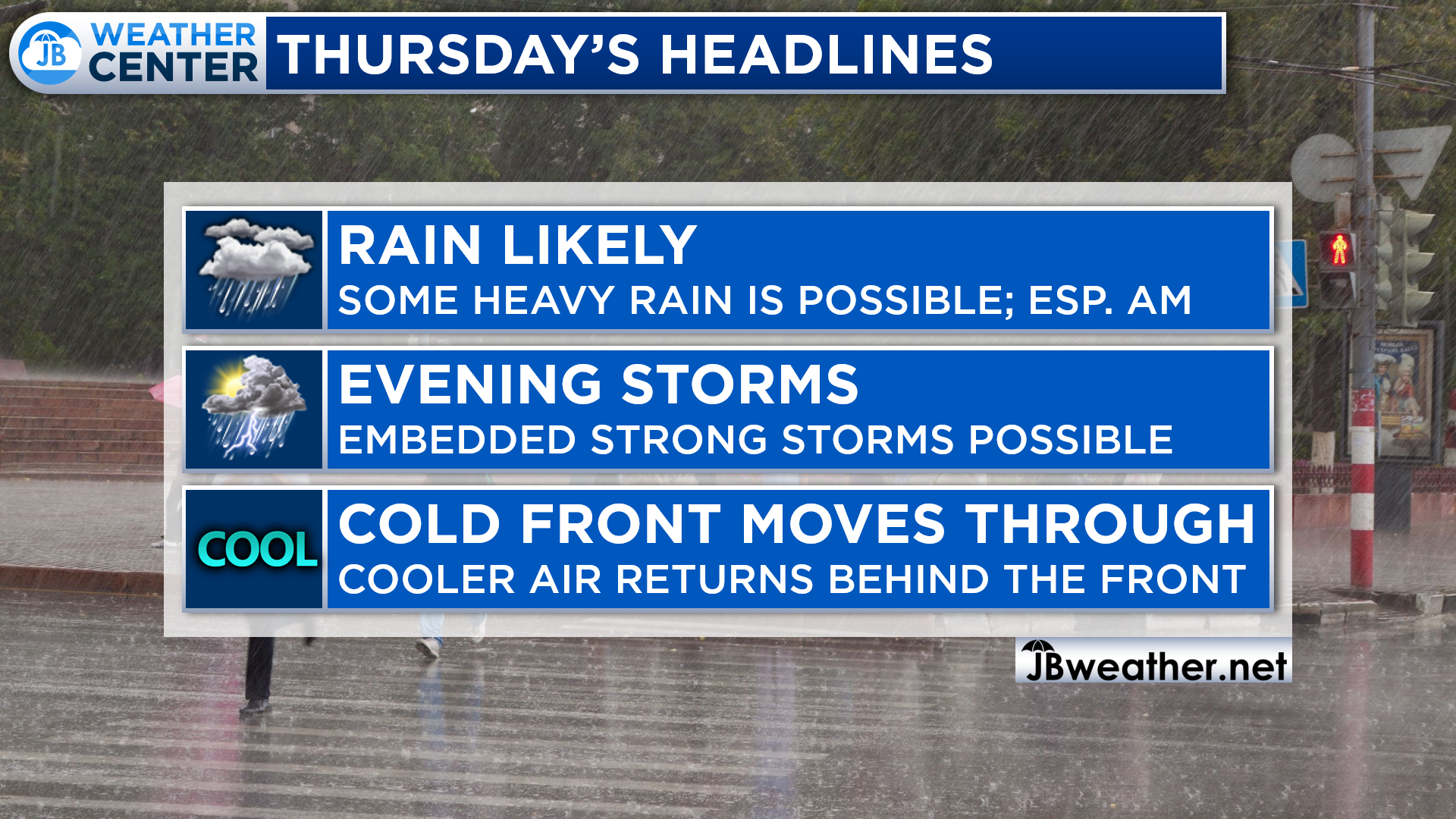
All in all, tomorrow looks like an impactful weather day! Plan on periods of rain throughout the day with the potential of a strong storm or two tomorrow afternoon or evening. While rain amounts should stay under an inch, impacts from the rain and storms could be moderate as this cold front moves through! Much cooler air is on tap for the end of the week and the weekend!
Stay with JB Weather for the latest information on Southern Maryland weather. You can always access my forecasts and updates here on the website, on Facebook, on Twitter, on Instagram, and on YouTube.
-JB
Calvert Title Company is guiding you HOME one closing at a time! Check out https://calverttitle.com/ today!
John Bordash
View More PostsJB Weather forecaster John Bordash is working around the clock to provide Southern Maryland, and neighboring communities, with accurate and reliable weather information.