Brought to you by R.E. Graves Heating & Air Conditioning
The last week has featured nothing but wild weather swings as the battle between Spring and Winter begins. After a recent string of mild days, we will see Old Man Winter make a comeback. As we head into Thursday, cold temperatures will settle back in, with a wintry mix being possible, too.
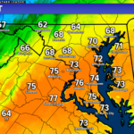
Today featured the exact opposite weather of what you would expect for February. After a round of morning showers, most of our region saw temperatures spike into the middle 70s this afternoon. This warmth is thanks to a southerly wind. Those winds will shift this evening, though, bringing this warm feel to an end.
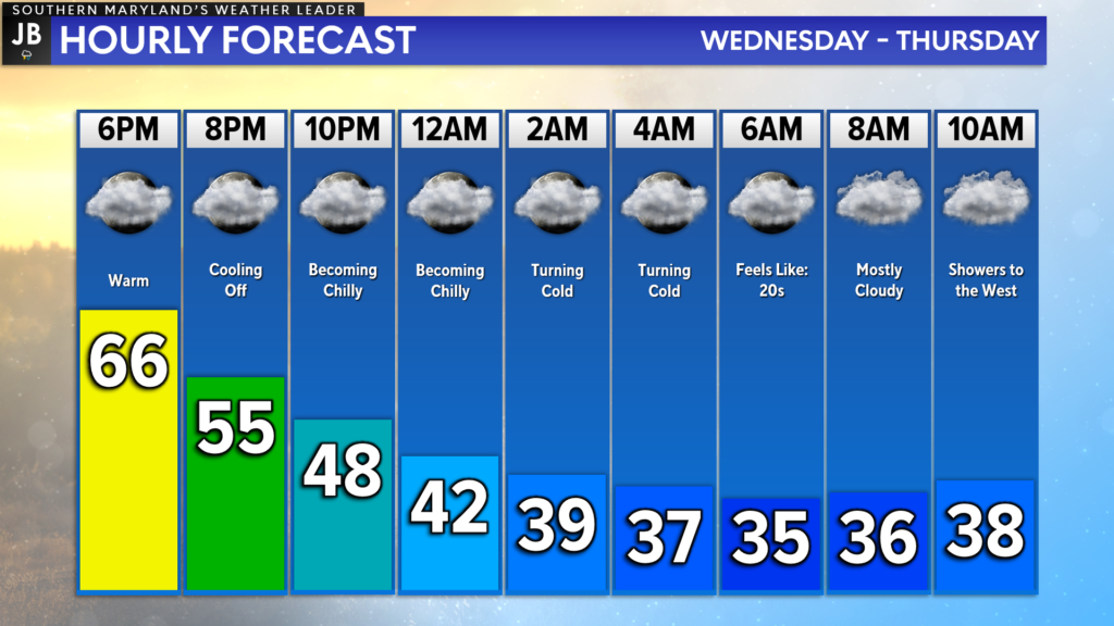
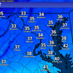
Temperatures will fall off quickly overnight. We will go from the 60s this evening into the 40s by midnight, and wake up to temperatures in the 30s at sunrise! Temperatures tomorrow morning will likely be cut in half from this afternoon’s highs.
We will also notice an increase in cloud cover overnight. These clouds will come as our next storm system beings to move towards the region. This system will interact with the cold air, and set up an interesting weather situation for Thursday.
I believe that our long-range Chesapeake’s Bounty Futurecast model is doing a good job at depicting this potential set-up. The game we are playing tomorrow is to see how early the precip can get in here, and how cold temperatures will be.
We will likely see an initial push of moisture work through the region late tomorrow morning and early afternoon. This moisture feed is likely to be weak, but with enough cold air present, we could see some light rain and sleet showers. The time frame to watch for this would be between 8/9am – 1/2pm. We would then would likely see a break in the activity for the evening rush.
The next wave of precipitation then moves in after sunset and is likely to have a stronger moisture feed. Temperatures should be warm enough at this point to ensure a plain, cold rain south of DC. However, areas northwest of DC could see a prolonged period of an icy mix, with freezing rain and sleet being possible.
Suppose the initial precip moves in quicker, is more substantial, or the air is colder. In that case, we could see a period of icing be possible across much of the region. It is important to note that a few of our computer models do show that potential. With that said, though, I am not sure I totally buy that solution. Nevertheless, this would not be a big ice storm.
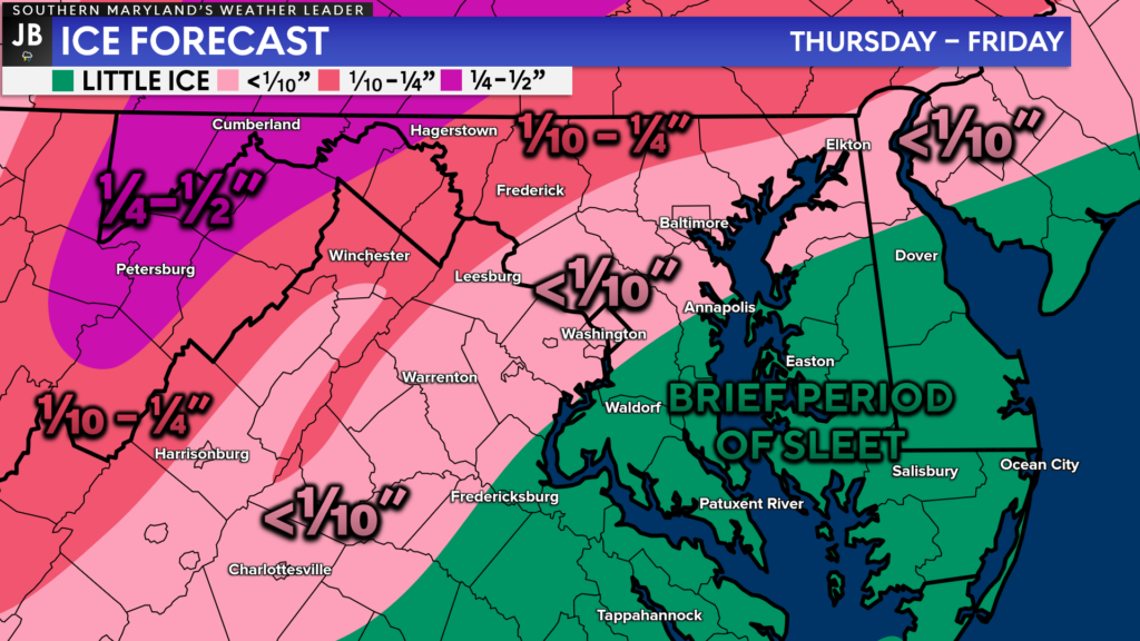
The highThe highest ice totals are likely to be kept well northwest of the DC Metro areas, back in the highlands and mountains. Areas along I-95 though could see a glaze of ice though. While a brief period of sleet is possible with the first wave of precip, I do not expect much ice accumulation in Southern MD.
While our air temperatures will be in the 30s and 40s tomorrow, today’s warm temperatures will help to keep many ground surfaces warm. This will help to limit the amount of freezing rain or sleet that could accumulate if we see additional moisture push through.
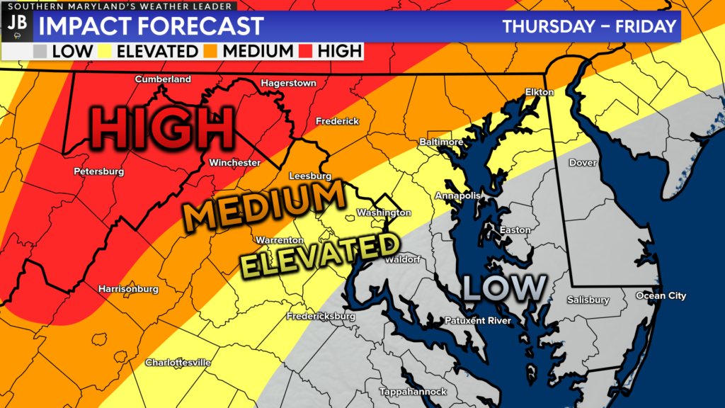
The highest impacts from this event will be found in areas to our northwest. It is in those zones where sleet and freezing rain are the most likely to accumulate, and cause issues. Locally, I expect low impacts from this event. While some sleet will be possible, ice accumulation will be low (if not next to zero).
As things stand right now, I would next expect school closures or delays in our local region tomorrow or on Friday. I would place the odds of any school impacts at just 10-20%. Travel is not likely to be highly impacted in our region. Travel is likely to be impacted NW of DC Thursday evening into Friday morning, though.
Stay with JB Weather for the latest information on Southern Maryland weather. You can always access my forecasts and updates here on the website, on Facebook, on Twitter, and on YouTube.
-JB

R.E. Graves Heating & Air Conditioning is a ⭐️⭐️⭐️⭐️⭐️ HVAC Contractor serving St Mary’s & Calvert. Just mention JB Weather to Save 20% off your next Heating repair bill when you Book now! https://bit.ly/3kFvjRs
