Brought to you by Cedar Point Federal Credit Union
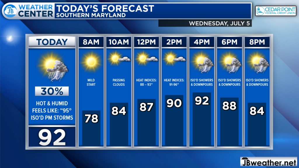
The 4th of July turned out to be rather seasonal with typical hot and humid conditions! Thankfully, storm chances held off. Today will be much of the same but with slightly higher chances of rain.

We are off to a mild start this morning, which will really set the tone for today. Temperatures will look to quickly climb through the 80s this morning. Temperatures peak in the lower to middle 90s this afternoon. High dewpoints will make it feel even warmer. The humidity will also lay the groundwork for summertime thunderstorms.
Futurecast paints the afternoon rain chance quite well. I am not expecting widespread severe weather today. However, popcorn downpours and thunderstorms will be possible across the region. The key time frame looks to be between 3-8pm, during the heating of the day. Locally heavy rain and damaging wind gusts would be the primary concerns.
Stay with JB Weather for the latest information on Southern Maryland weather. You can always access my forecasts and updates here on the website, on Facebook, on Twitter, on Instagram, and on YouTube.
-JB

Cedar Point has been providing trusted banking, lending and personal finance solutions to the Southern Maryland Community since 1945. Visit the credit union at any of its 6 locations in St. Mary’s, Charles and Calvert counties or online at www.cpfcu.com.

