Brought to you by Row House
After a pretty wild weather week, we have finally reached the weekend. However, this weekend will not offer much of a reprieve from the wild weather swings. We are likely to see everything from cold & wind to Spring-like warmth this weekend!
A cold front moved through earlier today, which ushered a dramatic drop in temperature. We saw temps go from the 70s to the 40s within a few hours. That cold front is what will set the stage for a cold and windy start to the weekend.
Temperatures overnight will look to get into the upper 20s with mainly clear skies. We will see temperatures rebound into the upper 40s/lower 50s tomorrow, which is actually somewhat seasonal this time of year. However, today’s gusty winds will intensify tomorrow as well.
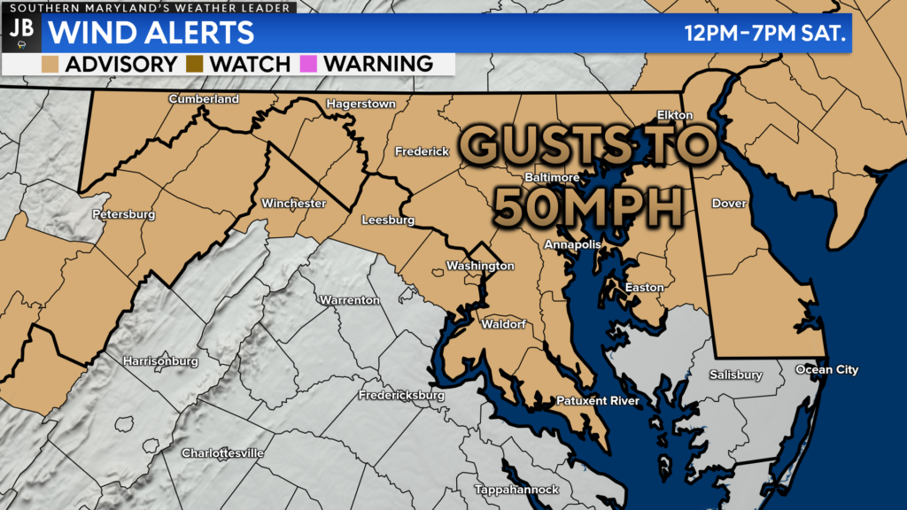
Winds at times tomorrow afternoon could gust upwards of 50mph. With this in mind, the National Weather Service has issued a Wind Advisory for all of Southern Maryland, and the areas shaded in tan, from 12pm-8pm on Saturday. These gusty winds, along with the low humidity, could lead to elevated fire risk. Outdoor burns are not recommended tomorrow.
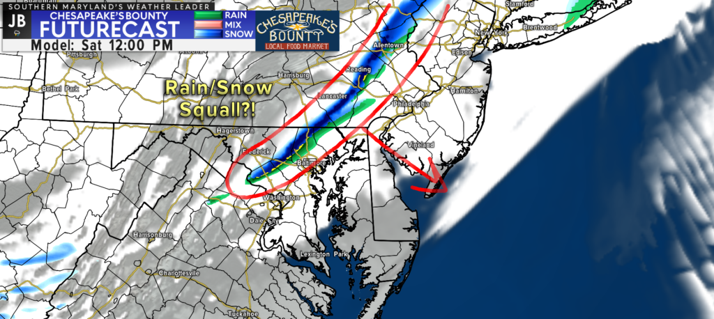
These gusty winds will come as another frontal boundary moves the region tomorrow. With enough moisture, there could be a narrow rain or snow squall that develops with it. This squall should stay to our north but could create brief hazardous travel in PA & the Northeast.
Once this front moves through tomorrow afternoon, we will see winds pick up and cold air funnel back into the region. These factors will set our region up for a cold night Saturday into Sunday.
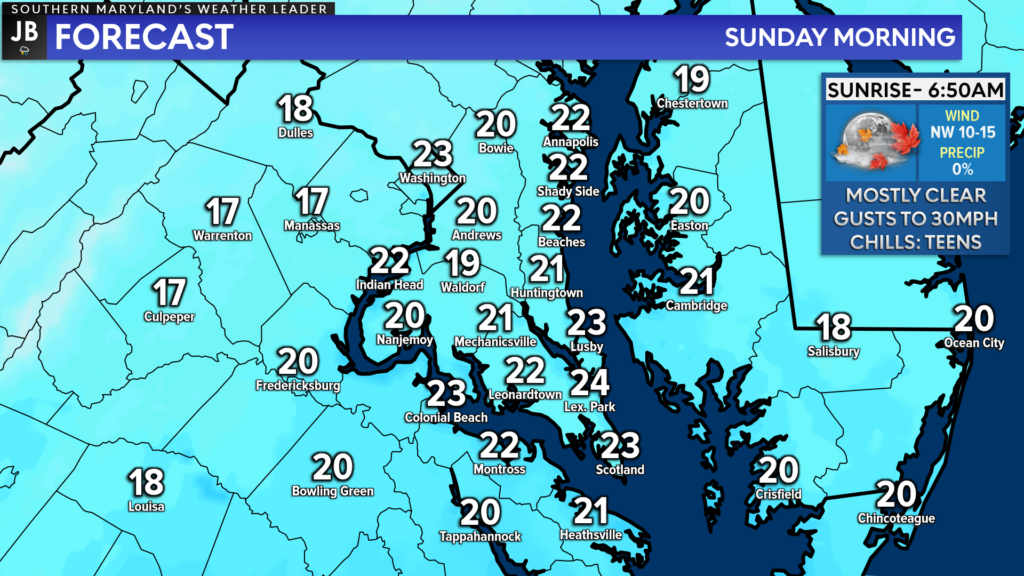
Temperatures Sunday morning are likely to be in the 20s regionwide. Winds will continue to gust upwards of 20-30mph at times, which will make it feel like we’re in the teens. We will keep the cold temps throughout the day on Sunday, with highs only in the 30s/lower 40s. Winds should relax some, though.
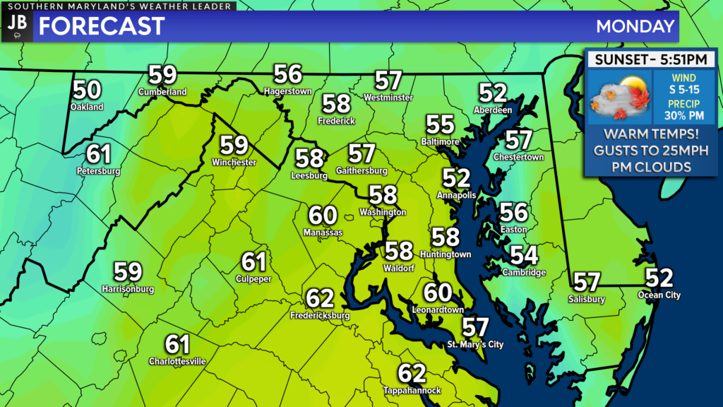
However, a southerly wind flow will return Sunday night and set our region up for a comfortable Monday! Right now, it looks like we could see highs get into the upper 50s/lower 60s for President’s Day. Winds will once again increase on Monday, with gusts up to 25mph possible, as warm air surges northward.
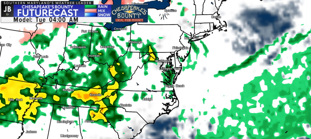
Clouds will increase late Monday ahead of our next storm system. Rain looks likely late Monday night, and into Tuesday, as a system passes to our northwest. Much of our daylight hours on Monday should remain dry, though, which will be welcomed news! Tuesday will be a different story, though.
All-in-all, we will see a classic battle between Spring and Winter this weekend. Current indications suggest that we may see that battle continue throughout the rest of the month, and into early March. This may even set the stage for additional snow chances to close out February, but we will talk more about that later this month.
In the meantime, get ready for some weather whiplash this weekend, as the weather pendulum continues to swing! It does look like President’s Day Monday will be the pick of the weekend!
Stay with JB Weather for the latest information on Southern Maryland weather. You can always access my forecasts and updates here on the website, on Facebook, on Twitter, and on YouTube.
-JB

Row House SOMD is more than just a workout; it’s about people, connection, strength and community. Our classes offer varied programming, helping you progress your workout and avoid plateaus. In our boat there’s a seat for everyone, so contact us TODAY at 301.686.7788 and mention JB Weather to schedule a FREE introductory class. Also receive a FREE GIFT when you sign up for a membership.
