Brought to you by Calvert Title Company
The heat has been turned up this week as we have seen southerly flow pump in some of the warmest and most humid conditions of the season, thus far. So far this week, 4 out of 5 days have featured temperatures above 90°, with the one exception, Tuesday, hitting 89°. Unfourently, the mid-summer heat will look to ramp up this weekend!
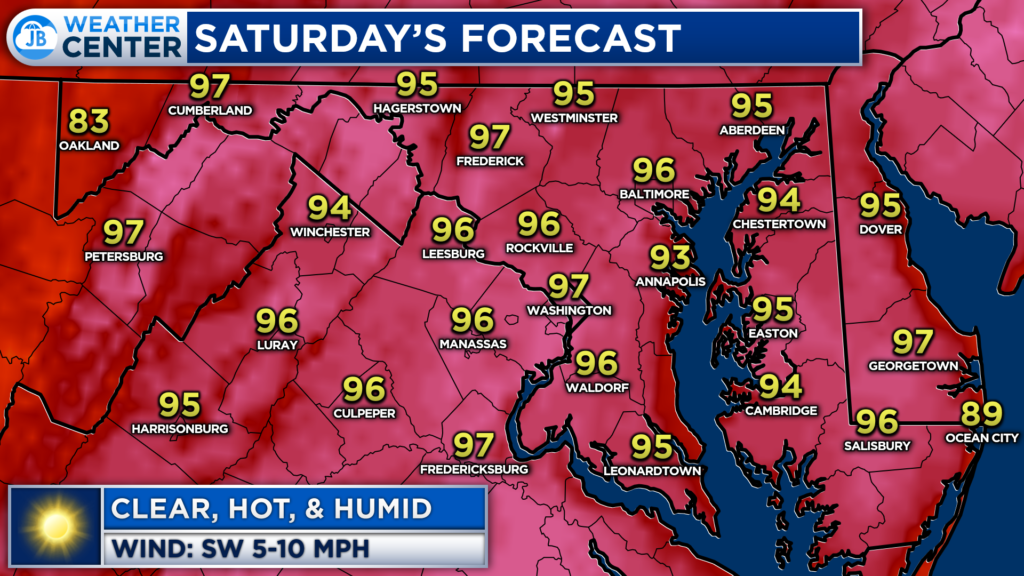
Tomorrow, temperatures should end up a couple of degrees warmer than today. After a warm and humid start tomorrow, I expect many areas on Saturday to reach the mid-90s by the afternoon. Mainly clear skies will help temperatures surge, as the only relief locally will be found at area beaches.
There will only be a 10% chance of a shower on Saturday, with that slight chance looking to be confined to the mountains. This means that sunblock and water will both be necessities for those heading outside.
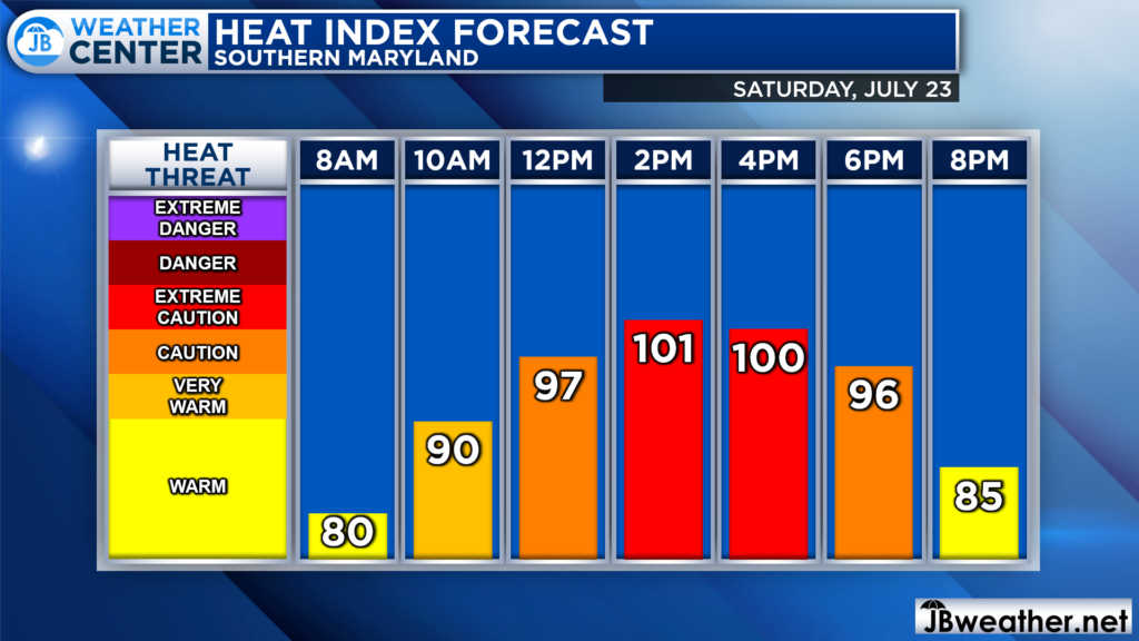
Heat indices, or feels like temperatures, on Saturday will look to max out over 100° by the afternoon hours. This will be thanks to dewpoints hanging out around 70°, which is quite humid. We should fall just below heat advisory criteria, which is 105°. However, still, take extreme caution with this heat. The warmest stretch will look to be during the early to mid-afternoon hours.
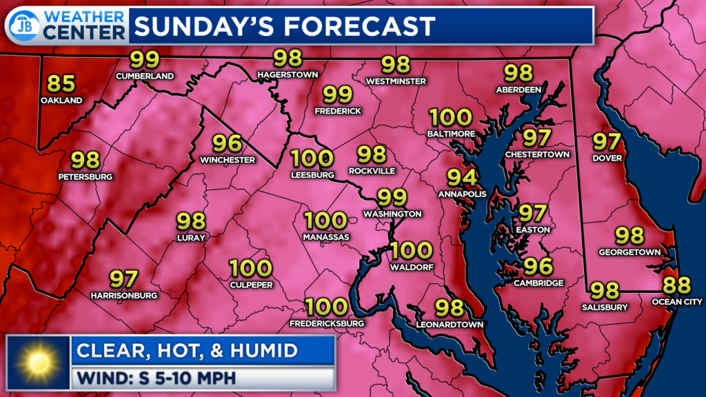
We will step up the oppressive heat on Sunday, likely becoming one of the hottest days of the year. Plentiful sunshine and southerly winds will allow temperatures to surge into the upper 90s for most, with some spots potentially breaking 100.
The only relief on Sunday would come from a 10-20% chance of a brief, isolated shower moving overhead during the afternoon. Otherwise, expect very hot conditions, especially away from the water.
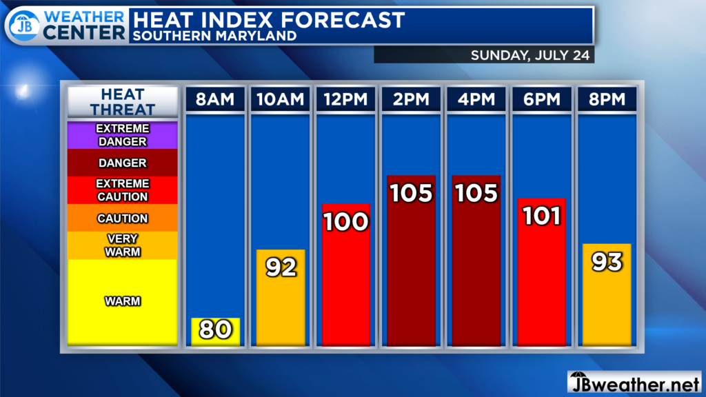
Heat indices on Sunday will likely be dangerous as they will look to max out between 104-109°. Sunday afternoon featuring not just high temperatures, but oppressive humidity. Dewpoints in the middle 70s will be the driving factor for these dangerous heat indices. We will likely see a heat advisory be issued for parts of the region on Sunday.
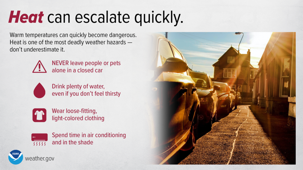
Heat is one of the leading weather-related killers in the United States, resulting in hundreds of fatalities each year. Heat can be very taxing on the body; heat-related illnesses that can occur with even a short period of exposure. Everyone can be vulnerable to heat, but some more so than others. Below are some safety tips
- Reduce, eliminate or reschedule strenuous activities until the coolest time of the day (before 8am or after 8pm).
- Wear lightweight, loose-fitting, light-colored clothing to reflect heat.
- Focus on drinking non-alcoholic and decaffeinated fluids. Drink water even if you don’t feel thirsty so that you stay hydrated.
- Spend time in air-conditioned locations to stay cool.
- Minimize direct exposure to the sun. Sunburn reduces your body’s ability to dissipate heat.
- Be aware of infants, older, sick, or frail people, and pets.
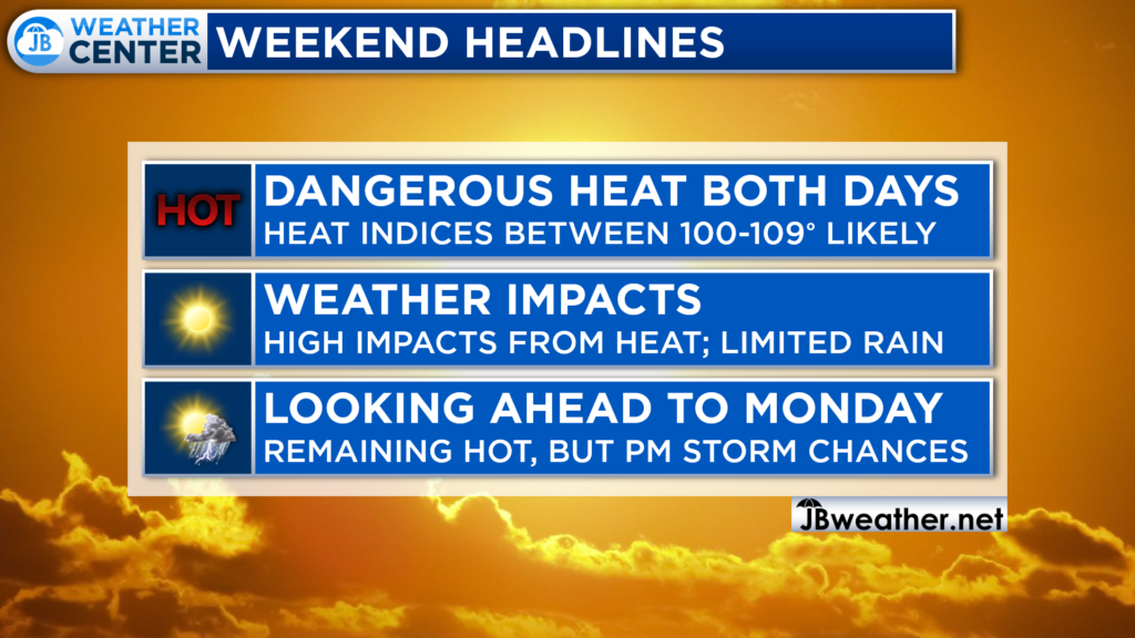
High impacts will be likely all weekend from the extreme heat that is settling in. Many spots will look to spend much of the daylight hours both days with temps in the upper 90s and heat indices over 100°. Rain chances will be limited, as well. The heat looks to continue into Monday, with relief not coming until Monday PM when a cold front moves through the chance of some rain.
Stay with JB Weather for the latest information on Southern Maryland weather. You can always access my forecasts and updates here on the website, on Facebook, on Twitter, on Instagram, and on YouTube.
-JB

Calvert Title Company is guiding you HOME one closing at a time! Check out https://calverttitle.com/ today!
