Brought to you by Berkshire Hathaway HomeServices McNeils Group Properties
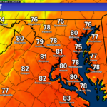
The first week of March has felt much more like Spring than Winter. While we have had some notable weather swings, the recent surge of warmth has several people ready for a complete switch over to Spring. Today’s record high of 81 at Pax River only leads to the readiness to ditch the Winter coats behind.
March is known as the battleground between Winter and Spring, so it should come as no surprise that these warmer days will soon fade. Winter will look to make one last appearance as we enter into the middle of this month. We had mentioned this potential for colder air to return in the March Outlook.
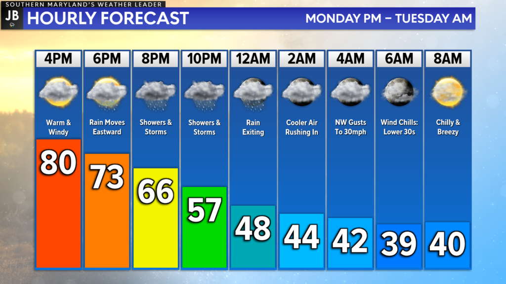
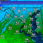
In the short term, we will see a cold front move through the region this evening, bringing a chance of showers/storms. Behind the front, we will see our winds switch out of the northwest and usher in much colder air. We’ll go from shorts to winter coats in just 12 hours!
Highs on Tuesday should still manage to get into the 50s by the afternoon. We will keep the northwest winds, though, which will be evidence of the colder air that will be pushing southeastward. We will see that colder air really make its presence known by Wednesday.
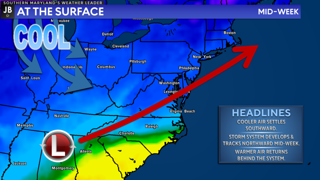
We will see the cold air really take hold of our region by Wednesday. Highs likely will not get out of the 40s as a developing system passes by. With enough cold air, some parts of the region may be able to see some snowflakes mix in with the cold rain! Yes, we could go from 80s to snow in just 48 hours!
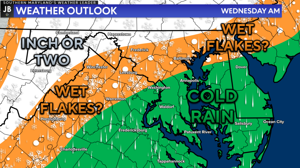
Temperatures Wednesday morning will be marginal, at best, for snow. We are likely to see temperatures in the middle 30s before getting into the 40s. This should lead to just a cold rain for most. However, the typically colder areas northwest of DC may be able to see those flakes! Some accumulation could even be possible in the highest elevations.
Our Chesapeake’s Bounty Futurecast is quite aggressive with this potential rain/snow mix. This model has temperatures bottoming out in the lower 30s Tuesday night, which would allow for a couple of hours of snow in some of our northern zones (northern Calvert/Charles Counties and points north). This would be the most “extreme” scenario, and I give this about a 20-30% chance of happening.
Even with this extreme scenario, the ground would be too warm to allow for accumulation. We would still see warmer temps lead to a changeover to all rain for everyone by midday.
Right now, I think areas northwest of DC will have the best shot at seeing non-accumulation flakes mix in with the rain. Locally, I would favor a cold rain. However, this will be something I’m watching. While accumulation is highly unlikely locally, a couple of degrees cooler could mean that we see some flakes falling.
In the grand scheme, this really does speak to the wild swings we are seeing with our weather as we transition out of Winter. Even just the potential to go from 80s to snow within 48 hours is just wild!
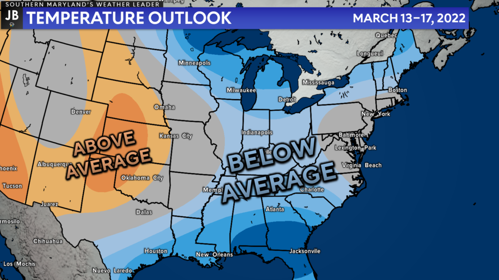
Behind the system on Wednesday, we will look to warm up later this week. 60s are likely to make a return by Saturday! However, another cold front will move through and will usher in a more prolonged period of near-to-below average temperatures for next week.
The Climate Prediction Center favors near-to-below average temperatures for much of next week. While this is not likely to be a true arctic blast, it will feel much more like mid-February than mid-March. It remains to be seen if we’ll see a system time up with this colder air to produce one last snow event. We shall see though!
I do think that this period next week will be Winter’s last gasp before a transition to warmer air to close out the month.
Stay with JB Weather for the latest information on Southern Maryland weather. You can always access my forecasts and updates here on the website, on Facebook, on Twitter, and on YouTube.
-JB

Real Estate now! Not sure where to start? View our Southern Maryland inventory of homes, land, farms and commercial properties on penfedrealty.com. Engage with our planning tools to determine your next real estate lifestyle decision, choose your realtor as a trusted advisor. Experience the difference with service and support from real estate’s forever brand!
1 thought on “Wild Weather Swings Continue This Week”
Comments are closed.
[…] [ March 7, 2022 ] Wild Weather Swings Continue This Week Top Stories […]