Brought to you by Berkshire Hathaway HomeServices PenFed Realty
The weather the last two days has reminded us that we are still in Winter! Cold and snow showers have brought the winter feel back to the region after a warm stretch last week. This colder weather pattern will not stick around for long, though! Southerly flow returns by mid-week to warm us back up.
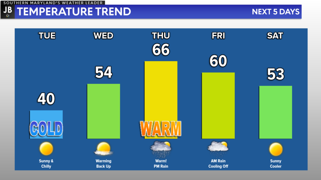
Tuesday will look to be our last cold day of the week, and thankfully it will come with no snow. Temperatures will rebound Wednesday before we get back into the 60s on Thursday. The warmth on Thursday, though, will come with a price. Rain looks to move in by Thursday evening as a cold front works closer to our region.
Temperatures moderate back down by late week, ahead of another cold blast for early next week.
Our Chesapeake’s Bounty Futurecast does a decent job of depicting this threat. We will see pockets of moderate to heavy rain develop along the front, which should move through late Thursday. Our model guidance right now suggests that there is the threat that our region could pick up between a half-inch to an inch of rain before we dry out on Friday.
There will be a window of time late Thursday, as the rain works through, where we could see embedded thunderstorms develop. The warm temperatures earlier in the day and racing winds in the upper levels of the atmosphere could allow this to happen after sunset on Thursday.
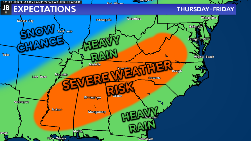
On Thursday, the highest severe weather risk appears to be across the southern Appalachians and Deep South. While I do not think we are talking about a widespread severe weather outbreak locally, I could see embedded thunderstorms develop. With enough wind energy in the middle-to-upper levels of the atmosphere, any potential thunderstorms could bring 50-60mph gusts late Thursday as they work through.
As things stand right now, the better severe weather ingredients should remain to our south. This does limit my concerns about our region seeing a higher-end severe risk. However, this could be the first time this year that we could see thunderstorms work through the region! A lot can, and likely will, change over the coming days with this forecast, so stay tuned.
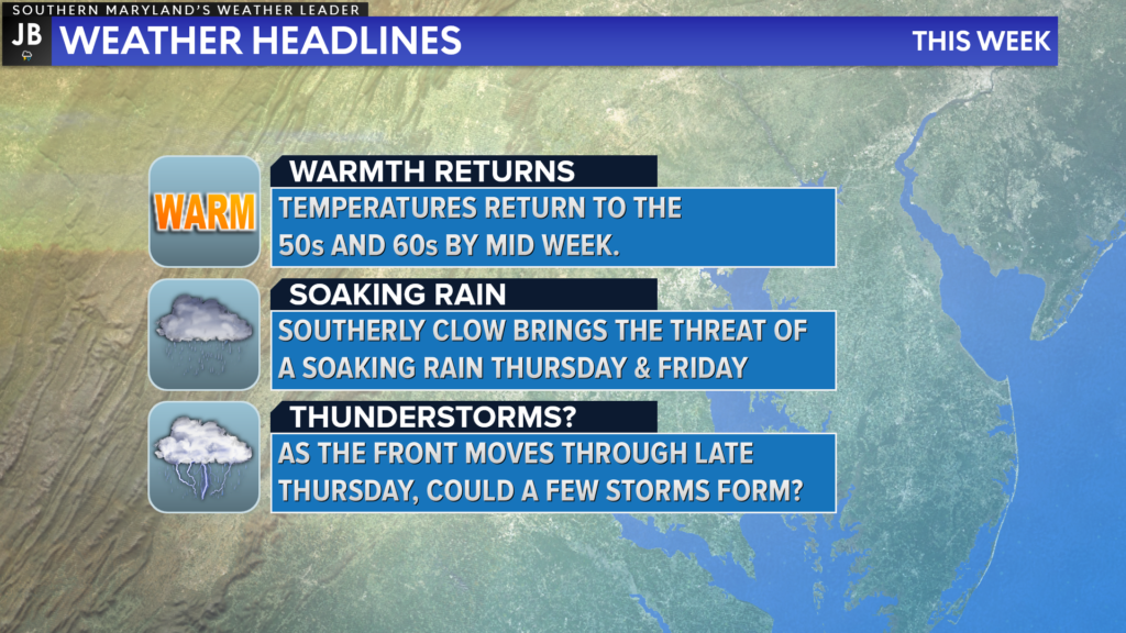
In summary, this recent cold blast will not last. Thanks to a southerly flow, we will see temperatures moderate back into the 50s and 60s by mid-week. A cold front will come through the region late Thursday, though, delivering a soaking rain and our first threat of thunderstorms!
While the thunderstorm threat late Thursday does not look too ominous right now, it will be something to keep tabs on throughout this week as we learn more. Nevertheless, another wave of cold air will look to settle in by late this weekend. Talk about an up and down pattern!
As always, stay with JB Weather for the latest information on Southern Maryland weather. You can always access my forecasts and updates here on the website, on Facebook, on Twitter, and on YouTube.
-JB

Real Estate now! Not sure where to start? View our Southern Maryland inventory of homes, land, farms and commercial properties on penfedrealty.com. Engage with our planning tools to determine your next real estate lifestyle decision, choose your realtor as a trusted advisor. Experience the difference with service and support from real estate’s forever brand!
John Bordash
View More PostsJB Weather forecaster John Bordash is working around the clock to provide Southern Maryland, and neighboring communities, with accurate and reliable weather information.

1 thought on “Warmth Returns Late Week With a Chance of Storms”
Comments are closed.
[…] [ February 14, 2022 ] Warmth Returns Late Week With a Chance of Storms Top Stories […]